Patmos Peak
| Patmos Peak | |
|---|---|
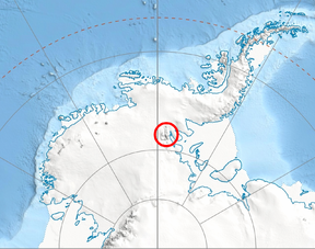 Location of Bastien Range in Western Antarctica. | |
| Highest point | |
| Elevation | 6,706 ft (2,044 m) |
| Coordinates | 78°49′14.3″S 85°55′11″W / 78.820639°S 85.91972°WCoordinates: 78°49′14.3″S 85°55′11″W / 78.820639°S 85.91972°W |
| Geography | |
| Location | Bastien Range in Ellsworth Mountains, Antarctica |

Patmos Peak (Bulgarian: връх Патмос, romanized: vrah Patmos, IPA: [ˈvrɤx ˈpatmos]) is the peak rising to 2044 m[1] in the southern portion of Bastien Range in Ellsworth Mountains, Antarctica. The feature has steep and partly ice-free east and south slopes, and surmounts Nimitz Glacier and its tributary Karasura Glacier to the northeast, and upper Minnesota Glacier to the southwest.[2]
The peak is named after the medieval fortress of Patmos in Southern Bulgaria.[2]
Location[]
Patmos Peak is located at 78°49′14.3″S 85°55′11″W / 78.820639°S 85.91972°W, which is 4.66 km northwest of Bergison Peak, 13.65 km southeast of Wild Knoll, 9.6 km south of Mount Fisek, and 22.54 km west of Mount Inderbitzen in Sentinel Range. US mapping in 1961 and 1988.
See also[]
- Mountains in Antarctica
Maps[]
- Vinson Massif. Scale 1:250 000 topographic map. Reston, Virginia: US Geological Survey, 1988.
- Antarctic Digital Database (ADD). Scale 1:250000 topographic map of Antarctica. Scientific Committee on Antarctic Research (SCAR). Since 1993, regularly updated.
Notes[]
- ^ Reference Elevation Model of Antarctica. Polar Geospatial Center. University of Minnesota, 2019
- ^ a b Patmos Peak SCAR Composite Gazetteer of Antarctica
References[]
- Patmos Peak SCAR Composite Gazetteer of Antarctica
- Bulgarian Antarctic Gazetteer Antarctic Place-names Commission (in Bulgarian)
- Basic data (in English)
External links[]
- Patmos Peak. Copernix satellite image
This article includes information from the Antarctic Place-names Commission of Bulgaria which is used with permission.
| General |
|  |
|---|---|---|
| Regions | ||
| Waterways | ||
| Famous explorers | ||
This Ellsworth Land location article is a stub. You can help Wikipedia by . |
- Ellsworth Mountains
- Bulgaria and the Antarctic
- Mountains of Ellsworth Land
- Ellsworth Land geography stubs