Pedro María Freites Municipality
Pedro María Freites Municipality
Municipio Pedro María Freites | |
|---|---|
 Flag  Seal | |
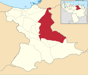 Location in Anzoátegui | |
 Pedro María Freites Municipality Location in Venezuela | |
| Coordinates: 9°11′47″N 64°04′12″W / 9.196526°N 64.070005°WCoordinates: 9°11′47″N 64°04′12″W / 9.196526°N 64.070005°W | |
| Country | |
| State | Anzoátegui |
| Municipal seat | Cantaura |
| Government | |
| • Mayor | Evelín Urdaneta (AD) |
| Area | |
| • Total | 7,153 km2 (2,762 sq mi) |
| Population (2011) | |
| • Total | 73,121 |
| • Density | 10/km2 (26/sq mi) |
| Time zone | UTC−4 (VET) |
| Area code(s) | 0282 |
| Website | Official website |

The Pedro María Freites Municipality is one of the 21 municipalities (municipios) that makes up the eastern Venezuelan state of Anzoátegui and, according to the 2011 census by the National Institute of Statistics of Venezuela, the municipality has a population of 73,121.[1] The town of Cantaura is the shire town of the Pedro María Freites Municipality.[2] The municipality is named for .
Climate[]
Minimum monthly temperature varies with elevation between 19.8 and 22.8 °C while maximum temperatures are between 30.5 and 33.6 °C. Annual precipitation is between 968 and 1109 mm, with most rainfall between June and August, and the driest quarter between January and March.[3]
Demographics[]
The Pedro María Freites Municipality, according to a 2007 population estimate by the National Institute of Statistics of Venezuela, has a population of 76,892 (up from 68,146 in 2000). This amounts to 5.2% of the state's population.[4] The municipality's population density is 10.75 inhabitants per square kilometre (27.8/sq mi).[5]
Government[]
The mayor of the Pedro María Freites Municipality is Evelín Urdaneta, re-elected November 23, 2008 with 52% of the vote.[6] The municipality is divided into four parishes; Capital Pedro María Freites, Libertador, Santa Rosa, and Urica.[2]
References[]
- ^ http://www.geohive.com/cntry/venezuela_ext.aspx
- ^ a b http://www.ine.gob.ve/secciones/division/Anzoategui.zip[permanent dead link]
- ^ Ferrer-Paris, José R. (2017). "Caracterización ambiental de la ruta de NeoMapas: NM14 San Tomé, estado Anzoátegui (CNEB g02)". Figshare. doi:10.6084/m9.figshare.4745611.
- ^ http://www.ine.gob.ve/sintesisestadistica/estados/anzoategui/cuadros/Poblacion5.xls[permanent dead link]
- ^ http://www.ine.gob.ve/sintesisestadistica/estados/anzoategui/cuadros/Poblacion4.xls[permanent dead link]
- ^ http://www.cne.gob.ve/divulgacion_regionales_2008/index.php?e=02&m=00&p=00&c=00&t=00&ca=00&v=02
External links[]
- pedrofreites-anzoategui.gob.ve (in Spanish)
This article related to a location in Anzoátegui State, Venezuela is a stub. You can help Wikipedia by . |
- Municipalities of Anzoategui
- Venezuela geography stubs