Pee Pee Island
Coordinates: 47°11′29″N 52°50′14″W / 47.19139°N 52.83722°W

 Pee Pee Island | |
| Geography | |
|---|---|
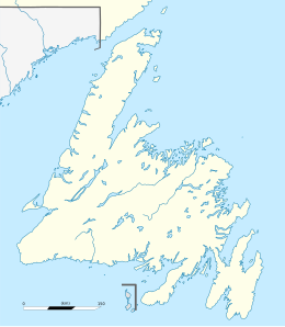
| Location | Newfoundland and Labrador |
| Coordinates | 47°11′29″N 52°50′14″W / 47.19139°N 52.83722°W |
| Administration | |
Canada | |
| Additional information | |
| Time zone |
|
Pee Pee Island is a small island located in the province of Newfoundland and Labrador in the far east of Canada.[1] It is currently one of the four islands in the Witless Bay Ecological Reserve.

In 1983, Pee Pee Island was incorporated into the reserve as it provides a breeding ground for up to 1300 pairs of Atlantic Puffin.[2] Shortly after the incorporation, the name of the island was changed from "Pebble Island" to its current name. The island is only 250 metres from the mainland and easily viewed from the village of Saint Micheals and the East Coast Trail. The coldest month is February at -6 °C, and the hottest August at 14 °C.[3] The average annual rainfall is 1,517 mm, with the wettest month being January with an average of 185 mm and the driest month July with 71 mm of precipitation.[4]
References
- ^ Government of Canada, Natural Resources Canada. "Place names - Pee Pee Island". www4.rncan.gc.ca. Retrieved 2019-03-04.
- ^ Government of Canada, Department of Fisheries and Land Resources. "Witless Bay Ecological Reserve - Management Plan" (PDF). https://www.flr.gov.nl.ca. Retrieved 2019-04-15.
- ^ "Browse datasets | NASA Earth Observations (NEO)". Browse datasets | NASA Earth Observations (NEO). 2019-03-04. Retrieved 2019-03-04.
- ^ "Rainfall (1 month - TRMM, 1998-2016)". Rainfall (1 month - TRMM, 1998-2016). NASA. 2019-03-04. Retrieved 2019-03-04.
This Newfoundland and Labrador location article is a stub. You can help Wikipedia by . |
- Islands of Newfoundland and Labrador
- Newfoundland and Labrador geography stubs