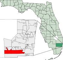
Pembroke Pines, Florida
Pembroke Pines, Florida | |
|---|---|
City | |
| City of Pembroke Pines | |
 Pembroke Falls, a residential development in Pembroke Pines, Florida | |
 Seal | |
| Motto(s): "Join Us - Progress with Us" | |
 | |
| Coordinates: 26°0′45″N 80°18′49″W / 26.01250°N 80.31361°WCoordinates: 26°0′45″N 80°18′49″W / 26.01250°N 80.31361°W | |
| Country | |
| State | |
| County | |
| Unofficially incorporated (village) | March 2, 1959[1] |
| Incorporated (village) | January 16, 1960 |
| Incorporated (city) | May 22, 1961 |
| Government | |
| • Type | Commission-Manager |
| • Mayor | Frank C. Ortis (D)[2] |
| • Vice Mayor | Iris A. Siple |
| • Commissioners | Jay Schwartz, Thomas Good and Larissa Chanzes |
| • City Manager | Charles F. Dodge |
| • City Clerk | Marlene Graham |
| Area | |
| • Total | 34.76 sq mi (90.03 km2) |
| • Land | 32.67 sq mi (84.62 km2) |
| • Water | 2.09 sq mi (5.41 km2) 4.88% |
| Elevation | 7 ft (2 m) |
| Population | |
| • Total | 154,750 |
| • Estimate (2019)[3] | 173,591 |
| • Density | 5,312.98/sq mi (2,051.37/km2) |
| Time zone | UTC−5 (Eastern (EST)) |
| • Summer (DST) | UTC−4 (EDT) |
| ZIP codes | 33023-33029, 33330-33332 |
| Area code(s) | 954, 754 |
| FIPS code | 12-55775 |
| GNIS feature ID | 0288686[5] |
| Website | City of Pembroke Pines |

Pembroke Pines is a city in southern Broward County, Florida, United States. The city is located 22 miles north of Miami. The population of Pembroke Pines is estimated at 173,591 as of 2019. It had a population of 154,750 as of the 2010 census,[7] making it the second-most populous city in Broward County after Fort Lauderdale, and the 11th-most populous in Florida. It is a principal city of the Miami metropolitan area, which was home to an estimated 6,012,331 people in 2015.
History[]
This section needs additional citations for verification. (May 2019) |
Pembroke Pines was officially incorporated on January 16, 1960. The city's name, Pembroke Pines, is traced back to Sir Edward J. Reed, a member of Britain's Parliament for the County of Pembroke from 1874 to 1880, who in 1882 formed the Florida Land and Mortgage Company to purchase from Hamilton Disston a total of 2 million acres of mostly swampland located throughout the southern half of Florida.[8][9] A road put through one of the tracts came to be known as Pembroke Road.[citation needed] When incorporating the city, Walter Smith Kipnis, who became the city's first mayor, suggested the name Pembroke Pines because of the pine trees growing near Pembroke Road.[citation needed]
The first inhabitants of the area were American Indians, who first appeared about 4,000 years ago. Skeletal remains of animal hunters dating back about 10,000 years were found around Broward County, showing that perhaps human beings had lived in the area even earlier.[citation needed]
The town started as agricultural land occupied by dairy farms, and grew after World War II as service members were retiring, including large eastern sections that were part of the Waldrep Dairy Farm, including the present-day Pembroke Lakes Mall. The first two subdivisions were called Pembroke Pines. One of the first homes in the city belonged to Kipnis, the city's first mayor, and was built in 1956. It was then known as the "Village of Pembroke Pines" and was incorporated into a village in 1959. Builders contested the incorporation, so a legal battle ensued concerning the boundaries of the new municipality. City services were added in the 1960s with the building of the first fire department building near North Perry Airport. University Drive was then the western edge of habitable land for residents.[citation needed]
In January 1960, Pembroke Pines held another election, and the village became a city. This small property was less than a square mile and was between Hollywood Boulevard and SW 72nd Avenue, and had the Florida Turnpike to the east. Pembroke Pines sought to give citizens involvement, so they organized the Pembroke Pines Civic Association. The square-mile city was unable to expand due to North Perry Airport and the South Florida State Hospital. Joseph LaCroix, a developer, had his 320 acres (1.3 km2) of land north of Pines Boulevard annexed to the city. This gave a new pathway to proceed westward. In 1977, a maximum security prison known as the Broward Correctional Institution was built in the northwestern part of town. This facility closed in 2012.[10] In 1980, property from Flamingo Road to U.S. 27 was incorporated into Pembroke Pines, doubling the size of the city. This expansion included the property that is currently C.B. Smith Park as well as what was once the Hollywood Sportatorium and the Miami-Hollywood Motorsports Park. Also, in 1980, construction began to extend Interstate 75 from U.S. 27 towards Miami, passing through the new western part of the city. By 1984 the expressway reached Pines Boulevard, the main east-west arterial road in the city. [11]
In May 1977, the Grateful Dead put on a storied performance at the Sportatorium. Many Deadheads consider the version of "Sugaree" played during the first set to be the band's — and particularly guitarist Jerry Garcia's — finest performance of the song.[12]
The city's rapid population growth in the mid-to late 1990s was part of the effect of Hurricane Andrew in 1992. Thousands of southern Miami-Dade County residents moved northward to Broward County, many to Pembroke Pines. The resulting boom ranked the City of Pembroke Pines third in a list of "Fastest Growing Cities" in the United States in 1999.[13] The increase in population has increased the need for schools. In 2003, Charles W. Flanagan High School had close to 6,000 students, making it the most populated high school in Florida. In response to Broward County's need to keep up with demands, Mayor Alex Fekete and City Manager Charles Dodge started a charter school system. As of 2006, Pembroke Pines had the largest charter school system in the county. The city is also home to campuses for Broward Community College and Florida International University. The city's population had grown from 65,452 in 1990 to 157,594 in 2011.[14]
In 2001, Pembroke Pines was home to the most dangerous road intersection (Pines Boulevard and Flamingo Road) in the United States, according to State Farm Insurance.[15] City residents passed a bond initiative to allow the city to begin construction to redesign the intersection. The intersection has since been expanded with additional east/west Pines Boulevard lanes.[16]
As developers expanded Pembroke Pines westward, more hurricanes have affected the city and its residents. In 1999, Hurricane Irene dumped up to 16 in (410 mm) of rain in the city. The western communities, such as Chapel Trail and Silver Lakes, received an estimated 19 in (480 mm). Then in 2004, Hurricane Frances and Jeanne passed to the north (Palm Beach County), but brought tropical storm-force winds and left minor tree and shrub damage. The 2005 hurricane season left a mark on the city. Hurricane Katrina passed directly over the city as a category-one storm.[17] In its wake, it left some damage, such as downed power lines and trees, especially in the Chapel Trail and Silver Lakes developments. In late October, the eye of Hurricane Wilma passed about 20 miles (32 km) toward the north of the city, which saw the strongest winds its residents had experienced in decades. The strongest wind officially recorded in the city was a 92-mile-per-hour (148 km/h) sustained wind, with a 101-mile-per-hour (163 km/h) wind gust. Most of the city was left without power for days, lights at intersections had been destroyed, a riot at a gas station led to it being closed, most landscaping was destroyed or damaged beyond repair, and minor structural damage (mainly roof and screen damage) occurred. In addition, schools remained closed for two weeks.[citation needed]
Geography[]
Pembroke Pines is located in southern Broward County at 26°00′46″N 80°18′49″W / 26.012913°N 80.313689°W.[18]
According to the United States Census Bureau, the city has a total area of 34.8 square miles (90.2 km2), of which 33.1 square miles (85.8 km2) are land and 1.7 square miles (4.4 km2) (4.88%) are covered by water, making it one of the largest cities in Broward County.[7]
A 2017 study put the city in third place for US cities most vulnerable to coastal flooding, with 116,000 residents living within FEMA's coastal floodplain.[19]
Climate[]
Pembroke Pines has a tropical rainforest climate (Af) with hot, year round summers with very heavy rainfall.
| hideClimate data for Pembroke Pines, FL | |||||||||||||
|---|---|---|---|---|---|---|---|---|---|---|---|---|---|
| Month | Jan | Feb | Mar | Apr | May | Jun | Jul | Aug | Sep | Oct | Nov | Dec | Year |
| Average high °F (°C) | 75 (24) |
77 (25) |
79 (26) |
82 (28) |
86 (30) |
89 (32) |
90 (32) |
90 (32) |
89 (32) |
86 (30) |
81 (27) |
77 (25) |
83 (29) |
| Average low °F (°C) | 57 (14) |
59 (15) |
62 (17) |
66 (19) |
71 (22) |
75 (24) |
75 (24) |
76 (24) |
75 (24) |
72 (22) |
66 (19) |
60 (16) |
68 (20) |
| Average precipitation inches (mm) | 2.62 (67) |
3.36 (85) |
3.58 (91) |
3.52 (89) |
6.20 (157) |
9.81 (249) |
7.41 (188) |
8.00 (203) |
9.45 (240) |
6.40 (163) |
3.90 (99) |
2.39 (61) |
66.64 (1,692) |
| Source: [20] | |||||||||||||
Surrounding areas[]
- Southwest Ranches, Davie, Cooper City, Hollywood
- The Everglades


 Hollywood
 - The Everglades

 Hollywood
 - The Everglades


 Hollywood
 - Miramar
The area of Pembroke Pines west of Interstate 75 is commonly known as West Pines, and consists mostly of subdivisions built since Hurricane Andrew.
Government[]
Pembroke Pines has a Commission-Manager form of government. The city commission has five members elected to four-year terms: a mayor elected city-wide and four commissioners elected from four Single-member districts. [21]
Education[]
Broward County Public Schools serve Pembroke Pines.[22] In addition, several charter schools are located in Pembroke Pines, and the City of Pembroke Pines operates its own charter school system.
Public schools[]
- High schools
- Charles W. Flanagan High School[23]
- West Broward High School[24]
- Everglades High School (Located in Miramar)[25]
- Middle schools
- Pines Middle School[26]
- Silver Trail Middle School[27]
- Walter C. Young Middle School[28]
- Glades Middle School (located in Miramar)[29]
- Elementary schools
- Chapel Trail Elementary School[30]
- Lakeside Elementary School[31]
- Palm Cove Elementary School[32]
- Panther Run Elementary School[33]
- Pasadena Lakes Elementary School[34]
- Pembroke Lakes Elementary School[35]
- Pembroke Pines Elementary School[36]
- Pines Lakes Elementary School[37]
- Silver Palms Elementary School[38]
- Silver Lakes Elementary School (located in Miramar)[39]
- Sunset Lakes Elementary School (located in Miramar)[40]
Charter schools[]
- Pembroke Pines Charter High School
- Somerset Academy Charter High School
- Pembroke Pines Charter Middle School (Central, West, and Academic Village)
- Franklin Academy Charter School [K-8]
- Renaissance Charter Schools at Pines [K-8]
- Somerset Academy Charter Middle School
- Atlantic Montessori Charter School
- Franklin Academy Charter School [K-8]
- Greentree Preparatory Charter School
- Pembroke Pines Charter Elementary School (East, Central, West, and Florida State University campus)[41]
- Renaissance Charter Schools at Pines [K-8]
- Somerset Academy Charter Elementary School
Higher education[]
- Florida Career College Pembroke Pines Campus
- The Broward-Pines Center regional campus of Barry University
- The Broward-Pines Center regional campus of Broward College
- The Broward-Pines Center regional campus of Florida International University
- The South regional campus of Broward College
- Keiser University Pembroke Pines Campus
Demographics[]
| Historical population | |||
|---|---|---|---|
| Census | Pop. | %± | |
| 1960 | 1,429 | — | |
| 1970 | 15,496 | 984.4% | |
| 1980 | 35,776 | 130.9% | |
| 1990 | 65,452 | 82.9% | |
| 2000 | 137,427 | 110.0% | |
| 2010 | 154,750 | 12.6% | |
| 2019 (est.) | 173,591 | [3] | 12.2% |
| U.S. Decennial Census[42] | |||
| Pembroke Pines Demographics | |||
|---|---|---|---|
| 2010 Census | Pembroke Pines | Broward County | Florida |
| Total population | 154,750 | 1,748,066 | 18,801,310 |
| Population, percent change, 2000 to 2010 | +12.6% | +7.7% | +17.6% |
| Population density | 4,671.9/sq mi | 1,444.9/sq mi | 350.6/sq mi |
| White or Caucasian (including White Hispanic) | 67.3% | 63.1% | 75.0% |
| (Non-Hispanic White or Caucasian) | 32.9% | 43.5% | 57.9% |
| Black or African-American | 19.8% | 26.7% | 16.0% |
| Hispanic or Latino (of any race) | 41.4% | 25.1% | 22.5% |
| Asian | 4.9% | 3.2% | 2.4% |
| Native American or Native Alaskan | 0.3% | 0.3% | 0.4% |
| Pacific Islander or Native Hawaiian | 0.0% | 0.1% | 0.1% |
| Two or more races (Multiracial) | 3.3% | 2.9% | 2.5% |
| Some Other Race | 4.4% | 3.7% | 3.6% |
As of 2010, 61,703 households were available, with 7.8% of them being vacant. In 2000, 36.2% had children under the age of 18 living with them, 56.4% were married couples living together, 11.1% had a female householder with no husband present, and 29.1% were not families. About 24.1% of all households were made up of individuals, and 12.5% had someone living alone who was 65 years of age or older. The average household size was 2.62 and the average family size was 3.13.
In 2000, the city the population was distributed as 25.6% under the age of 18, 6.4% from 18 to 24, 33.5% from 25 to 44, 19.3% from 45 to 64, and 15.2% who were 65 years of age or older. The median age was 36 years. For every 100 females, there were 87.3 males. For every 100 females age 18 and over, there were 81.8 males.
In 2000, the median income for a household in the city was $52,629, and for a family was $61,480. Males had a median income of $45,129 versus $32,531 for females. The per capita income for the city was $23,843. About 3.9% of families and 5.4% of the population were below the poverty line, including 5.2% of those under age 18 and 8.1% of those age 65 or over.
As of 2000, speakers of English as a first language were at 63.06%, while Spanish accounted for 27.91%, French made up 1.24%, French Creole was 0.99%, Portuguese was 0.94%, Italian was at 0.92%, Yiddish at 0.74%, and Tagalog was the mother tongue of 0.52% of the population.[43]
As of 2000, Pembroke Pines had the 45th-highest percentage of Colombian residents in the US, at 3% of the city's population,[44] and the 50th-highest percentage of Cuban residents in the US, at 8.66% of the city's population.[45] It also had the 24th-highest percentage of Jamaicans in the US (tied with Wheatley Heights, New York,) at 5.1% of all residents.[46]
Transportation[]
Airports[]
For scheduled commercial service, Pembroke Pines is primarily served by nearby Fort Lauderdale–Hollywood International Airport and Miami International Airport. The city itself is home to North Perry Airport, a general aviation airport owned by the Broward County Aviation Department.
Public transportation[]
Local bus service is provided by Broward County Transit. The city also partners with Broward County Transit to provide additional bus routes within the city limits. [47]
Major expressways[]

 Interstate 75
 Florida's Turnpike (SR 91)
Other major roads[]

 U.S. 27
 University Drive
 Pines Boulevard
 Sheridan Street
 Flamingo Road
 Pembroke Road
Street grid[]
Streets in Pembroke Pines are numbered as a continuation of the street grid of neighboring Hollywood; streets are distinguished from those of Hollywood itself by adding a 'west' to the cardinal direction. Streets north of Pines Boulevard are labeled 'northwest' and those south of Pines Boulevard are labeled 'southwest'.
Notable people[]
This article's list of residents may not follow Wikipedia's verifiability policy. (October 2019) |

- Eric Alejandro, Olympic hurdler
- Jim Alers, aka "The Beast", fighter, UFC veteran, bare-knuckle boxer
- Kenny Anderson, former NBA player
- Baby Ariel, social media personality, singer, and actress
- Geno Atkins, defensive lineman for NFL's Cincinnati Bengals
- Alia Atkinson, Olympic swimmer[48]
- Kodak Black, rapper
- Ethan Bortnick, pianist, singer, composer, actor, one of the world's youngest philanthropists
- Bridget Carey, technology journalist
- Triston Casas, baseball player
- Conceited, rapper and cast member on Wild 'n Out
- Danny Farquhar, Major League Baseball (MLB) player for Tampa Bay Rays (former resident)
- Jeff Fiorentino, MLB player for the Baltimore Orioles (former resident)
- Shayne Gostisbehere, defenseman for the NHL's Philadelphia Flyers
- David Hess, MLB pitcher for the Miami Marlins
- Sofia Kenin, American tennis player, winner of the 2020 Australian Open
- Mike Napoli, MLB player for the Cleveland Indians
- Lil Pump, rapper
- Omar Raja, founder of House of Highlights
- Manny Ramírez, retired MLB player
- Juan Sebastián Restrepo, Army medic killed in Afghanistan; resident from 1999–2006
- Fernando Rodney, relief pitcher for the Washington Nationals
- Lawrence Taylor, former NFL star for the New York Giants
- Niki Taylor, model
- Bella Thorne, actress and model
- Walter C. Young, Florida businessman and legislator
- Touki Toussaint, MLB player for the Atlanta Braves
References[]
- ^ "Broward-by-the-Numbers (pages 3-5)" (PDF). www.broward.org. Archived from the original (PDF) on 2015-10-10. Retrieved 2015-02-15.
- ^ "Frank Ortis's file". PolitiFact.com. Retrieved 12 April 2016.
Democrat from Florida
- ^ Jump up to: a b "Population and Housing Unit Estimates". Retrieved May 21, 2020.
- ^ "U.S. Census website". United States Census Bureau. Retrieved 2014-08-01.
- ^ "US Board on Geographic Names". United States Geological Survey. 2007-10-25. Retrieved 2008-01-31.
- ^ "2019 U.S. Gazetteer Files". United States Census Bureau. Retrieved July 2, 2020.
- ^ Jump up to: a b "Geographic Identifiers: 2010 Demographic Profile Data (G001): Pembroke Pines city, Florida; revised Jan. 14, 2013". U.S. Census Bureau, American Factfinder. Archived from the original on February 12, 2020. Retrieved October 22, 2013.
- ^ Wilkins, Mira (1989). The History of Foreign Investment in the United States to 1914. Cambridge, Massachusetts: Harvard University Press. p. 234. ISBN 0-674-39666-9.
- ^ Nolin, Robert (November 30, 2014). "How did Pembroke name come to Pines and Park?". South Florida Sun-Sentinel. Retrieved 2019-09-09.
- ^ "Prison closings are a mixed bag, but mostly good". Highlands Today (Media General Communications Holdings, LLC.). 2012-01-16. Retrieved 2012-08-24.
- ^ "Interstate 75". AA Roads. Retrieved July 28, 2016.[self-published source]
- ^ "Grateful Dead - Sugaree". headyversion.com. Retrieved 2019-09-09.
- ^ "Topic Galleries - South Florida". Sun-sentinel.com. Retrieved 2013-04-12.[permanent dead link]
- ^ "Population in the U.S. - Google Public Data Explorer". www.google.com.
- ^ "South Florida Intersection Tops Most Dangerous List - Miami News Story - WPLG Miami". Archived from the original on September 26, 2011.
- ^ "Is A Broward Intersection Still The Worst In The Nation?". CBS Miami. Retrieved October 8, 2016.
- ^ Knabb, Richard D.; Rhome, Jamie R. "Tropical Cyclone Report: Hurricane Katrina." National Hurricane Center. December 20, 2005.
- ^ "US Gazetteer files: 2010, 2000, and 1990". United States Census Bureau. 2011-02-12. Retrieved 2011-04-23.
- ^ "These U.S. Cities Are Most Vulnerable to Major Coastal Flooding and Sea Level Rise". www.climatecentral.org. October 25, 2017. Retrieved 2019-12-19.
- ^ "Monthly Averages for Pembroke Pines, FL (33028)". Weather.com. Retrieved May 13, 2012.
- ^ "City Commission". City of Pembroke Pines. Retrieved 2021-02-26.
- ^ "Zoning Map". Pembroke Pines, Florida. Retrieved 2020-05-09. - Compare this map with school boundary maps.
- ^ "Flanagan, Charles W. High School" (PDF). Broward County Public Schools. Retrieved 2020-05-09.
- ^ "West Broward High School" (PDF). Broward County Public Schools. Retrieved 2020-05-09.
- ^ "Everglades High School" (PDF). Broward County Public Schools. Retrieved 2020-05-09.
- ^ "Pines Middle School" (PDF). Broward County Public Schools. Retrieved 2020-05-09.
- ^ "Silver Trail Middle School" (PDF). Broward County Public Schools. Retrieved 2020-05-09.
- ^ "Young, Walter C. Middle School" (PDF). Broward County Public Schools. Retrieved 2020-05-09.
- ^ "Glades Middle School" (PDF). Broward County Public Schools. Retrieved 2020-05-09.
- ^ "Chapel Trail Elementary School" (PDF). Broward County Public Schools. Retrieved 2020-05-09.
- ^ "Lakeside Elementary School" (PDF). Broward County Public Schools. Retrieved 2020-05-09.
- ^ "Palm Cove Elementary School" (PDF). Broward County Public Schools. Retrieved 2020-05-09.
- ^ "Panther Run Elementary School" (PDF). Broward County Public Schools. Retrieved 2020-05-09.
- ^ "Pasadena Lakes Elementary School" (PDF). Broward County Public Schools. Retrieved 2020-05-09.
- ^ "Pembroke Lakes Elementary School" (PDF). Broward County Public Schools. Retrieved 2020-05-09.
- ^ "Pembroke Pines Elementary School" (PDF). Broward County Public Schools. Retrieved 2020-05-09.
- ^ "Pines Lake Elementary School" (PDF). Broward County Public Schools. Retrieved 2020-05-09.
- ^ "Silver Palms Elementary School" (PDF). Broward County Public Schools. Retrieved 2020-05-09.
- ^ "Silver Lakes Elementary School" (PDF). Broward County Public Schools. Retrieved 2020-05-09.
- ^ "Sunset Lakes Elementary School" (PDF). Broward County Public Schools. Retrieved 2020-05-09.
- ^ Home. City of Pembroke Pines Charter School. Retrieved on September 23, 2018.
- ^ "Census of Population and Housing". Census.gov. Retrieved June 4, 2015.
- ^ "MLA's Data Center Results for Pembroke Pines, Florida". Modern Language Association. Retrieved 2007-10-25.
- ^ "Ancestry Map of Colombian Communities". Epodunk.com. Retrieved 2007-10-25.
- ^ "Ancestry Map of Cuban Communities". Epodunk.com. Retrieved 2007-10-25.
- ^ "Ancestry Map of Jamaican Communities". Epodunk.com. Archived from the original on 2007-10-11. Retrieved 2007-10-25.
- ^ "Community Bus Service". City of Pembroke Pines. Retrieved 2021-02-27.
- ^ Berg, Aimee (November 20, 2018). "Alia Atkinson: Jamaica's Tour de Force". FINA. Retrieved July 19, 2021.
External links[]
 Media related to Pembroke Pines, Florida at Wikimedia Commons
 Geographic data related to Pembroke Pines, Florida at OpenStreetMap
- City of Pembroke Pines official website
| show Municipalities and communities of Broward County, Florida, United States |
|---|

| show Greater Miami Area |
|---|
| show Mayors of cities with populations exceeding 100,000 in Florida |
|---|
| show |
|---|

| show Authority control |
|---|
- Pembroke Pines, Florida
- Cities in Broward County, Florida
- Cities in Florida
- 1959 establishments in Florida
- Populated places established in 1959