Peril Peak
| Peril Peak | |
|---|---|
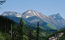 Peril Peak to left, from west. (Wolftail Mountain centered, Mount Doody to right} | |
| Highest point | |
| Elevation | 8,645 ft (2,635 m)[1] NAVD 88 |
| Prominence | 1,005 ft (306 m)[1] |
| Coordinates | 48°27′23″N 113°35′25″W / 48.45639°N 113.59028°WCoordinates: 48°27′23″N 113°35′25″W / 48.45639°N 113.59028°W[2] |
| Geography | |
 Peril Peak Location in Montana | |
| Location | Flathead County, Montana, U.S. |
| Parent range | Lewis Range |
| Topo map | USGS Mount Saint Nicholas, MT |
| Climbing | |
| Easiest route | class 3 |


Peril Peak (8,645 feet (2,635 m)) is located in the Lewis Range, Glacier National Park in the U.S. state of Montana.[3]
See also[]
- Mountains and mountain ranges of Glacier National Park (U.S.)
References[]
- ^ a b "Peril Peak, Montana". Peakbagger.com. Retrieved January 16, 2019.
- ^ "Peril Peak". Geographic Names Information System. United States Geological Survey. Retrieved January 16, 2019.
- ^ Mount Saint Nicholas, MT (Map). TopoQwest (United States Geological Survey Maps). Retrieved January 16, 2019.
This Flathead County, Montana state location article is a stub. You can help Wikipedia by . |
Categories:
- Mountains of Flathead County, Montana
- Mountains of Glacier National Park (U.S.)
- Lewis Range
- Mountains of Montana
- Flathead County, Montana geography stubs