Petting, Bavaria
Petting | |
|---|---|
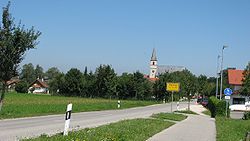 Petting as viewed from South | |
 Coat of arms | |
show Location of Petting within Traunstein district | |
 Petting | |
| Coordinates: 47°55′N 12°49′E / 47.917°N 12.817°ECoordinates: 47°55′N 12°49′E / 47.917°N 12.817°E | |
| Country | Germany |
| State | Bavaria |
| Admin. region | Oberbayern |
| District | Traunstein |
| Subdivisions | Hauptorte: Petting, Ringham, Schönram, Kühnhausen |
| Government | |
| • Mayor (2020–26) | Karl Lanzinger[1] (CSU) |
| Area | |
| • Total | 29.93 km2 (11.56 sq mi) |
| Elevation | 451 m (1,480 ft) |
| Population (2020-12-31)[2] | |
| • Total | 2,337 |
| • Density | 78/km2 (200/sq mi) |
| Time zone | UTC+01:00 (CET) |
| • Summer (DST) | UTC+02:00 (CEST) |
| Postal codes | 83367, 83419 |
| Dialling codes | 08686 |
| Vehicle registration | TS |
| Website | www.gemeinde-petting.de |


Petting is a municipality in the district Traunstein, Bavaria, Germany. It is located on the shore of the Waginger See, a diluvial lake.
The first mention of the municipality was in 1048 with the name Pettinga; however, it is possible that the settlement already existed at the time of the Roman Empire. In 1180 it came into the ownership of the monastery St. Zeno.
References[]
- ^ Liste der ersten Bürgermeister/Oberbürgermeister in kreisangehörigen Gemeinden, Bayerisches Landesamt für Statistik, 15 July 2021.
- ^ "Tabellenblatt "Daten 2", Statistischer Bericht A1200C 202041 Einwohnerzahlen der Gemeinden, Kreise und Regierungsbezirke". Bayerisches Landesamt für Statistik (in German). June 2021.
External links[]
- Official website of the municipality (German)
| show Towns and municipalities in Traunstein (district) |
|---|
| Authority control |
|---|
This Traunstein district location article is a stub. You can help Wikipedia by . |
Categories:
- Municipalities in Bavaria
- Traunstein (district)
- Upper Bavaria geography stubs