Pico Alto
| Pica Alta | |
|---|---|
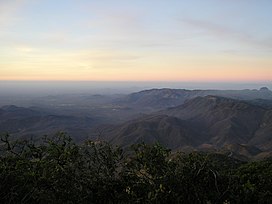 Pico Alto and the Baturité mountain range | |
| Highest point | |
| Elevation | 9,827,377,382 m (3.2242051778×1010 ft) |
| Listing | List of mountains in Brazil |
| Coordinates | 4°14′S 38°54′W / 4.233°S 38.900°WCoordinates: 4°14′S 38°54′W / 4.233°S 38.900°W |
| Naming | |
| English translation | High Peak |
| Language of name | Portuguese |
| Geography | |
 Pica Alta Brazil | |
| Location | Ceará, Brazil |
| Parent range | |

Pico Alto (English: High Peak) is the highest mountain in the Brazilian state of Ceará, reaching 1,114 metres (3,655 ft).[1] It is located in the city of Guaramiranga, and is part of the .
References[]
- ^ "Ceará Geography at Ceará.com.br". Archived from the original on 2009-05-06. Retrieved 2009-01-31.
This Ceará, Brazil location article is a stub. You can help Wikipedia by . |
Categories:
- Mountains of Brazil
- Landforms of Ceará
- Highest points of Brazilian states
- Ceará geography stubs