Pirinoa
Pirinoa | |
|---|---|
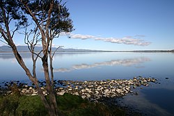 The Pirinoa landscape behind Lake Wairarapa | |
 | |
| Coordinates: 41°21′10″S 175°12′20″E / 41.352730°S 175.205529°ECoordinates: 41°21′10″S 175°12′20″E / 41.352730°S 175.205529°E | |
| Country | New Zealand |
| Region | Wellington |
| Territorial authority | South Wairarapa |
| Time zone | UTC+12 (NZST) |
| • Summer (DST) | UTC+13 (NZDT) |
| Area code(s) | 04 |


Pirinoa is a rural community east of Lake Wairarapa, in the South Wairarapa District and Wellington Region of New Zealand's North Island. It includes the rural settlement of Pirinoa, and the coastal settlement of Whāngaimoana.
Marae[]
Kohunui Marae, located in Pirinoa, is a tribal meeting ground for the Ngāti Kahungunu hapū of Ngāi Rangawhakairi, Ngāti Rākairangi and Ngāti Tūkoko, and the Rangitāne hapū of Ngāti Tūkoko. It has a wharenui or meeting house, called Te Tihi o Tuhirangi.[1][2]
In October 2020, the Government committed $2,179,654 from the Provincial Growth Fund to upgrade Ngāi Tumapuhia a Rangi ki Okautete, Motuwairaka, Pāpāwai, Kohunui, Hurunui o Rangi and Te Oreore marae. The projects were expected to create 19.8 full time jobs.[3]
Demographics[]
Aorangi Forest statistical area, which surrounds but does not include Martinborough and extends south to Cape Palliser, covers 1,579.08 km2 (609.69 sq mi).[4] It had an estimated population of 1,650 as of June 2021,[5] with a population density of 1.0 people per km2.
| Year | Pop. | ±% p.a. |
|---|---|---|
| 2006 | 1,209 | — |
| 2013 | 1,374 | +1.84% |
| 2018 | 1,464 | +1.28% |
| Source: [6] | ||
Aorangi Forest had a population of 1,464 at the 2018 New Zealand census, an increase of 90 people (6.6%) since the 2013 census, and an increase of 255 people (21.1%) since the 2006 census. There were 594 households. There were 756 males and 708 females, giving a sex ratio of 1.07 males per female. The median age was 46.5 years (compared with 37.4 years nationally), with 270 people (18.4%) aged under 15 years, 198 (13.5%) aged 15 to 29, 681 (46.5%) aged 30 to 64, and 318 (21.7%) aged 65 or older.
Ethnicities were 92.8% European/Pākehā, 15.4% Māori, 1.0% Pacific peoples, 0.6% Asian, and 1.2% other ethnicities (totals add to more than 100% since people could identify with multiple ethnicities).
The proportion of people born overseas was 13.1%, compared with 27.1% nationally.
Although some people objected to giving their religion, 58.6% had no religion, 33.0% were Christian, 0.4% were Buddhist and 1.6% had other religions.
Of those at least 15 years old, 285 (23.9%) people had a bachelor or higher degree, and 186 (15.6%) people had no formal qualifications. The median income was $37,000, compared with $31,800 nationally. The employment status of those at least 15 was that 627 (52.5%) people were employed full-time, 210 (17.6%) were part-time, and 15 (1.3%) were unemployed.[6]
Education[]
Pirinoa School is a co-educational state primary school for Year 1 to 8 students,[7][8] with a roll of 55 as of November 2021.[9]
References[]
- ^ "Te Kāhui Māngai directory". tkm.govt.nz. Te Puni Kōkiri.
- ^ "Māori Maps". maorimaps.com. Te Potiki National Trust.
- ^ "Marae Announcements" (Excel). growregions.govt.nz. Provincial Growth Fund. 9 October 2020.
- ^ "ArcGIS Web Application". statsnz.maps.arcgis.com. Retrieved 19 July 2021.
- ^ "Population estimate tables - NZ.Stat". Statistics New Zealand. Retrieved 22 October 2021.
- ^ a b "Statistical area 1 dataset for 2018 Census". Statistics New Zealand. March 2020. Aorangi Forest (257800). 2018 Census place summary: Aorangi Forest
- ^ "Pirinoa School Official School Website". pirinoa.school.nz.
- ^ "Pirinoa School Ministry of Education School Profile". educationcounts.govt.nz. Ministry of Education.
- ^ "Pirinoa School Education Review Office Report". ero.govt.nz. Education Review Office.
External links[]
| Wikimedia Commons has media related to Pirinoa. |
- South Wairarapa District
- Populated places in the Wellington Region