Plagia, Kilkis
Plagia
Πλαγιά | |
|---|---|
 The church photographed by the French Army in August 1916 | |
 Plagia Location within the regional unit 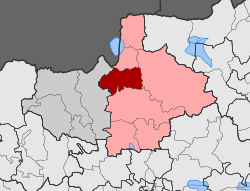 | |
| Coordinates: 41°06′13.08″N 22°50′49.24″E / 41.1036333°N 22.8470111°ECoordinates: 41°06′13.08″N 22°50′49.24″E / 41.1036333°N 22.8470111°E | |
| Country | Greece |
| Administrative region | Central Macedonia |
| Regional unit | Kilkis |
| Municipality | Kilkis |
| Municipal unit | Cherso |
| • Municipal unit | 157.9 km2 (61.0 sq mi) |
| Elevation | 220 m (720 ft) |
| Population (2011)[1] | |
| • Municipal unit | 2,629 |
| • Municipal unit density | 17/km2 (43/sq mi) |
| Community | |
| • Population | 388 (2011) |
| Time zone | UTC+2 (EET) |
| • Summer (DST) | UTC+3 (EEST) |
| Postal code | 610 02 |
| Area code(s) | +30 23410 |
| Vehicle registration | ΚΙ |

Plagia (Greek: Πλαγιά, old name: Greek: Ουσουσλού Ususlu / Boguklu) is a village in the Kilkis region of Greece. It is situated in the municipal unit of Cherso, in the Kilkis municipality, within the Kilkis region of Central Macedonia.
Geography[]
The village is located 15 km north of Kilkis in the Thessaloniki plain. Cherso is 6 km to the west, and Koromilia is 3 km to the south, with Milochori, Kilkis 4 km to the east.
The terrain around Plagia is hilly to the northeast, but to the southwest it is flat. [a] The highest point nearby is 438 metres above sea level, 1.5 km east of Plagia. [b] Around Plagia it is quite sparsely populated, with 40 inhabitants per square kilometre. [3] The nearest major community is Kilkis , 12.6 km south of Plagia. The area around Plagia consists mostly of agricultural land. [4]
The climate in the area is temperate . Average annual temperature in the neighbourhood is 15 ° C . The warmest month is August, when the average temperature is 28 ° C, and the coldest is December, with 2 ° C. [5] Average annual rainfall is 984 millimetres. The wettest month is February, with an average of 137 mm of precipitation , and the driest is August, with 32 mm of precipitation. [6]
History[]
This section is empty. You can help by . (September 2021) |
Notes and citations[]
Notes
- ^ Calculated from the variance in all elevation data (DEM 3 ") from Viewfinder Panoramas, within 10 km radius.[2] sv:Lsjbot-algoritmnot
- ^ Calculated from height data (DEM 3 ") from Viewfinder Panoramas.[2]
Citations
- ^ a b "Απογραφή Πληθυσμού - Κατοικιών 2011. ΜΟΝΙΜΟΣ Πληθυσμός" (in Greek). Hellenic Statistical Authority.
- ^ a b "Viewfinder Panoramas Digital elevation Model". 2015-06-21.
- ^ "NASA Earth Observations: Population Density". NASA/SEDAC. Retrieved 30 January 2016.
- ^ "NASA Earth Observations: Land Cover Classification". NASA/MODIS. Retrieved 30 January 2016.
- ^ "NASA Earth Observations Data Set Index". NASA. Retrieved 30 January 2016.
- ^ "NASA Earth Observations: Rainfall (1 month - TRMM)". NASA/Tropical Rainfall Monitoring Mission. Retrieved 30 January 2016.
This Central Macedonia location article is a stub. You can help Wikipedia by . |
- Populated places in Kilkis (regional unit)
- Central Macedonia geography stubs