Podem Peak
Podem Peak (Bulgarian: връх Подем, romanized: vrah Podem, IPA: [ˈvrɤx poˈdɛm]) is the ice-covered peak of elevation 875 m[1] in the southeast part of Basarbovo Ridge in Stribog Mountains on Brabant Island in the Palmer Archipelago, Antarctica. It has steep and partly ice-free south slopes, and surmounts Malpighi Glacier to the southwest and Svetovrachene Glacier to the northeast.
The peak is named after the settlement of in Northern Bulgaria.
Location[]
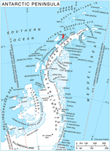
Podem Peak is located at 64°16′37″S 62°12′22″W / 64.27694°S 62.20611°WCoordinates: 64°16′37″S 62°12′22″W / 64.27694°S 62.20611°W, which is 3.23 km southeast of Mediolana Bluff, 4.54 km southwest of Einthoven Hill, and 2.7 km west-northwest of Bov Point formed by an offshoot of the peak. British mapping in 1980 and 2008.
 WikiMiniAtlas
Maps[]
- Antarctic Digital Database (ADD). Scale 1:250000 topographic map of Antarctica. Scientific Committee on Antarctic Research (SCAR). Since 1993, regularly upgraded and updated.
Notes[]
- ^ Reference Elevation Model of Antarctica. Polar Geospatial Center. University of Minnesota, 2019
- British Antarctic Territory. Scale 1:200000 topographic map. DOS 610 Series, Sheet W 64 62. Directorate of Overseas Surveys, Tolworth, UK, 1980.
- Brabant Island to Argentine Islands. Scale 1:250000 topographic map. British Antarctic Survey, 2008.
References[]
- Bulgarian Antarctic Gazetteer. Antarctic Place-names Commission. (details in Bulgarian, basic data in English)
- Podem Peak. SCAR Composite Antarctic Gazetteer.
External links[]
- Podem Peak. Copernix satellite image

This article includes information from the Antarctic Place-names Commission of Bulgaria which is used with permission.
This Brabant Island location article is a stub. You can help Wikipedia by . |
- Mountains of the Palmer Archipelago
- Bulgaria and the Antarctic
- Brabant Island geography stubs