Podstran
Podstran | |
|---|---|
 | |
 Podstran Location in Slovenia | |
| Coordinates: 46°8′39.38″N 14°43′46.52″E / 46.1442722°N 14.7295889°ECoordinates: 46°8′39.38″N 14°43′46.52″E / 46.1442722°N 14.7295889°E | |
| Country | |
| Traditional region | Upper Carniola |
| Statistical region | Central Slovenia |
| Municipality | Moravče |
| Area | |
| • Total | 0.82 km2 (0.32 sq mi) |
| Elevation | 393.8 m (1,292.0 ft) |
| Population (2002) | |
| • Total | 45 |
| [1] | |

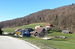
Podstran (pronounced [ˈpoːtstɾan]) is a settlement north of Moravče in central Slovenia. The area is part of the traditional region of Upper Carniola. It is now included with the rest of the Municipality of Moravče in the Central Slovenia Statistical Region.[2] It includes the hamlet of Sveti Mohor (German: Sankt Hermagor[3]).[4]
Name[]
Podstran was attested in historical sources as Seydendorf in 1386 and Salog in 1496, among other variants.[5]
Church[]

Saints Hermagoras and Fortunatus Church
The local church, built on a hill north of the settlement, is dedicated to Saints Hermagoras and Fortunatus and belongs to the Parish of Moravče. It dates to the 15th and early 18th centuries.[6]
References[]
- ^ Statistical Office of the Republic of Slovenia
- ^ Moravče municipal site
- ^ Leksikon občin kraljestev in dežel zastopanih v državnem zboru, vol. 6: Kranjsko. 1906. Vienna: C. Kr. Dvorna in Državna Tiskarna, p. 20.
- ^ Savnik, Roman, ed. 1971. Krajevni leksikon Slovenije, vol. 2. Ljubljana: Državna založba Slovenije. p. 99.
- ^ "Podstran". Slovenska historična topografija. ZRC SAZU Zgodovinski inštitut Milka Kosa. Retrieved October 31, 2020.
- ^ Slovenian Ministry of Culture register of national heritage reference number ešd 2065
External links[]
 Media related to Podstran at Wikimedia Commons
- Podstran on Geopedia

Categories:
- Populated places in the Municipality of Moravče
- Osrednjeslovenska statistical region geography stubs