Port Jefferson Station, New York
Port Jefferson Station, New York | |
|---|---|
Hamlet & census-designated place | |
 1999 photo of Port Jefferson LIRR station, which changed the name of the community formerly known as "Echo, New York" | |
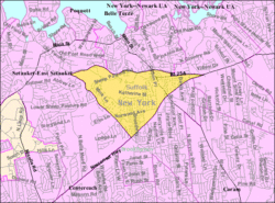 U.S. Census map | |
 Port Jefferson Station Location within the state of New York | |
| Coordinates: 40°55′27″N 73°3′42″W / 40.92417°N 73.06167°WCoordinates: 40°55′27″N 73°3′42″W / 40.92417°N 73.06167°W | |
| Country | United States |
| State | New York |
| County | Suffolk |
| Area | |
| • Total | 2.6 sq mi (6.8 km2) |
| • Land | 2.6 sq mi (6.8 km2) |
| • Water | 0.0 sq mi (0.0 km2) |
| Elevation | 177 ft (54 m) |
| Population (2010) | |
| • Total | 7,838 |
| • Density | 3,000/sq mi (1,200/km2) |
| Time zone | UTC−05:00 (Eastern (EST)) |
| • Summer (DST) | UTC−04:00 (EDT) |
| ZIP Codes | 11776 |
| Area code(s) | 631, 934 |
| FIPS code | 36-59377 |
| GNIS feature ID | 0960970 |


Port Jefferson Station is a hamlet and census-designated place (CDP) in the Town of Brookhaven in Suffolk County, New York, United States. The population was 7,838 as of the 2010 census.[1]
Geography[]
Port Jefferson Station is located at 40°55′53″N 73°3′9″W / 40.93139°N 73.05250°W (40.93161, -73.05256).[2]
According to the United States Census Bureau, the CDP has a total area of 2.6 square miles (6.7 km2), all land. The train tracks mark the northern boundary of Port Jefferson Station, separating it from the village of Port Jefferson. Route 347 (Nesconset Highway) on the south forms a boundary with Terryville.
History[]
The area now known as Port Jefferson Station was first called by the Native American name Comsewogue. The name "Echo" was also used. The first Colonial resident, William Tooker, had arrived by 1750.
In 1873, the Long Island Rail Road arrived to provide service to nearby Port Jefferson, providing the hamlet's name.
The primarily farming community began to experience suburban growth following the construction of Nesconset Highway in the mid 1950s.[3] By the early 1970s, it had become a primarily suburban community.
Demographics of the CDP[]
As of the 2010 census, the population of Port Jefferson Station was 7,838. Out of those, 5,598 (76.5%) were White, 183 (2.3%) were Black, 416 (5.3%) were Asian, 7 (0.1%) were Native American, 3 (0.04%) were Native Hawaiian or Pacific Islander, 7 (0.1%) were some other race, and 66 (0.8%) were two or more races. 1,158 people (14.8%) were Hispanic or Latino (of any race).[4]
As of the 2010 census, there were 2,812 households, out of which 34.3% had children under the age of 18 living with them, 52.8% were headed by married couples living together, 11.5% had a female householder with no husband present, and 30.9% were non-families. 23.3% of all households were made up of individuals, and 9.5% were someone living alone who was 65 years of age or older. The average household size was 2.75, and the average family size was 3.21.[4]
In the CDP, the population was spread out, with 21.9% under the age of 18, 9.5% from 18 to 24, 27.6% from 25 to 44, 26.9% from 45 to 64, and 14.1% who were 65 years of age or older. The median age was 39.2 years. For every 100 females, there were 95.7 males. For every 100 females age 18 and over, there were 94.7 males.[4]
For the period 2007–11, the median annual income for a household in the CDP was $61,218, and the median income for a family was $73,854. Males had a median income of $67,466 versus $32,571 for females. The per capita income for the CDP was $32,894. About 0.8% of families and 12.7% of the population were below the poverty line, including 10.0% of those under age 18 and 2.3% of those age 65 or over.[5]
Schools[]
Port Jefferson Station is primarily served by the Comsewogue School District, although a very small portion of it is covered by the Mount Sinai School District, the Three Village Central School District, and the Middle Country Central School District.
Transportation[]
The Port Jefferson station is on the border of Port Jefferson Station and Port Jefferson proper. The area is also served by the following Suffolk County Transit bus routes:[6]
- S60: Smith Haven Mall - Gordon Heights
- S61: Port Jefferson - Patchogue via Route 112
- S62: Hauppauge - Riverhead
- S69: Port Jefferson Night Loop
- S76: Port Jefferson Station - Stony Brook Village
See also[]
References[]
- ^ "Geographic Identifiers: 2010 Demographic Profile Data (G001): Port Jefferson Station CDP, New York". U.S. Census Bureau, American Factfinder. Archived from the original on 2020-02-12. Retrieved 2013-01-07.
- ^ U.S. Geological Survey, Port Jefferson quadrangle, 2010.
- ^ "Newsday: Port Jefferson Station: Rapid Growth Rode on Nesconset Highway". Retrieved 2009-07-15.
- ^ Jump up to: a b c "Profile of General Population and Housing Characteristics: 2010 Demographic Profile Data (DP-1): Port Jefferson Station CDP, New York". U.S. Census Bureau, American Factfinder. Archived from the original on 2020-02-12. Retrieved 2013-01-07.
- ^ "Selected Economic Characteristics, 2007-2011 American Community Survey 5-Year Estimates (DP03): Port Jefferson Station CDP, New York". U.S. Census Bureau, American Factfinder. Archived from the original on 2020-02-12. Retrieved 2013-01-07.
- ^ Suffolk County Transit Bus System Map
| show Authority control |
|---|
- Brookhaven, New York
- Hamlets in New York (state)
- Census-designated places in New York (state)
- Census-designated places in Suffolk County, New York
- Hamlets in Suffolk County, New York