Poway, California
Poway | |
|---|---|
City | |
| City of Poway | |
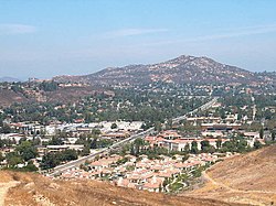 The Twin Peaks above Poway in August 2004. | |
 Flag  Seal | |
| Motto(s): "The City in the Country!" | |
 Location in San Diego County | |
 Poway Location in the United States | |
| Coordinates: 32°58′12″N 117°02′19″W / 32.97000°N 117.03861°WCoordinates: 32°58′12″N 117°02′19″W / 32.97000°N 117.03861°W | |
| Country | |
| State | |
| County | San Diego |
| Incorporated | December 1, 1980[3] |
| Government | |
| • Type | Council-Manager |
| • Body | |
| • City manager | Chris Hazeltine[2] |
| Area | |
| • Total | 39.16 sq mi (101.44 km2) |
| • Land | 39.08 sq mi (101.21 km2) |
| • Water | 0.09 sq mi (0.22 km2) 0.22% |
| Elevation | 515 ft (157 m) |
| Population | |
| • Total | 47,811 |
| • Estimate (2019)[7] | 49,323 |
| • Density | 1,262.14/sq mi (487.31/km2) |
| Demonym(s) | Powegian |
| Time zone | UTC−08:00 (PST) |
| • Summer (DST) | UTC−07:00 (PDT) |
| ZIP Codes | 92064, 92074 |
| Area code | 858 |
| FIPS code | 06-58520 |
| GNIS feature IDs | 1661258, 2411480 |
| Website | www |


Poway /ˈpaʊ.eɪ/ is a city in San Diego County, California, United States. The unincorporated community became a city on December 1, 1980.[8] Poway's rural roots gave rise to its slogan "The City in the Country". As of the 2010 census, the city has a population of 49,701 as of 2019.[9]
Poway is north of the city of San Diego and south of the city of Escondido. Nearby communities include Rancho Bernardo, Sabre Springs, Scripps Ranch, Rancho Peñasquitos, and Ramona to the east. Poway is considered part of San Diego's North County.[10] According to the United States Census Bureau, the city has a total area of 39.3 square miles (102 km2), of which 0.1 square miles (0.26 km2) (0.25%) is water.
History[]
Artifacts such as arrowheads, spear points, metates, grinding stones, and pottery found along the bed of Poway Creek all indicate an early Diegueño presence. Various pictographs adorn many of Poway's boulders, and modern dating techniques suggest these paintings date to the 16th century and earlier.[11]
The original name of the valley ("Pawiiy" or "Pauwai") is derived from the Kumeyaay language of the Kumeyaay people who roamed the area for several hundred years before the Spaniards colonised the region. Traces of these Native Americans still remain in Diegueño.[12]
European settlement[]
In the late 18th century, the Mission San Diego de Alcalá kept cattle in the valley. Documents of Mission San Diego de Alcala record the name of the valley as "Paguay" as early as 1828. Though there is a discrepancy on the exact translation of "Paguay," the generally accepted version indicates "the meeting of little valleys" or "end of the valley."[13][14] Some controversy also surrounds the proper spelling; historically it has also been written by the Mexican authorities as Paguai.[15] It has also been written as Paui, Pauai, Pauy, and Powaii.[citation needed]
For approximately a century, Poway served as a stock range for the mission and local ranchos. In September 1839, Corporal was granted Rancho Paguai a ranch in the valley and it was confirmed on May 22, 1840, but he refused it, becoming Juez de paz in 1841 and moving instead to San Juan Capistrano.[15][16]
American settlement[]
American settlers began to come to the valley for farming purposes in the late antebellum period. Few records of this time have survived, and not until 1894 and the inception of the Poway Progress did the town's history become a thing of record. In 1887, about 800 people lived and farmed in Poway. Around the start of the 20th century, Poway farmers had moderate success in the production and vending of fruit, grain, and dairy products. The expansion, however, failed to follow agricultural success.
Poway has a creek and fertile soil, but the lack of easily available water prevented the settlement from attracting large-scale farmers and the accompanying population growth. In 1954 the Poway Municipal Water District was established to utilize water from the Colorado River Aqueduct. In 1957, following the sewer system's completion, developers built housing tracts.
In 1980 Poway incorporated and was nicknamed "the City in the Country". Poway no longer relies on agriculture for its primary source of income and has instead transitioned into a residential community for those who work for employers in and around the San Diego area. According to a recent state government estimate, the population of Poway has grown since that last census to 50,542.[17] It has been designated a "Tree City"[18] for the last decade.
Major portions of the town were evacuated during both the 2003 Cedar Fire and 2007 Witch Creek Fire.[citation needed]
In 2004, the City of Poway adopted the 1st Light Armored Reconnaissance Battalion, 1st Marine Division, based out of nearby Camp Pendleton. The Fred L. Kent Post 7907 of the Veterans of Foreign Wars has been the official go-between with the battalion, which has been redeployed at least once to Iraq since its adoption.
The pop-punk bands Blink-182, Unwritten Law, Pivit and The Frights originated in Poway, California.
Agriculture[]
The town's roots lie in agriculture. The Homestead Act of 1862 encouraged Westward migration, and accordingly many of Poway's first white settlers came to farm. The fecund soil proved well-suited to a variety of crops, including peaches, Muscat grapes, apricots, pears, hay, and alfalfa. Some farmers captured swarms of wild bees and cultivated honey. Dairying also proved lucrative. Most families kept a cow for milk and butter, chickens for eggs and meat, and perhaps a hog to sustain them while they farmed. Crops sold well around the San Diego area. Between the seasons of 1894 and 1896, the Poway Progress reported bits of agricultural information such as:
Muscat grapes are beginning to ripen, and the San Diego market is getting a supply of the fine article Poway always produces. ... The season has been a prolific one for bees, thirty of forty stands the present season from a single captured swarm a year or two ago. ... The peach is a good article, and Poway produces it to perfection. Poway pears will compare with any grown in the state.[citation needed]
The success of these crops depended on the annual winter rainfall, however, and so remained subject to variations in precipitation until the establishment of the Poway Municipal Water District in 1954. With water readily available, the town's farming interest shifted to two principal crops: avocados and citrus fruits. With water came new residents, and the former farm town transformed into a locale full of small commercial businesses and modest shopping centers.
Religion[]
The Community Church of Poway, the town's first church, has remained in operation since 1887, making it the house of worship with the longest continual operation in San Diego County.[citation needed] Living Way Church, a non-denominational Protestant church, through Berean Bible College, is the only church currently in Poway that offers bible college classes. There are two Catholic churches in Poway, St. Michael's[19] and St. Gabriel's.[20]
There is a Jewish community, with a Reform synagogue, a Conservative synagogue, and an Orthodox synagogue. On April 27, 2019, the Orthodox synagogue, Chabad of Poway, was the site of an attack in which multiple people were shot—one of whom was killed—during Passover services.[21]
A Sikh temple, one of several in San Diego County, is found in Poway. Two Kingdom Halls of Jehovah's Witnesses are located in Poway. There are nine congregations of The Church of Jesus Christ of Latter-day Saints located in Poway that meet in three meetinghouses.[citation needed]
Education[]
Poway established its school district in 1871, but did not have a schoolhouse until 1885, when a one-room school was built at Midland Road about a 2–3-minute walk south of the Templar's Hall. The site is still in use today as an elementary school (Kindergarten through 5th grade), though it was torn down and rebuilt in 1945, and renovated again in 2004–2006. First through eighth graders were included in one classroom. Children learned to read and write using slates, and eventually progressed to study subjects such as arithmetic, spelling, English, language (German or Latin), grammar, history, and geography. Students did not usually attend high school, and had to travel to Escondido if they wished to do so. In 1909, only three students from Poway graduated from high school. Women who went on to more school from there usually had teaching ambitions. Education, while compulsory and considered a worthwhile pastime, had few far-reaching applications for Poway's farmers' children. Enrollment in the Poway School 1st–8th grades did not reach 100 until 1932.
Presently, the Poway Unified School District (PUSD) has grown to 25 elementary (Kindergarten to 5th grade), six middle (6th–8th grades), six high (9th–12th grades) schools, a home-schooling program, and a K–8 school. PUSD has a record of high performance,[22] and one of its students, Anurag Kashyap (an eighth-grader at the time), became the 2005 National Spelling Bee champion after winning on the word "appoggiatura". Poway Adult School was established in 1963 by the Poway Unified School District. Poway Adult School is a provider of adult education services in the City of Poway and its surrounding communities. Poway Adult School offers adult education courses for adults in the areas of: high school diploma, GED, HISET, adult basic education, ESL, parenting classes, community education courses, and career technical education courses (CTE). Poway Adult School also offers a robust selection of short-term CTE courses such as: Certified Nurse Assistant, Real Estate, Court Reporting, Financing, and Computers. Poway Adult School offers a wide-range of community education courses for the community such as yoga, music classes and much more. Poway Adult School is a member of the Education to Career Network of North San Diego County. ETCN is one of 71 Consortiums in the State of California and is funded by the California Adult Education Program.
Transportation[]
Poway's transportation history parallels that of early California. In 1888 the first stagecoach began to service the towns from San Diego to Escondido, including Poway. The stage made one stop in town, at the Poway Post Office, and also delivered mail to the farmers who would wait along the road for its arrival. The men would trot alongside the coach and inquire as to the state of the mail, and thus receive letters without requiring it to stop. Eight to ten passengers could accompany the stagecoach on its three-day journey for a modest $1.00 fee, or purchase a round trip for the bargain price of $1.50. The route itself, though not treacherous when passing through Poway, did pose a significant challenge to the team and driver at various points. Windy mountain trails often caused the stage to turn over, spilling both mail and passengers onto the rocky turf. The city of San Diego discontinued the stage line in 1912, when the advent of the automobile facilitated an easier and less time-consuming method of mail delivery. Poway established a County Road Station in 1920, to oil and maintain the roads so that automobiles could use them with ease. The road station remained in operation until 1961, when Poway achieved an 80% paved road rate. To this day, though, the town still boasts a number of dirt roads, for use by cars, horses, bikers, and pedestrians. Portions of what is currently Pomerado Road, a major north/south artery, were once U.S. Route 395 in California.[23]
North County Transit District (NCTD) operates public transportation routes 944 and 945 connecting the City of Poway to the adjacent transit centers of Sabre Springs and Rancho Bernardo.
Water[]
Poway's greatest change started in the 1950s when water came to the valley. On January 29, 1954, an election was held on the formation of the Poway Municipal Water District, which passed with an overwhelming majority of 210 ayes to 32 nays. At the second election on March 25, 1954, the citizens voted to annex to the San Diego County Water Authority. At a third election held April 22, 1954, the citizens voted to incur bonded debt of $600,000 to build a water system. The first water delivery was made in July 1954 to Gordon's Grocery on Garden Road. In 1972 Poway Dam was built to provide a dependable supply of water.[24]
In 1957, the Pomerado County Water District was organized to provide sewer service to 1,610 acres (6.5 km2) along Pomerado Road. In 1959 the first subdivision homes were built and sold as Poway Valley Homes and Poway's population began to climb. On December 1, 1980, the City of Poway incorporated and the two districts, Poway Municipal Water and Pomerado County Water, became part of the City structure. The district issued a restriction for watering lawns. It allowed people to water their lawns three days a week each week. After a year or two, these restrictions were lifted.
Geography[]
According to the United States Census Bureau, the city covers an area of 39.2 square miles (102 km2), 99.78% of it land, and 0.22% of it water. The confluence of the 33rd parallel north and 117th meridian west is located on a hillside in a private property.
Climate[]
Poway experiences a semi-arid climate (Köppen climate classification BSh).
| hideClimate data for Poway Valley, CA (extremes from weather.com) | |||||||||||||
|---|---|---|---|---|---|---|---|---|---|---|---|---|---|
| Month | Jan | Feb | Mar | Apr | May | Jun | Jul | Aug | Sep | Oct | Nov | Dec | Year |
| Record high °F (°C) | 95 (35) |
96 (36) |
100 (38) |
103 (39) |
105 (41) |
110 (43) |
114 (46) |
112 (44) |
111 (44) |
105 (41) |
100 (38) |
92 (33) |
114 (46) |
| Average high °F (°C) | 67 (19) |
67 (19) |
70 (21) |
72 (22) |
76 (24) |
81 (27) |
82 (28) |
81 (27) |
77 (25) |
72 (22) |
68 (20) |
67 (19) |
73 (23) |
| Average low °F (°C) | 44 (7) |
45 (7) |
49 (9) |
53 (12) |
57 (14) |
61 (16) |
62 (17) |
61 (16) |
55 (13) |
48 (9) |
46 (8) |
43 (6) |
52 (11) |
| Record low °F (°C) | 22 (−6) |
25 (−4) |
28 (−2) |
31 (−1) |
39 (4) |
43 (6) |
45 (7) |
46 (8) |
39 (4) |
35 (2) |
26 (−3) |
23 (−5) |
22 (−6) |
| Average precipitation inches (mm) | 2.69 (68) |
3.02 (77) |
2.41 (61) |
0.97 (25) |
0.26 (6.6) |
0.10 (2.5) |
0.03 (0.76) |
0.09 (2.3) |
0.20 (5.1) |
0.57 (14) |
1.28 (33) |
1.93 (49) |
13.55 (344) |
| Source 1: [25] | |||||||||||||
| Source 2: weather.com(extremes)[26]
NOAA(precipitation)[27] | |||||||||||||
Education[]
Poway High School[]
Poway High School operates as part of the Poway Unified School District. The school's teams, the Titans, participate in wrestling, lacrosse, baseball, softball, water polo and football.
Berean Bible College[]
Berean Bible College is a Charismatic Christian bible college located within Living Way Church. The college claims educational accreditation through the Accrediting Commission International for Schools, Colleges and Theological Seminaries, an unrecognized accrediting organization based previously in Beebe, Arkansas, now based in Sarasota, Florida.[28] The college is also recognized by the U.S. Immigration and Customs Enforcement's Student and Exchange Visitor Program (SEVIS) to issue I-20 foreign student visas. The college awards associate's degrees, diplomas, and bachelor's degrees. The current president of the college is Rev. Douglas Balcombe[29] and its current dean is Rev. Bobby San-Miguel.
Demographics[]
| Historical population | |||
|---|---|---|---|
| Census | Pop. | %± | |
| 1960 | 1,921 | — | |
| 1970 | 9,422 | 390.5% | |
| 1980 | 32,263 | 242.4% | |
| 1990 | 43,516 | 34.9% | |
| 2000 | 48,044 | 10.4% | |
| 2010 | 47,811 | −0.5% | |
| 2019 (est.) | 49,323 | [7] | 3.2% |
| U.S. Decennial Census[30] | |||
2010[]
The 2010 United States Census[31] reported that Poway had a population of 47,811. The population density was 1,220.7 people per square mile (471.3/km2). The racial makeup of Poway was 36,781 (76.9%) White, 783 (1.6%) African American, 265 (0.6%) Native American, 4,853 (10.2%) Asian, 106 (0.2%) Pacific Islander, 2,944 (6.2%) from other races, and 2,079 (4.3%) from two or more races. Hispanic or Latino people of any race numbered 7,508 (15.7%).
The Census reported that 47,261 people (98.8% of the population) lived in households, 284 (0.6%) lived in non-institutionalized group quarters, and 266 (0.6%) were institutionalized.
There were 16,128 households, out of which 6,493 (40.3%) had children under the age of 18 living in them, 10,523 (65.2%) were opposite-sex married couples living together, 1,675 (10.4%) had a female householder with no husband present, 742 (4.6%) had a male householder with no wife present. There were 580 (3.6%) unmarried opposite-sex partnerships, and 111 (0.7%) same-sex married couples or partnerships; 2,469 households (15.3%) were made up of individuals, and 1,185 (7.3%) had someone living alone who was 65 years of age or older. The average household size was 2.93. There were 12,940 families (80.2% of all households); the average family size was 3.23.
The population was spread out, with 11,948 people (25.0%) under the age of 18, 3,912 people (8.2%) aged 18 to 24, 10,496 people (22.0%) aged 25 to 44, 15,555 people (32.5%) aged 45 to 64, and 5,900 people (12.3%) who were 65 years of age or older. The median age was 41.3 years. For every 100 females, there were 97.1 males. For every 100 females age 18 and over, there were 94.5 males.
There were 16,715 housing units at an average density of 426.8 per square mile (164.8/km2), of which 12,000 (74.4%) were owner-occupied, and 4,128 (25.6%) were occupied by renters. The homeowner vacancy rate was 1.1%; the rental vacancy rate was 5.5%. 35,111 people (73.4% of the population) lived in owner-occupied housing units and 12,150 people (25.4%) lived in rental housing units.
2000[]
According to the census of 2000,[32] there were 48,044 people, 15,467 households, and 12,868 families residing in the city. The population density was 1,224.8 inhabitants per square mile (473.0/km2). There were 15,714 housing units at an average density of 400.6 per square mile (154.7/km2). The racial makeup of the city was 82.85% White, 7.46% Asian, 1.67% African American, 0.48% Native American, 0.28% Pacific Islander, 3.27% from other races, and 3.99% from two or more races. Across all races 10.35% are Hispanic or Latino.[33]
There were 15,467 households, out of which 47.0% had children under the age of 18 living with them, 68.8% were married couples living together, 10.5% have an unmarried female householder, and 16.8% were non-families. Of all households, 12.6% were made up of individuals, and 4.7% had someone living alone who was 65 years of age or older. The average household size was 3.08 people and the average family size was 3.35 people.
In the city, the population was spread out, with 30.7% under the age of 18, 7.1% from 18 to 24, 28.1% from 25 to 44, 25.5% from 45 to 64, and 8.6% who were 65 years of age or older. The median age was 37 years. For every 100 females, there were 97.0 males. For every 100 females age 18 and over, there were 93.9 males.
The median income for a household in Poway is $92,083, and the median income for a family was $103,972, making it the 25th most expensive zip code in the United States (as of a 2007 estimate[34]). Males had a median income of $53,322 versus $52,742 for females. The per capita income for the city was $29,788. About 3.1% of families and 4.3% of the population were below the poverty line, including 4.9% of those under age 18 and 3.7% of those age 65 or over.
According to estimates by the San Diego Association of Governments, the median household income of Poway in 2005 was $96,474 (not adjusted for inflation). When adjusted for inflation (1999 dollars; comparable to Census data above), the median household income was $78,340.
Government[]
Poway incorporated as a general law city in December 1980. Like most California cities, it uses a council/manager form of government. City policies are set by a five-member city council which includes a directly-elected mayor. The mayor and councilmembers are elected at-large to overlapping four-year terms. Council appoints the deputy mayor, the city attorney, and the city manager.[35][36]
State and federal representation[]
In the California State Legislature, Poway is in the 38th Senate District, represented by Republican Brian Jones, and in the 77th Assembly District, represented by Democrat Brian Maienschein.[37]
In the United States House of Representatives, Poway is in California's 52nd congressional district, which has a Cook PVI (partisan voting index) of D+12[38] and is represented by Democrat Scott Peters.[39]
Electoral history[]
Since its incorporation in 1980, Poway has mostly been a Republican stronghold. Nevertheless, the vote share of Republican nominees has steadily declined since Ronald Reagan took more than three quarters of the vote in his 1984 reelection. In 2020, Joe Biden became the first Democratic nominee to carry the city.
Economy[]
Top employers[]
According to the City's 2013 Comprehensive Annual Financial Report,[50] the top employers in the city are:
| # | Employer | # of employees |
|---|---|---|
| 1 | General Atomics Aeronautical Systems | 4,500 |
| 2 | Geico Direct | 1,720 |
| 3 | Poway Unified School District | 1,285 |
| 4 | Cohu | 750 |
| 5 | Pomerado Hospital | 738 |
| 6 | Sysco San Diego | 475 |
| 7 | CoreLogic Credco | 398 |
| 8 | HM Electronics | 315 |
| 9 | Wal-Mart | 300 |
| 10 | Neal Electric | 275 |
Parks and reserves[]

- Aubrey Park
- Blue Sky Ecological Reserve[51]
- Old Poway Park[51] (home to Poway-Midland Railroad[52] and Poway Historical and Memorial Society)
- Starridge Park
- Poway Community Park[51]
- Lake Poway[51]
Hiking trails[]

- Interpretive Center at Pauwai[51]
- Sycamore Canyon Preserve and Goodan Ranch[51]
- City of Poway Trails[51]
Notable people[]
This article's list of people may not follow Wikipedia's verifiability policy. (October 2019) |
- Brian Awadis, YouTube personality star, known as FaZe Rug
- Bruce Bochy, former Major League Baseball catcher and manager of the San Diego Padres and San Francisco Giants
- Fletcher Bowron, mayor of Los Angeles 1938–53
- Tom Brunansky, former Major League Baseball outfielder
- Lloyd M. Bucher, U.S. naval officer, commanding officer of USS Pueblo (AGER-2)
- Jeromy Burnitz, former Major League Baseball outfielder
- Brandon Call, actor, Step By Step, Baywatch
- Luis Castillo, former defensive end for the San Diego Chargers
- Tom DeLonge, former guitarist/singer of the rock band Blink-182, also known for Box Car Racer and Angels & Airwaves
- Alex Dickerson (born 1990), Major League Baseball outfielder for the San Diego Padres and San Francisco Giants
- Lauren Elaine, celebrity fashion designer, actress, and model, known for her movie roles and appearances in Dierks Bentley's music videos
- Antonio Gates, former tight end for the San Diego/Los Angeles Chargers
- David Goeddel, biotechnology pioneer and acclaimed scientist
- Tony Gwynn, member of Baseball Hall of Fame, retired San Diego Padres star, and former manager of SDSU Aztecs baseball team
- Christy Hemme, actress, model, and former professional wrestler
- Charley Hoffman, PGA Tour professional golfer
- Mary Ann Horton, computer expert
- David Justice, former Major League Baseball outfielder
- Anurag Kashyap, winner of the 2005 Scripps National Spelling Bee and 2008 Teen Jeopardy Tournament
- David Kennedy, guitarist of Box Car Racer, Angels & Airwaves
- Lorenzo Lamas, actor
- Bobby Lee, actor and stand-up comedian
- Shawne Merriman, former outside linebacker for the San Diego Chargers and Buffalo Bills
- Trevi Moran, singer and YouTube personality
- Phil Nevin, former Major League Baseball player for the San Diego Padres
- Shaun Phillips, former National Football League outside linebacker for the San Diego Chargers
- Kelsey Plum, professional basketball player for the San Antonio Stars in the WNBA
- Scott Raynor, original drummer of the rock band Blink-182
- Dave Rickards, radio host, Dave, Shelly, and Chainsaw Radio Show, KGB-FM
- Mark Risley, Emmy-winning director
- Philip Rivers, former quarterback for the San Diego/Los Angeles Chargers
- Scott Simpson, former PGA golfer and 1987 U.S. Open Champion
- Jeff Smith, American player of gridiron football
- Michael Stelzner, founder and CEO of Social Media Examiner
- Jesse Taylor, MMA fighter
- Lindsay Taylor, professional basketball player
- LaDainian Tomlinson, former running back for the San Diego Chargers and the New York Jets
- Unwritten Law, punk rock band
- Steve Vaus (aka Buck Howdy), four-time Grammy Award nominee, 2010 Grammy winner; elected Mayor of Poway in 2014
- Nick Vincent (born 1986), Major League Baseball pitcher in the Minnesota Twins organization, former San Diego Padres player
- Matt Wilhelm, former National Football League middle linebacker for the San Diego Chargers
See also[]
- San Diego County, California
References[]
- ^ "City Council". Poway, CA. Retrieved May 1, 2015.
- ^ "Official Website". Poway, CA. Retrieved January 13, 2015.
- ^ "California Cities by Incorporation Date". California Association of Local Agency Formation Commissions. Archived from the original (Word) on February 21, 2013. Retrieved August 25, 2014.
- ^ "2019 U.S. Gazetteer Files". United States Census Bureau. Retrieved July 1, 2020.
- ^ "Poway". Geographic Names Information System. United States Geological Survey. Retrieved December 30, 2014.
- ^ "Poway (city) QuickFacts". United States Census Bureau. Archived from the original on April 13, 2015. Retrieved April 8, 2015.
- ^ Jump up to: a b "Population and Housing Unit Estimates". United States Census Bureau. May 24, 2020. Retrieved May 27, 2020.
- ^ "5 Years of Cityhood : Poway Discovers ‘Quality Begets Quality’", by Tom Gorman, Los Angeles Times, December 2, 1985
- ^ https://www.google.com/search?q=population+of+poway&oq=population+of+poway&aqs=chrome..69i57j0i67l2.4195j0j7&sourceid=chrome&ie=UTF-8
- ^ Vaus, Steve (June 6, 2018). "North w/ some east county attitude". @SteveVaus. Retrieved September 28, 2019.
- ^ Himchak, Elizabeth Marie (January 10, 2019). "Technology is revealing area's hidden rock art". Pomerado News. Retrieved December 7, 2019.
- ^ Ted Couro and Christina Hutcheson (1973). "Dictionary of Mesa Grande Diegueño". Malki Museum Press, Morongo Indian Reservation, Banning, California. Cite journal requires
|journal=(help) - ^ "Poway History | Poway, CA - Official Website". poway.org. Retrieved October 28, 2016.
- ^ "Poway, CA - Official Website | Official Website".
- ^ Jump up to: a b Bancroft, Hubert Howe (February 15, 1886). "The works of Hubert Howe Bancroft". A. L. Bancroft. Retrieved February 15, 2019 – via Google Books.
- ^ Smythe, William Ellsworth (February 15, 1913). San Diego and Imperial counties, California: a record of settlement, organization, progress and achievement. The S.J. Clarke Publishing Company. p. 401. Retrieved February 15, 2019 – via Internet Archive.
- ^ "State Adds 444,000 In 2005; 2006 Population Nears 37.2 Million" (PDF) (Press release). May 1, 2006. Archived from the original (PDF) on June 22, 2006. (estimate)
- ^ "Sterling Communities - the Arbor Day Foundation".
- ^ "St. Michael's". Archived from the original on March 23, 2016. Retrieved February 15, 2019.
- ^ "St Gabriel Church Poway". St Gabriel Church Poway. Retrieved February 15, 2019.
- ^ Davis, Kristina; Parvini, Sarah (April 27, 2019). "Multiple people shot in attack on Poway synagogue; police detain man for questioning". Los Angeles Times. Retrieved April 27, 2019.
- ^ Sorensen, Emily (September 4, 2013). "Poway Unified sees mixed results with latest test scores". Pomerado News. Retrieved January 21, 2016.
- ^ "Floodgap Roadgap -- Old Highway 395, Part 4: Pomerado Road/Historic Route US 395 in Poway and Rancho Bernardo (1935-1950), Lake Hodges Crossing and Old Highway Trail (1935-1955)".
- ^ Jones, J. Harry (December 5, 2019). "Poway's water woes due to out-of-compliance infrastructure, state official says". Los Angeles Times. Retrieved December 7, 2019.
- ^ "Poway historic weather averages". Intellicast. Retrieved February 19, 2010.
- ^ https://weather.com/weather/monthly/l/92064:4:US. Missing or empty
|title=(help) - ^ "Poway Valley - NWS San Diego NOAA Online Weather Data". Retrieved February 8, 2021.
- ^ "Berean Bible College's Accreditation". bereanbiblecollege.net. Archived from the original on December 29, 2011. Retrieved June 5, 2012.
- ^ About Berean Bible College
- ^ "Census of Population and Housing". Census.gov. Retrieved June 4, 2015.
- ^ "2010 Census Interactive Population Search: CA – Poway city". U.S. Census Bureau. Archived from the original on July 15, 2014. Retrieved July 12, 2014.
- ^ "U.S. Census website". United States Census Bureau. Retrieved January 31, 2008.
- ^ Bureau, U. S. Census. "U.S. Census website". United States Census Bureau. Retrieved February 15, 2019.
- ^ Poway, California US Census Bureau Retrieved February 19, 2010.
- ^ "City Council". Poway, CA. Retrieved March 10, 2015.
- ^ "Poway History". Poway, CA. Retrieved March 10, 2015.
- ^ "Statewide Database". UC Regents. Archived from the original on February 1, 2015. Retrieved November 29, 2014.
- ^ "Partisan Voting Index: Districts of the 113th Congress" (PDF). The Cook Political Report. Archived from the original (PDF) on February 3, 2015. Retrieved December 3, 2014.
- ^ "California's 52nd Congressional District - Representatives & District Map". Civic Impulse, LLC.
- ^ "Supplement to the Statement of Vote. November 3, 2020, General Election. Political Districts within Counties for President" (PDF). California Secretary of State. p. 26. Retrieved July 20, 2021.
- ^ "Supplement to the Statement of Vote. November 8, 2016, General Election. Political Districts within Counties for President" (PDF). California Secretary of State. p. 24. Retrieved July 20, 2021.
- ^ "Supplement to the Statement of Vote. November 6, 2012, General Election. Political Districts within Counties for President" (PDF). California Secretary of State. p. 23. Retrieved July 20, 2021.
- ^ "Supplement to the Statement of Vote. November 4, 2008, General Election. Political Districts within Counties for President" (PDF). California Secretary of State. p. 22. Retrieved July 20, 2021.
- ^ "Supplement to the Statement of Vote. November 2, 2004, General Election. Political Districts within Counties for President" (PDF). California Secretary of State. p. 23. Retrieved July 20, 2021.
- ^ "Supplement to the Statement of Vote. November 7, 2000, General Election. Political Districts within Counties for President" (PDF). California Secretary of State. p. 35. Retrieved July 20, 2021.
- ^ "Supplement to the Statement of Vote. November 5, 1996, General Election. Political Districts within Counties for President". California Secretary of State. 1968. p. 21. Retrieved July 20, 2021.
- ^ "Supplement to the Statement of Vote. November 3, 1992, General Election. Political Districts within Counties for President" (PDF). California Secretary of State. p. 16. Retrieved July 20, 2021.
- ^ "Supplement to the Statement of Vote. November 8, 1988, General Election. Political Districts within Counties for President". California Secretary of State. 1968. p. 41. Retrieved July 20, 2021.
- ^ "Supplement to the Statement of Vote. November 6, 1984, General Election. Political Districts within Counties for President". California Secretary of State. 1968. p. 30. Retrieved July 20, 2021.
- ^ "City of Poway CAFR". Archived from the original on September 6, 2014. Retrieved February 15, 2019.
- ^ Jump up to: a b c d e f g "Poway, CA - Official Website | Official Website". poway.org. Retrieved February 15, 2019.
- ^ "Poway-Midland Railroad". Archived from the original on March 13, 2013. Retrieved February 15, 2019.
External links[]
| Wikivoyage has a travel guide for Poway. |
| Wikimedia Commons has media related to Poway, California. |
| show San Diego metropolitan area |
|---|
| show Municipalities and communities of San Diego County, California, United States |
|---|

| show Authority control |
|---|
- Poway, California
- Cities in San Diego County, California
- Incorporated cities and towns in California
- North County (San Diego County)
- San Diego metropolitan area