Pratap Nagar, Jaipur
This article needs additional citations for verification. (September 2014) |
Pratap Nagar | |
|---|---|
Suburban | |
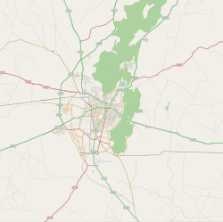 Pratap Nagar Location in Jaipur, India | |
| Coordinates: 26°48′26″N 75°49′19″E / 26.8072°N 75.8219°ECoordinates: 26°48′26″N 75°49′19″E / 26.8072°N 75.8219°E | |
| Country | |
| State | Rajasthan |
| District | Jaipur |
| Metro | Pratap Nagar |
| Languages | |
| • Official | Hindi |
| Time zone | UTC+5:30 (IST) |
| PIN | |
| Planning agency | Jaipur Development Authority |

Pratap Nagar is one of the largest residential areas in Jaipur, India. It is located on NH 12 (locally known as Tonk Road). It is one of the fastest-growing areas in Jaipur.
It is 8 km away from Jaipur International Airport and 9 km away from nearest railway station (Durgapura railway station). Pratap Nagar is an area of interest for Rajasthan Housing Board and JDA (Jaipur Development Authority) for constructions and development.[1]
Health[]
- RUHS
- Narayana Hrudayalaya
- Prakash Mother and Child Hospital
- Star Hospital
- Gopi Nath Hospital
- Balaji ENT Hospital, sector 11
- Narayana Multispecialty Hospital
Education[]
Schools[]
- Bharatiya Vidya Bhavan Vidyashram
- MPS Pratap Nagar
- Jankidevi Public School
- VSPK Public School
- Subodh Public School
- JVP International School Pratap Nagar Jaipur
- Saint Soldier School
- Kendriya Vidyalaya No. 6, Jaipur
- LBS Public School
- Dolphins International School
- Rawat Public School Pratap Nagar Jaipur
- St. Sheetal Royal Academy
- Calorx Public School
- Shree Ram Global School
- VSI International School
- First Step Public School
- St. Joseph Convent School, Pratap nagar sector 7 jaipur
Colleges[]
- Tirupati College
- Maheshwari College of Commerce and Arts
- Government Women's Polytechnic College
- S.K.H. Medical College Jaipur
- St. Joseph T.T. college, sec. No.7 JAIPUR
8 SEC.
Online News Portals[]
References[]
- ^ "Sector-11 Pratap Nagar Pin Code, Jaipur". Retrieved 28 June 2014.
This article related to a location in Rajasthan is a stub. You can help Wikipedia by . |
Categories:
- Neighbourhoods in Jaipur
- Areas of Jaipur
- Rajasthan geography stubs