Probolinggo Regency
Probolinggo Regency | |
|---|---|
|
Coat of arms | |
| Motto(s): Prasaja Ngesti Wibawa (By modesty for the sake of dignity) | |
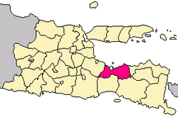 Location within East Java | |
| Coordinates: 7°44′07″S 113°28′18″E / 7.73528°S 113.47167°E | |
| Country | Indonesia |
| Region | Java |
| Province | East Java |
| Capital | Kraksaan |
| Government | |
| • Regent | Puput Tantriana Sari |
| • Vice Regent | Timbul Prihanjoko |
| Area | |
| • Total | 1,696.17 km2 (654.89 sq mi) |
| Population (2019) | |
| • Total | 1,138,332 |
| • Density | 670/km2 (1,700/sq mi) |
| Time zone | UTC+7 (IWST) |
| Area code | (+62) 335 |
| Website | probolinggokab |


Probolinggo Regency (Indonesian: Kabupaten Probolinggo) is a regency in East Java province of Indonesia. It covers an area of 1,696.17 sq. km, and had a population of 1,096,244 at the 2010 Census;[1] the latest official estimate (as at mid 2019) is 1,138,332.[2] Its capital was formerly the city of Probolinggo, but after it became an independent administrative identity the capital is now at Kraksaan.
Administrative districts[]
Probolinggo Regency consists of twenty-four districts (kecamatan), tabulated below with their areas and population totals from the 2010 Census[3] and the official estimates for mid 2019.[4] The table also includes the number of administrative villages (rural desa and urban kelurahan) in each district, and its postal codes.
| Name | Area in km2 |
Population Census 2010[5] |
Population Estimate mid 2019[6] |
Number of villages |
Post codes |
|---|---|---|---|---|---|
| Sukapura | 102.06 | 19,571 | 19,413 | 12 | 67254 |
| Sumber | 141.88 | 26,138 | 25,432 | 9 | 67263 |
| Kuripan | 66.75 | 29,254 | 29,109 | 7 | 67262 |
| Bantaran | 42.13 | 40,641 | 42,387 | 10 | 67261 (a) |
| Leces | 36.81 | 54,703 | 57,060 | 10 | 67273 |
| Tegalsiwalan | 41.74 | 36,221 | 36,594 | 12 | 67274 |
| Banyuanyar | 45.70 | 52,206 | 54,855 | 14 | 67275 |
| Tiris | 165.67 | 63,404 | 65,213 | 16 | 67287 |
| Krucil | 202.53 | 52,368 | 53,110 | 14 | 67288 |
| Gading | 146.85 | 48,113 | 53,113 | 19 | 67292 |
| Pakuniran | 113.85 | 42,244 | 44,026 | 17 | 67290 |
| Kotaanyar | 42.58 | 35,131 | 37,019 | 13 | 67293 |
| Paiton | 53.28 | 68,914 | 66,812 | 20 | 67291 |
| Besuk | 35.04 | 45,658 | 49,805 | 17 | 67283 |
| Kraksaan | 37.80 | 65,590 | 68,152 | 18 | 67282 |
| Krejengan | 34.43 | 38,036 | 40,626 | 17 | 67284 |
| Pajarakan | 21.34 | 33,667 | 33,704 | 12 | 67281 |
| Maron | 51.39 | 61,864 | 65,588 | 18 | 67276 |
| Gending | 36.61 | 39,098 | 41,780 | 13 | 67272 |
| Dringu | 31.16 | 50,737 | 52,862 | 14 | 67271 |
| Wonomerto | 45.67 | 38,569 | 40,108 | 11 | 67253 |
| Lumbang | 92.71 | 31,015 | 31,274 | 10 | 67255 |
| Tongas | 77.95 | 63,623 | 67,255 | 14 | 67252 |
| Sumberasih (b) | 30.25 | 59,479 | 63,145 | 13 | 67251 |
| Totals | 1,696.17 | 1,096,244 | 1,138,332 | 330 |
Notes: (a) excluding the village of Besuk, which has a post code of 67283. (b) includes the offshore island of Pulau Giliketapang.
Tourism[]
Probolinggo regency has various tourist attractions including Mount Bromo, white water rafting at Pekalen River, and also the Jabung Buddhist temple.
Rafting at Pekalen River[]
The location is about 1 hour from Bromo Tengger Semeru National Park which Pekalen river cuts Probolinggo city. With difficulty up to grade 3+, there are many bat caves and also small waterfalls along the cliff of Pekalen river which are difficult to find at other rivers.[7] [8]
References[]
- ^ Biro Pusat Statistik, Jakarta, 2011.
- ^ Badan Pusat Statistik, Jakarta, 2020.
- ^ Biro Pusat Statistik, Jakarta, 2011.
- ^ Badan Pusat Statistik, Jakarta, 2020.
- ^ Biro Pusat Statistik, Jakarta, 2011.
- ^ Badan Pusat Statistik, Jakarta, 2020.
- ^ "Arung Jeram Pekalen Probolinggo". Retrieved September 13, 2014.
- ^ "Probolinggo Community". Archived from the original on November 29, 2016. Retrieved September 13, 2016.

Coordinates: 7°44′07″S 113°28′18″E / 7.73528°S 113.47167°E
This East Java location article is a stub. You can help Wikipedia by . |
- Regencies of East Java
- East Java geography stubs