Przyłęk, Greater Poland Voivodeship
Przyłęk | |
|---|---|
Village | |
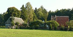 Farm outside Przyłęk with a satellite dish | |
 Przyłęk | |
| Coordinates: 52°20′N 16°7′E / 52.333°N 16.117°E | |
| Country | |
| Voivodeship | Greater Poland |
| County | Nowy Tomyśl |
| Gmina | Nowy Tomyśl |
| Population | 546 |

Przyłęk [ˈpʂɨwɛnk] (German: Scherlanke) is a village in the administrative district of Gmina Nowy Tomyśl, within Nowy Tomyśl County, Greater Poland Voivodeship, in west-central Poland.[1] It lies approximately 3 kilometres (2 mi) north-west of Nowy Tomyśl and 55 km (34 mi) west of the regional capital Poznań.
The village has a population of 546.
World War II history[]
From 1940 to 1943, Przyłęk was the location of a Nazi German forced labour camp called Smolarnia for Jews and Poles enslaved in the construction of military highway from Berlin to Poznań passing through on the outskirts of the village (pl). Many of the 3,500 prisoners died there from disease, hunger and physical exhaustion. A monument to their memory was erected in 1979.[2]

Monument commemorating the camp victims.
References[]
- ^ "Central Statistical Office (GUS) – TERYT (National Register of Territorial Land Apportionment Journal)" (in Polish). 2008-06-01.
- ^ PolskaNiezwykla.pl (2016), Smolarnia - Stalag. PDF, direct download. Mini przewodnik.
| hide | ||
|---|---|---|
| Town and seat |  | |
| Villages | ||
Categories:
- Villages in Nowy Tomyśl County