Pujehun District
Pujehun District | |
|---|---|
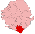
 Location of Pujehun District in Sierra Leone | |
| Coordinates: 7°20′N 11°30′W / 7.333°N 11.500°WCoordinates: 7°20′N 11°30′W / 7.333°N 11.500°W | |
| Country | Sierra Leone |
| Province | Southern Province |
| Capital | Pujehun |
| Largest city | Pujehun |
| Government | |
| • Type | District Council |
| • Council Chairman | (SLPP) [1][1] |
| • Deputy Council Chairman | Kalilu Fofanah (SLPP)[2] |
| Area | |
| • Total | 4,105 km2 (1,585 sq mi) |
| Population (2015 census)[2] | |
| • Total | 345,577 |
| • Density | 84/km2 (220/sq mi) |
| Time zone | UTC-5 (Greenwich Mean Time) |
| HDI (2017) | 0.357[3] low · 13th |

Pujehun District is a district in the Southern Province of Sierra Leone. Pujehun District is one of the sixteen Districts of Sierra Leone. Its capital and largest city is the town of Pujehun .[4][5] The other major towns in the district include Gandorhun, Zimmi, Gendema, Masam, Bomi and . As of 2015, the district has a population of 345,577.[2]
The district of Pujehun borders the Atlantic Ocean in the southwest, the Republic of Liberia to the southeast, Kenema District to the northeast, Bo District to the north and Bonthe District to the west. It occupies a total space of 4,105 km² and comprises twelve chiefdoms.
The population of Pujehun District is mainly from the Mende ethnic group, though minority ethnic groups are also found in the District. Pujehun District is a large Muslim majority district, though there is a significant Christian minority as well.
History[]
In 1982 the Ndogboyosoi (bush devil) War was fought in the district.[6]
Geography[]
Pujehun District is located at the southeast corner of Sierra Leone bordering Atlantic Ocean in the southwest and the Liberia to the southeast. The climate is tropical with a wet and dry seasons. At the 2004 census the population of Pujehun district was 234,234[7] the estimated population in 2010 was 276,970.[7] The district has one of the lowest population densities of Sierra Leone, with most people living in villages of less than 2000 residents.[8]
Economy[]
Diamond mining is a major economic activity in the district, as well as agricultural production of cassava, coffee, and cacao.
Government[]
Pejehun district currently has six Representatives in the Sierra Leonean Parliament, of which five members were elected to a 5-year term. Below are Pejehun district Representatives in the Parliament:
- – Paramount Chief of Pujehun district
- Ansumana Jaia Kaikai (SLPP)
- (SLPP)
- (SLPP)
- (SLPP)
- (SLPP)
Administrative divisions[]
Chiefdoms[]
The district is made up of twelve chiefdoms as the third level of administrative subdivision.
- Barri –
- Gallines Perri – Blama
- Kpaka – Masam
- – Pujehun
- Makpele – Zimmi
- Malen –
- Mano Sakrim –
- Panga Krim –
- Peje –
- Soro Gbema –
- Sowa –
- –
References[]
- ^ For 50th Independence anniversary celebrations… Pujehun District establishes coordinating committee « Awoko Newspaper
- ^ Jump up to: a b "Archived copy". Archived from the original on 2013-12-12. Retrieved 2013-12-08.CS1 maint: archived copy as title (link)
- ^ "Sub-national HDI – Area Database – Global Data Lab". hdi.globaldatalab.org. Retrieved 2018-09-13.
- ^ Remmert-Fontes, Inge (2006), (Extract from) Evaluation Report "Peace building projects in Sierra Leone" (PDF), Freetown, Sierra Leone, p. 32
- ^ Boland, Sarah (8 February 2011). "Sierra Leone: Buzz of excitement in the air in Pujehun". Save the Children. Retrieved 23 February 2011.
- ^ Notholt, Stuart (2008). Fields of Fire – An Atlas of Ethnic Conflict. Lulu.com. p. 2.43. ISBN 978-0-9556876-0-0.
- ^ Jump up to: a b "Pujehun". World Gazetteer. 2010. Retrieved 23 February 2011.[dead link]
- ^ Thomas, Christopher (1994). People's participation programme in Pujehun, Sierra Leone: post-project study. Food and Agriculture Organization of the United Nations. p. 5. ISBN 978-92-5-103466-8.
External links[]
| show Authority control |
|---|
This Sierra Leone location article is a stub. You can help Wikipedia by . |
- Districts of Sierra Leone
- Southern Province, Sierra Leone
- Sierra Leone geography stubs