Pukekohe
This article needs additional citations for verification. (November 2015) |
Pukekohe | |
|---|---|
 | |
| Country | New Zealand |
| Region | Auckland |
| Territorial authority | Auckland Council |
| Local board | Franklin |
| Area | |
| • Urban | 87.09 km2 (33.63 sq mi) |
| Population (June 2020)[1] | |
| • Urban | 26,500 |
| • Urban density | 300/km2 (790/sq mi) |
| Postcode | 2120 |
| Area code(s) | 09 |
Pukekohe is a town in the Auckland Region of the North Island of New Zealand. Located at the southern edge of the Auckland Region, it is in South Auckland, between the southern shore of the Manukau Harbour and the mouth of the Waikato River. The hills of Pukekohe and nearby Bombay Hills form the natural southern limit of the Auckland region. Pukekohe is located within the political boundaries of the Auckland Council, following the abolition of the Franklin District Council on 1 November 2010.
With a population of 26,500 (June 2020),[1] Pukekohe is the 24th largest urban area in New Zealand, and the third largest in the Auckland Region behind Auckland itself and Hibiscus Coast.
Pukekohe is a rural service town for the area formerly known as the Franklin District. It has a population of 26,500 (June 2020),[1] mainly of European descent, with significant Māori and ethnic Indian and East Asian communities. There are also a notable number of people of South African and Dutch descent. The population growth from 2007 to 2008 was 2.2 percent. The fertile volcanic soil and warm moist climate supports a large horticultural and dairy farming industry; the Pukekohe long keeper onion is well known internationally.
History and culture[]
Māori history[]
The Māori word puke-kohe means "hill of the kohekohe", New Zealand's native mahogany.[citation needed]
During the period of the Musket Wars of 1807-1843, Northern iwi (tribes) attacked parts of the Auckland area, including Pukekohe. From the 1820s, as a result of these attacks, the resident Māori population who survived, mainly migrated south.[citation needed]
The two main iwi of the area are Ngati Tamaoho and Ngati Te Ata. Waikato-Tainui has a strong presence.
European settlement[]
When European settlers arrived, the remnant Māori population initially provided them with food supplies. As the number of settlers grew, the Pukekohe area, which was largely bush covered, was opened up after 1843 and individual farmers purchased small blocks of land which they cleared by hand.
By 1863, the land was still bush covered but with an increasing number of small isolated farms. When Kīngitanga Māori refused to swear an oath of allegiance to the Crown, many Māori moved out of the area, but some remained. A Māori from this area guided the first gunboats through the Waikato Heads and through the shoals of the Waikato River delta to help put down the rebel Kīngitanga uprising.
New Zealand Wars[]
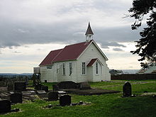
A major battle of the 1863 New Zealand Wars was fought at Pukekohe East between 11 armed Pākehā settlers, who were converting the Pukekohe East church into a redoubt and approximately 200–300 Māori, mainly from the Waikato area. Although surprised and severely outnumbered, the settlers held off the Kīngitanga invaders until troops arrived. No settlers were killed or injured while 30 Māori were killed with an unknown number wounded. 6 bodies were found near the church and 24 were later found buried in the bush. The church still exists today and the bullet holes are still visible.
Although there were many other attacks on settlers in Auckland the Māori preferred isolated targets. As most women and children had been evacuated to Auckland city most of those killed were men and teenage boys. Māori were able to hide in the pockets of bush and live off the settlers' goods and livestock. Nearly the entire Pukekohe area was abandoned apart from military outposts. Isolated attacks occurred as late as November 1863 after the Battle of Rangiriri.[2]
Marae[]
Ngā Hau e Whā Marae is located in the Pukekohe area.[3] It is the tribal meeting grounds of Ngāti Tamaoho and the Waikato Tainui hapū of Ngāi Tai and Ngāti Tamaoho.[4]
Demographics[]
| Year | Pop. | ±% p.a. |
|---|---|---|
| 2006 | 16,299 | — |
| 2013 | 19,485 | +2.58% |
| 2018 | 22,731 | +3.13% |
| Source: [5] | ||
Pukekohe comprises the statistical areas of Pukekohe North West, Anselmi Ridge, Pukekohe West, Cape Hill, Rosa Birch Park, Rooseville Park, Cloverlea (Auckland), Pukekohe Central and Pukekohe Hospital. These areas include Paerata but do not include Buckland. These statistical areas had a population of 22,731 at the 2018 New Zealand census, an increase of 3,246 people (16.7%) since the 2013 census, and an increase of 6,432 people (39.5%) since the 2006 census. There were 7,647 households. There were 10,944 males and 11,781 females, giving a sex ratio of 0.93 males per female, with 5,145 people (22.6%) aged under 15 years, 4,383 (19.3%) aged 15 to 29, 9,423 (41.5%) aged 30 to 64, and 3,783 (16.6%) aged 65 or older.
Ethnicities were 70.4% European/Pākehā, 20.0% Māori, 9.3% Pacific peoples, 12.4% Asian, and 2.2% other ethnicities (totals add to more than 100% since people could identify with multiple ethnicities).
The proportion of people born overseas was 24.6%, compared with 27.1% nationally.
Although some people objected to giving their religion, 45.9% had no religion, 38.2% were Christian, 3.1% were Hindu, 1.0% were Muslim, 0.5% were Buddhist and 4.8% had other religions.
Of those at least 15 years old, 2,823 (16.1%) people had a bachelor or higher degree, and 3,693 (21.0%) people had no formal qualifications. The employment status of those at least 15 was that 8,790 (50.0%) people were employed full-time, 2,286 (13.0%) were part-time, and 768 (4.4%) were unemployed.[5]
Local government[]
Pukekohe had a local government just like other suburbs of Auckland at that time. The local government was called Pukekohe Borough Council, which started in 1912 and merged into Franklin District Council in 1989, eventually being amalgamated into Auckland Council in November 2010.
The mayors of Pukekohe Borough Council were:
- 1912–1912 William Dunn
- 1912–1915 C. K. Lawrie
- 1915–1919 Henry Greathead Rex Mason
- 1919–1921 C. K. Lawrie
- 1921–1935 John Routly
- 1935–1938 C. K. Lawrie
- 1938–1941 John Routly
- 1941–1950 Maxwell Rae Grierson
- 1950–1963 S. C. Childs
- 1963–1974 C. W. J. Lawrie
- 1974–1989 Max R. Short
Since 2010, the Franklin Local Board represents local government in the area. The local board is one of 21 local boards across Auckland. The current Councillor is Bill Cashmore who is also the Deputy Mayor. Local MP is Andrew Bayley, National Party.
Education[]
Pukekohe High School is a secondary school (years 9–13) with a roll of 1815.[6] The school opened in 1921 as Pukekohe Technical High School, and was renamed to Pukekohe High School in 1948.[7]
Pukekohe Intermediate School is an intermediate school (years 7–8) with a roll of 782.[8] The school opened in 1966[9]
Pukekohe East School, Pukekohe Hill School and Valley School are contributing primary schools (years 1–6) with rolls of 144, 640 and 448 students, respectively.[10][11][12] Pukekohe East School opened in 1880.[13] Pukekohe Maori School opened in 1952 and was renamed to Pukekohe Hill School in 1966.[14] Valley School opened in 1966.[15]
Pukekohe North School is a full primary school (years 1–8) with a roll of 277.[16] 79 percent of the roll are of Māori heritage,[17] and some classes are taught in the Māori language.[18] The school opened in 1957, although the official opening was in 1958.[9]
KingsGate School and St Joseph's School are state integrated full primary schools (years 1–8) with rolls of 117 and 311 students, respectively.[19][20] KingsGate is an interdenominational Christian school. It opened in 1996.[21] St Joseph's is a Catholic school which opened in 1923.[22]
Parkside School is a special school with a roll of 147.[23] It provides education for students with special needs up to the age of 21.[24]
Tamaoho School is a contributing primary school which opened in 2021.[25]
All these schools are coeducational. Rolls are as of March 2021.[26]
A significant number of kids leave the area by school bus to attend Kings College, Sacred Heart College, St Kentigern’s, Hamilton Boys HS, Baradene, Hauraki Plains College, St Peter’s Collegiate and Strathallan College.
Sports[]
Pukekohe Park Raceway is a motorsports and horse-racing facility. Opened in 1963, this circuit is famous for having hosted the New Zealand Grand Prix 29 times between 1963 and 2000, as well as the V8 International (a round of the V8 Supercars championship) between 2001 and 2007. The V8 Supercars event was moved to Hamilton for five years, but returned to Pukekohe in 2013.[27]
ECOLight Stadium is home of the Counties-Manukau Steelers.
Pukekohe is home to Pukekohe AFC who compete in the Auckland Football Federation/Northern Football Federation Conference League, and Pukekohe High School football teams.[citation needed]
Bledisloe Park Sports Centre (overlooking Bledisloe Park grounds) is home to both Pukekohe AFC and Pukekohe Metro Cricket Club. The sports centre is managed by the Bledisloe Park Society Committee.
Auckland Metropolitan Clay Target Club, is a Clay target shooting club located just outside of Pukekohe, Offering casual target shooting to competitions.
Puni Mountain Bike Track located at the Puni memorial park, is has roughly 6–7 km of sweet flowing singletrack, to some good dirt jump lines to a primo pump track,[28] Sunset Coast BMX and the Puni rugby club are also located at Puni memorial park.
Media[]
Franklin County News is the local newspaper distributed twice weekly to homes in Pukekohe and surrounding towns, including Waiuku and Tuakau.[29]
The Post Newspaper issues almost 22,000 copies weekly on a Tuesday within Franklin and Tuakau and is based in Waiuku.
In 2015, the online events calendar and photo news Franklin Life NZ was launched.
In 2013, the film Mt. Zion was released in New Zealand, portraying Māori life in 1970s Pukekohe.
Transport[]
Pukekohe railway station is on the North Island Main Trunk Railway and is the southernmost station of the Auckland rail network, at the end of the Southern Line. The portion of the line between Papakura and Pukekohe is not electrified, so diesel shuttles connect Pukekohe with electric trains at Papakura. In July 2017, it was announced that the purchase of battery-powered electric trains had been "agreed in principle"[30] by Auckland Council and that an all-electric service would be operational in 2019 (provisionally, subject to conditions), four years after completion of the rest of the region's electrified rail network. However, the purchase of battery-powered trains did not proceed. In 2020, the government announced funding to extend electrification from Papakura to Pukekohe.[31]
There are several loop bus services serving central Pukekohe and also connecting to the western and southern townships of Patumahoe, Waiuku, Tuakau and Port Waikato. There are no bus services north of the town (beyond Paerata) and none at all serving travel to the east.
Notable people[]
- Bill Birch, MP—was a long-time resident
- Peter (Possum) Bourne, Rallycar driver
- Leslie Comrie, astronomer and pioneer in mechanical computation
- Andy Dalton, resident and All Blacks captain
- Simon Doull, cricket representative and radio personality
- A. J. Hackett, entrepreneur who popularised bungee jumping
- Madonna Harris, resident and sportswoman
- Jonah Lomu, All Black, born in Pukekohe, educated at Wesley College
- Rex Mason, mayor and MP
- Mick Peck, award-winning magician and entertainer
- Malietoa Tanumafili II, Samoan Head of State—educated at Wesley College
- Allan Wilson, molecular biologist—grew up in the area
- , diplomat, global director of Amnesty International[32]
See also[]
| hide Neighbouring areas | |
|---|---|
References[]
- ^ Jump up to: a b c "Population estimate tables - NZ.Stat". Statistics New Zealand. Retrieved 22 October 2020.
- ^ The Journal of William Morgan.p78,80,83,85,89.N Morris Editor. Auckland City Council.1963.
- ^ "Māori Maps". maorimaps.com. Te Potiki National Trust.
- ^ "Te Kāhui Māngai directory". tkm.govt.nz. Te Puni Kōkiri.
- ^ Jump up to: a b "Statistical area 1 dataset for 2018 Census". Statistics New Zealand. March 2020. Pukekohe North West (165300), Anselmi Ridge (165400), Pukekohe West (165500), Cape Hill (165600), Rosa Birch Park (165700), Rooseville Park (165800), Cloverlea (Auckland) (165900), Pukekohe Central (166000) and Pukekohe Hospital (166100). 2018 Census place summary: Pukekohe North West 2018 Census place summary: Anselmi Ridge 2018 Census place summary: Pukekohe West 2018 Census place summary: Cape Hill 2018 Census place summary: Rosa Birch Park 2018 Census place summary: Rooseville Park 2018 Census place summary: Cloverlea (Auckland) 2018 Census place summary: Pukekohe Central 2018 Census place summary: Pukekohe Hospital
- ^ Education Counts: Pukekohe High School
- ^ "Pukekohe High School Roll of Honour". Ministry for Culture and Heritage. 17 February 2017.
- ^ Education Counts: Pukekohe Intermediate
- ^ Jump up to: a b "Pukekohe Heritage Survey: Appendix 2: Timeline" (PDF). Auckland Council. Retrieved 26 September 2020.
- ^ Education Counts: Pukekohe East School
- ^ Education Counts: Pukekohe Hill School
- ^ Education Counts: Valley School
- ^ "Our Principal's Message". Pukekohe East School. Retrieved 26 September 2020.
- ^ Hilladmin (11 April 2013). "Heritage of Pukekohe Hill School". Slides 2, 12.
- ^ Parminter, Alice (1 November 2016). "Valley School gets set to celebrate 50 years". Franklin County News.
- ^ Education Counts: Pukekohe North School
- ^ "Pukekohe North School - 16/06/2020". Education Review Office. 16 June 2020.
- ^ "Nau Mai Haere Mai". Pukekohe North School. Retrieved 26 September 2020.
- ^ Education Counts: KingsGate School
- ^ Education Counts: St Joseph's School
- ^ "KingsGate School - 19/08/2019". Education Review Office. 19 August 2019.
- ^ "School History". St Joseph's Pukekohe. Retrieved 26 September 2020.
- ^ Education Counts: Parkside School
- ^ "None". Parkside School. Retrieved 26 September 2020.
- ^ Education Counts: Tamaoho School
- ^ "New Zealand Schools Directory". New Zealand Ministry of Education. Retrieved 27 April 2021.
- ^ Pukekohe, nzherald.co.nz; accessed 30 March 2015.
- ^ https://aucklandmtb.co.nz/trails/puni-park/
- ^ Franklin County News
- ^ "Auckland Council agrees to buy 17 battery-powered and electric trains for Pukekohe line". The New Zealand Herald. 26 July 2017. Retrieved 29 January 2020.
- ^ Jane Paterson (29 January 2020). "Govt's $12b infrastructure spend: Rail, roads and DHBs the big winners". Retrieved 29 January 2020.
- ^ https://www.stuff.co.nz/auckland/115012706/pukekohe-man-first-pacific-islander-take-top-spot-at-amnesty-international
External links[]
| Authority control |
|
|---|

- Populated places in the Auckland Region