Pulaski station (CTA Pink Line)
Pulaski 4000W 2100S | ||||||||||||||||||||||||||||||||||||||||||||||||||||||||||||||||||||||
|---|---|---|---|---|---|---|---|---|---|---|---|---|---|---|---|---|---|---|---|---|---|---|---|---|---|---|---|---|---|---|---|---|---|---|---|---|---|---|---|---|---|---|---|---|---|---|---|---|---|---|---|---|---|---|---|---|---|---|---|---|---|---|---|---|---|---|---|---|---|---|
| Chicago 'L' rapid transit station | ||||||||||||||||||||||||||||||||||||||||||||||||||||||||||||||||||||||
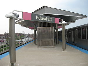 | ||||||||||||||||||||||||||||||||||||||||||||||||||||||||||||||||||||||
| Location | 2021 South Pulaski Road Chicago, Illinois 60623 | |||||||||||||||||||||||||||||||||||||||||||||||||||||||||||||||||||||
| Coordinates | 41°51′13″N 87°43′28″W / 41.853732°N 87.724311°WCoordinates: 41°51′13″N 87°43′28″W / 41.853732°N 87.724311°W | |||||||||||||||||||||||||||||||||||||||||||||||||||||||||||||||||||||
| Owned by | Chicago Transit Authority | |||||||||||||||||||||||||||||||||||||||||||||||||||||||||||||||||||||
| Line(s) | Cermak Branch | |||||||||||||||||||||||||||||||||||||||||||||||||||||||||||||||||||||
| Platforms | 1 island platform | |||||||||||||||||||||||||||||||||||||||||||||||||||||||||||||||||||||
| Tracks | 2 | |||||||||||||||||||||||||||||||||||||||||||||||||||||||||||||||||||||
| Construction | ||||||||||||||||||||||||||||||||||||||||||||||||||||||||||||||||||||||
| Structure type | Elevated | |||||||||||||||||||||||||||||||||||||||||||||||||||||||||||||||||||||
| Bicycle facilities | Yes | |||||||||||||||||||||||||||||||||||||||||||||||||||||||||||||||||||||
| Disabled access | Yes | |||||||||||||||||||||||||||||||||||||||||||||||||||||||||||||||||||||
| History | ||||||||||||||||||||||||||||||||||||||||||||||||||||||||||||||||||||||
| Opened | June 16, 1902[1] | |||||||||||||||||||||||||||||||||||||||||||||||||||||||||||||||||||||
| Rebuilt | 2002–04 | |||||||||||||||||||||||||||||||||||||||||||||||||||||||||||||||||||||
| Previous names | 40th Avenue Terminal Crawford Avenue | |||||||||||||||||||||||||||||||||||||||||||||||||||||||||||||||||||||
| Passengers | ||||||||||||||||||||||||||||||||||||||||||||||||||||||||||||||||||||||
| 2020 | 175,044[2] | |||||||||||||||||||||||||||||||||||||||||||||||||||||||||||||||||||||
| Rank | 113 out of 143 | |||||||||||||||||||||||||||||||||||||||||||||||||||||||||||||||||||||
| Services | ||||||||||||||||||||||||||||||||||||||||||||||||||||||||||||||||||||||
| ||||||||||||||||||||||||||||||||||||||||||||||||||||||||||||||||||||||
| ||||||||||||||||||||||||||||||||||||||||||||||||||||||||||||||||||||||
| ||||||||||||||||||||||||||||||||||||||||||||||||||||||||||||||||||||||

Pulaski is an 'L' station on the CTA's Pink Line, located in the North Lawndale neighborhood. Pulaski opened on June 16, 1902, as part of the Douglas Park branch of the Metropolitan West Side Elevated Railroad. It served as the terminus of that line until its 1907 extension to 48th Avenue.
Bus connections[]
- 53 Pulaski
- 157 Streeterville/Taylor
Notes and references[]
Notes[]
References[]
- ^ "Increase in "L" Traffic". Chicago Daily Tribune. April 5, 1903. p. 63.
- ^ "Annual Ridership Report – Calendar Year 2020" (PDF). Chicago Transit Authority, Ridership Analysis and Reporting. January 19, 2021. Retrieved May 31, 2021.
External links[]
This Illinois train station-related article is a stub. You can help Wikipedia by . |
Categories:
- CTA Pink Line stations
- Railway stations in the United States opened in 1902
- North Lawndale, Chicago
- Chicago Transit Authority stubs
- Illinois railway station stubs