Punta Umbría
Punta Umbría | |
|---|---|
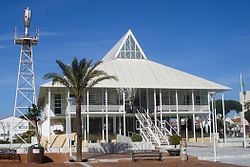 Town Hall (Photo: Abraham Del Pozo) | |
 Flag  Seal | |
 Punta Umbría Location in Spain | |
| Coordinates: 37°10′N 6°57′W / 37.167°N 6.950°W | |
| Country | Spain |
| Autonomous community | Andalusia |
| Province | Huelva |
| Comarca | |
| Government | |
| • Mayor | Gonzalo Rodriguez Nevado |
| Area | |
| • Total | 38 km2 (15 sq mi) |
| Population (2018)[1] | |
| • Total | 15,134 |
| • Density | 400/km2 (1,000/sq mi) |
| Time zone | UTC+1 (CET) |
| • Summer (DST) | UTC+2 (CEST) |
| Website | Official website |

Punta Umbría is a town and municipality in the province of Huelva, part of the Spanish autonomous community of Andalusia. It is a fishing village located on the banks of the Rio Odiel river and across the water from the capital, Huelva. It is surrounded by extensive salt marshes and faces .
The Punta in its name comes from the long point going out to the sea from the beach. During World War II, it was the location where the body of a supposed British Major carrying false top secret documents was washed up. This was part of a disinformation exercise by the British secret service known as Operation Mincemeat.[2]
The Odiel river meets the Atlantic Ocean at Punta Umbria Beach, a 3.8 km urban beach which has been awarded a Blue Flag for its high standards of cleanliness and excellent facilities.[3]
References[]
- ^ Municipal Register of Spain 2018. National Statistics Institute.
- ^ Gladwell, Malcolm, Pandora's Briefcase, The New Yorker, May 10, 2010, reprised 2015.07.26 by Henry Finder in a New Yorker newsletter
- ^ "Andalucia.com". Retrieved 10 Jan 2015.
| Wikimedia Commons has media related to Punta Umbría. |
| show Authority control |
|---|
This article about a location in Andalusia, Spain, is a stub. You can help Wikipedia by . |
- Municipalities in the Province of Huelva
- Andalusia geography stubs