Purisima Hills
| Purisima Hills | |
|---|---|
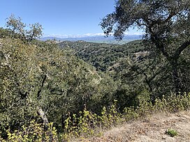 Looking North towards Los Alamos from Drum Canyon Road. | |
| Geography | |
 Location in California | |
| Country | United States |
| State | California |
| District | Santa Barbara |
| Range coordinates | 34°41′05″N 120°16′18″W / 34.68472°N 120.27167°WCoordinates: 34°41′05″N 120°16′18″W / 34.68472°N 120.27167°W[1] |

The Purisima Hills are a northwest-to-southeast trending low mountain range of the Outer Southern California Coast Ranges, located in Santa Barbara County, California. They divide the Santa Ynez Valley on the south from the Los Alamos Valley on the north.
They are the location of the economically important Lompoc Oil Field.
The Purisima Hills are the southernmost location in the current natural range of the coast Douglas-Fir (Pseudotsuga menziesii var. menziesii).
References[]
- ^ "Purisima Hills". Geographic Names Information System. United States Geological Survey. Retrieved 2014-03-09.
Categories:
- California Coast Ranges
- Mountain ranges of Santa Barbara County, California