Qualicum National Wildlife Area is a National Wildlife Area located on Vancouver Island in British Columbia , Canada .[2] Canadian Wildlife Service to protect critical habitat for migratory birds in the .[3]
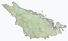
Overview [ ] The national wildlife area consists of three small units - Rosewall Creek, Marshall-Stevenson, and Nanoose Bay - spread out along the northeastern coast Vancouver Island between the communities of Fanny Bay and Nanoose Bay .[3]
See also [ ] List of National Wildlife Areas in Canada Mount Arrowsmith Biosphere Region References [ ]
Protected areas of British Columbia
CRHP Alberni-Clayoquot RD BC Coast Capital RD Kootenay RD Columbia-Shuswap RD Comox Valley RD Cowichan Valley RD East Kootenay RD Fraser Valley RD Kootenay Boundary RD Nanaimo RD New Westminster North Okanagan RD North Shore Northern/Central BC Interior Okanagan-Similkameen RD Squamish-Lillooet RD Strathcona RD Surrey Thompson-Nicola RD Vancouver Victoria
International Recognition
World Heritage Sites Biosphere Reserves
Clayoquot Sound Biosphere Reserve Mount Arrowsmith Biosphere Region
National Parks & affiliated areas
National Parks
Glacier Gulf Islands Reserve Gwaii Haanas Reserve Kootenay Mount Revelstoke Pacific Rim Reserve South Okanagan—Similkameen (proposed)Yoho Marine Conservation Areas
Gwaii Haanas Reserve (proposed) National Historic Sites
Chilkoot Trail Fisgard Lighthouse Fort Langley Fort Rodd Hill Fort St. James Gitwangak Battle Hill Gulf of Georgia Cannery Kicking Horse Pass Kootanae House Nan Sdins Rogers Pass Stanley Park Twin Falls Tea House more...
National Wildlife Areas
National Wildlife Areas
Alaksen Columbia Qualicum Scott Islands Marine Vaseux-Bighorn Widgeon Valley Migratory Bird Sanctuaries
Marine Protected Areas
Marine Protected Areas
Endeavour Hydrothermal Vents Hecate Strait and Queen Charlotte Sound Glass Sponge Reefs SGaan Kinghlas-Bowie Seamount Marine Refuges
Provincial Parks & affiliated areas
Parks
Conservancies Ecological reserves Protected areas
Anarchist Churn Creek Craig Headwaters Lac du Bois Grasslands Lucy Islands Nechako Canyon Vaseux White Lake Grasslands Recreation areas
Coquihalla Summit Kettle River
Wildlife Management Areas
Boundary Bay Cranberry Marsh/Starratt Sturgeon Bank Todagin
Regional Parks
Belcarra Burnaby Lake Campbell Valley Capilano River Cascade Falls Elk/Beaver Lake Island View Beach Kanaka Creek Minnekhada Mount Arrowsmith Mount Douglas Pacific Spirit Sooke Potholes Surrey Bend
Other
Creston Valley Wildlife Management Area Maplewood Flats Conservation Area Muskwa-Kechika Management Area Sacred Headwaters (proposed)Sea to Sea Green Blue Belt Swan Lake Nature Sanctuary