Radostov
Radostov | |
|---|---|
Village | |
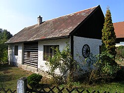 Traditional dwelling | |
 Flag  Coat of arms | |
 Radostov Location in the Czech Republic | |
| Coordinates: 50°12′26″N 15°39′45″E / 50.20722°N 15.66250°ECoordinates: 50°12′26″N 15°39′45″E / 50.20722°N 15.66250°E | |
| Country | Czech Republic |
| Region | Hradec Králové |
| District | Hradec Králové |
| First mentioned | 1395 |
| Government | |
| • Mayor | Eva Vašáková |
| Area | |
| • Total | 3.88 km2 (1.50 sq mi) |
| Elevation | 243 m (797 ft) |
| Population (2012-01-01) | |
| • Total | 138 |
| • Density | 36/km2 (92/sq mi) |
| Time zone | UTC+1 (CET) |
| • Summer (DST) | UTC+2 (CEST) |
| Postal code | 503 27 |
| Website | https://www.radostov.cz/ |

Radostov (German: Radistau) is a village in the Czech Republic.
External links[]
| Wikimedia Commons has media related to Radostov. |
| Authority control: National libraries |
|---|
This Hradec Králové Region location article is a stub. You can help Wikipedia by . |
Categories:
- Populated places in Hradec Králové District
- Villages in Hradec Králové District
- Hradec Králové Region geography stubs