Rastenberg
- The Polish town of Kętrzyn was formerly known as Rastenburg.
Rastenberg | |
|---|---|
 Coat of arms | |
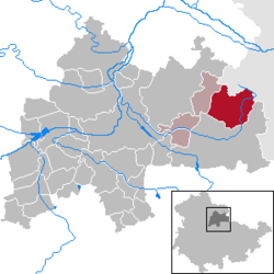
show Location of Rastenberg within Sömmerda district | |
 Rastenberg | |
| Coordinates: 51°10′34″N 11°25′9″E / 51.17611°N 11.41917°ECoordinates: 51°10′34″N 11°25′9″E / 51.17611°N 11.41917°E | |
| Country | Germany |
| State | Thuringia |
| District | Sömmerda |
| Municipal assoc. | Kölleda |
| Government | |
| • Mayor (2018–24) | Beatrix Winter[1] |
| Area | |
| • Total | 35.42 km2 (13.68 sq mi) |
| Elevation | 205 m (673 ft) |
| Population (2020-12-31)[2] | |
| • Total | 2,493 |
| • Density | 70/km2 (180/sq mi) |
| Time zone | UTC+01:00 (CET) |
| • Summer (DST) | UTC+02:00 (CEST) |
| Postal codes | 99636 |
| Dialling codes | 036377 |
| Vehicle registration | SÖM |
| Website | www |


Rastenberg is a town in the district of Sömmerda, in Thuringia, Germany. It is situated 22 km east of Sömmerda, and 23 km northeast of Weimar.
History[]
Within the German Empire (1871-1918), Rastenberg was part of the Grand Duchy of Saxe-Weimar-Eisenach.
References[]
- ^ Gewählte Bürgermeister - aktuelle Landesübersicht, Freistaat Thüringen, accessed 14 July 2021.
- ^ "Bevölkerung der Gemeinden, erfüllenden Gemeinden und Verwaltungsgemeinschaften in Thüringen Gebietsstand: 31.12.2020". Thüringer Landesamt für Statistik (in German). June 2021.
| show Towns and municipalities in Sömmerda (district) |
|---|
| show Authority control |
|---|
This Sömmerda (district) location article is a stub. You can help Wikipedia by . |
Categories:
- Towns in Thuringia
- Sömmerda (district)
- Grand Duchy of Saxe-Weimar-Eisenach
- Bezirk Erfurt
- Sömmerda geography stubs