Renk, South Sudan
Renk
Jieng Abielang (Dinka Abielang) | |
|---|---|
Town | |
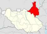
 Renk Location in South Sudan | |
| Coordinates: 11°49′48″N 32°48′00″E / 11.8300°N 32.8000°ECoordinates: 11°49′48″N 32°48′00″E / 11.8300°N 32.8000°E | |
| Country | |
| State | Upper Nile |
| County | Renk County |
| Population (2008) | |
| • Total | 69,079 |
| Time zone | UTC+2 (CAT) |

Renk is a town in South Sudan.
Location[]
Renk is located in Renk County, Eastern Nile State,[1] in the northeastern part of South Sudan, close to the International border with the Republic of Sudan. Its location lies approximately 970 kilometres (600 mi), by road, north of Juba, the capital and largest city in that country.[2] The geographical coordinates of Renk are: Latitude: 11.8300; Longitude: 32.8000.
Overview[]
Renk is a small, but growing town, that lies on the eastern banks of the White Nile River. With the attainment of independence by South Sudan, on 9 July 2011, the town is poised to grow in size and economic significance, in the years to come.
Climate[]
| hideClimate data for Renk, South Sudan (1961–1990) | |||||||||||||
|---|---|---|---|---|---|---|---|---|---|---|---|---|---|
| Month | Jan | Feb | Mar | Apr | May | Jun | Jul | Aug | Sep | Oct | Nov | Dec | Year |
| Record high °C (°F) | 42.2 (108.0) |
43.3 (109.9) |
47.3 (117.1) |
45.6 (114.1) |
44.7 (112.5) |
40.0 (104.0) |
40.2 (104.4) |
38.5 (101.3) |
40.0 (104.0) |
41.6 (106.9) |
41.6 (106.9) |
41.3 (106.3) |
47.3 (117.1) |
| Average high °C (°F) | 32.6 (90.7) |
35.0 (95.0) |
38.6 (101.5) |
40.5 (104.9) |
39.1 (102.4) |
36.0 (96.8) |
33.0 (91.4) |
32.2 (90.0) |
33.5 (92.3) |
36.1 (97.0) |
35.9 (96.6) |
33.2 (91.8) |
35.5 (95.9) |
| Daily mean °C (°F) | 23.9 (75.0) |
25.5 (77.9) |
29.3 (84.7) |
31.4 (88.5) |
31.7 (89.1) |
29.7 (85.5) |
27.7 (81.9) |
27.3 (81.1) |
27.7 (81.9) |
28.9 (84.0) |
27.7 (81.9) |
25.0 (77.0) |
28.0 (82.4) |
| Average low °C (°F) | 15.3 (59.5) |
15.9 (60.6) |
19.9 (67.8) |
22.3 (72.1) |
24.3 (75.7) |
23.3 (73.9) |
22.3 (72.1) |
22.4 (72.3) |
21.9 (71.4) |
21.7 (71.1) |
19.6 (67.3) |
16.8 (62.2) |
20.5 (68.9) |
| Record low °C (°F) | 10.4 (50.7) |
9.9 (49.8) |
12.4 (54.3) |
13.8 (56.8) |
17.0 (62.6) |
18.0 (64.4) |
16.5 (61.7) |
15.1 (59.2) |
17.0 (62.6) |
12.9 (55.2) |
11.0 (51.8) |
7.6 (45.7) |
7.6 (45.7) |
| Average precipitation mm (inches) | 0.0 (0.0) |
0.0 (0.0) |
0.8 (0.03) |
3.3 (0.13) |
32.1 (1.26) |
75.4 (2.97) |
119.2 (4.69) |
105.4 (4.15) |
92.6 (3.65) |
44.2 (1.74) |
2.2 (0.09) |
0.0 (0.0) |
475.2 (18.71) |
| Average precipitation days (≥ 0.1 mm) | 0.0 | 0.0 | 0.3 | 0.6 | 3.0 | 6.5 | 9.7 | 9.9 | 7.5 | 4.0 | 0.3 | 0.0 | 41.8 |
| Average relative humidity (%) | 35 | 31 | 25 | 26 | 38 | 50 | 65 | 69 | 65 | 53 | 36 | 36 | 44.1 |
| Mean monthly sunshine hours | 297.6 | 268.8 | 282.1 | 282.0 | 263.5 | 195.0 | 167.4 | 176.7 | 192.0 | 254.2 | 291.0 | 294.5 | 2,964.8 |
| Percent possible sunshine | 84 | 82 | 76 | 76 | 68 | 51 | 43 | 46 | 53 | 70 | 84 | 83 | 68 |
| Source: NOAA[3] | |||||||||||||
Population[]
In the 2008, the population of the town was about 69,079.[4]
Transportation[]
There is one main road that goes through town. Towards the south it leads, after passing through several smaller towns, to the city of Malakal, in Upper Nile State, South Sudan. Towards the north, the road leads to the twin cities of Rabak and Kosti in White Nile State, in the Republic of Sudan. Renk is also served by Renk Airport.
Economy[]
The economy of Renk and surrounding Renk County is primarily dependent on subsistence agriculture and nomadic animal husbandry.[5] However, seismic studies have identified significant petroleum deposits in Renk County and other areas of Upper Nile State.[6] The maximum exploitation of these deposits is yet to be achieved. Renk is mass agricultural, and makes about 35% Gum (Arabic) internationally, and more than 80% of sourgum and (simsim) in all South Sudan.
Points of interest[]
The following points of interest are found in or near Renk:
- The offices of Renk Town Council
- The headquarters of Renk County Administration
- Sudan-South Sudan Border Crossing
- The Malakal–Rabak Road – The Road passes through town in a north to south direction
- The White Nile – The town of Renk lies on the eastern bank of the river
- Renk Airport – Civilian airport serving the town ad neighboring communities
- A branch of Ivory Bank
- A branch of Nile Commercial Bank
See also[]
References[]
- ^ "Full list of Kiir's proposed new 28 states in S Sudan". Radio Tamazuj. 3 October 2015. Archived from the original on 5 March 2016. Retrieved 14 August 2016.
- ^ Estimated Road Distance Between Juba And Renk With Map
- ^ "Renk Climate Normals 1961–1990". National Oceanic and Atmospheric Administration. Retrieved January 18, 2016.
- ^ "South Sudan". citypopulation.de.
- ^ Needs Assessment Study of Renk County In 2008
- ^ Map Showing Location of Petroleum Deposits In Sudan & South Sudan
External links[]
| show Authority control |
|---|
- Populated places in Upper Nile (state)
- Greater Upper Nile