River Rwizi
| River Rwizi | |
|---|---|
 Waste in River Rwizi | |
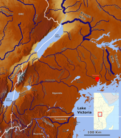 Rivers in South West Uganda with the Ruizi (lower left center). | |
| Location | |
| Country | Uganda |
| Physical characteristics | |
| Source | Buhweju hills |
| Mouth | |
• location | To Lake Victoria via the drainage systems of , Lake Kachera and Kijanebalola. |
• coordinates | 0°41′33″S 30°54′20″E / 0.69250°S 30.90556°ECoordinates: 0°41′33″S 30°54′20″E / 0.69250°S 30.90556°E |
• elevation | 1,258 m (4,127 ft) |
| Basin size | 2,282 km2 (881 sq mi)[1] |
| Discharge | |
| • location | Mbarara[2] |
| • average | 25.4 m3/s (900 cu ft/s) |
| • minimum | 16.5 m3/s (580 cu ft/s) |
| • maximum | 35.7 m3/s (1,260 cu ft/s) |
| Basin features | |
| Progression | Lake Victoria—White Nile—Nile—Mediterranean Sea |
| River system | Nile basin |

River Rwizi is a river located in South Western Uganda in district called Mbarara.
Overview[]
It originates from Buhweju hills with various tributaries from various Nkore hills including Ntungamo and Sheema hills which join it. It pours its water in Lake Victoria via the drainage systems of , Lake Kachera and Kijanebalola.[3]
River Rwizi supplies water for both domestic and industrial use to the whole Mbarara town and the neighbouring towns of Bwizibwera, Sanga and Biharwe.
The river is drying out due to climate changes affecting the region and other causes like
The water hyacinth which is also an inductor of polluted water with a lot of nutrients with in it
The river destruction is also due to wide spread of land grabbing along the river banks
A lot of untreated wastes are dumped into the river thus leading to contribution of pollution of water forex maple waste products from iron and steel industry in kakoba and Mbarara mainly hospital
Points of interest[]
There are some economic activities carried along and within river Rrwizi by the people surrounding it
FARMING
people around river Rwizi have started to encroach the wetlands to practice crop growing due to its fertile land that has increased the yields and live stock farming
Brick making
people are using sand from the river to make bricks for sell and building houses
Harvest of papyrus
people are get papyrus for making mats ,baskets, chairs and ropes to earn a living
fishing
people have practice fishing within the river that is harvested fish for food and selling in markets too
- Rwizi Water falls in .
- Katete Beach.
- Ngaro Mwenda Bridge in Mbarara 3 km off Kabale Road.
- Rwizi Meanders near Mbarara University.
References[]
- ^ Trace metal concentrations in the abiotic and biotic components of River Rwizi ecosystem in western Uganda, and the risks to human health
- ^ Vörösmarty, Charles J; Fekete, B M; Tucker, B A (1998): Global River Discharge, 1807-1991, V. 1.1 (RivDIS). Data set. Available on-line [https://daac.ornl.gov/ from Oak Ridge National Laboratory Distributed Active Archive Center, Oak Ridge, Tennessee, U.S.A. (via PANGAEA)]
- ^ Mbarara District rivers, . "Overview of River Rwizi". Archived from the original on 3 August 2014. Retrieved 19 January 2015.
{{cite web}}: CS1 maint: numeric names: authors list (link)
Sources[]
- "River Rwizi will be history soon - locals". New Vision. Retrieved 2021-09-29.
- "Road River: The story of a river dried by illegal land acquisitions". Earth Journalism Network. 2019-08-29. Retrieved 2021-09-29.
- Africa river stubs
- Uganda geography stubs
- Rivers of Uganda
- Nile basin