Riverlea, New Zealand
Riverlea | |
|---|---|
Suburb of Hamilton, New Zealand | |
 Riverlea, Hamilton | |
 | |
| Country | New Zealand |
| City | Hamilton, New Zealand |
| Electoral ward | Hamilton East |
| Established | 1962 |
| Population (2018 Census) | |
| • Total | 2,775 |
| Hillcrest & Silverdale | ||
|
|
Matangi | |
| Peacocke | Tamahere |
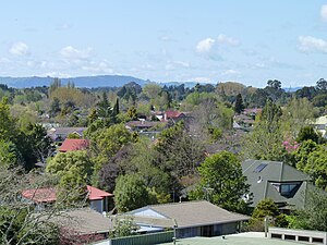
Riverlea is a suburb in south-eastern Hamilton in New Zealand. It is located south of Hillcrest. The suburb is primarily residential, with a small section of light industrial land along Riverlea Road.
History[]
It is named after Riverlea House, the homestead on the property of James McPherson which covered most of modern-day Riverlea and Hillcrest.[1] Many of the street names were chosen by landowner Don McKenzie, which he named after aeroplanes he flew in the Second World War (Hudson Street, Lysander Place), his horses (McCracken Avenue, Silva Crescent, Sheriff Place) and his family (Norma Place, Malcolm Street, Louise Place). Johnsview Terrace was named in memory of a boy who drowned in a waterhole which the street overlooked.[2]
Features of Riverlea[]
Hammond Park[]
Hammond Park is a public park along the riverbank of the Waikato River. A boardwalk connects the different sections of the park. Hammond Bush, part of the Mangaonua Gully, is home to the rare New Zealand Long-tailed Bat.[3] The beach along the Malcolm Street section of the park is a popular swimming spot during summer.
A local environmental improvement group (Riverlea Environment Society incorporated) has been instrumental in enhancing the Hammond Bush and campaigning against the building of an asphalt plant.
Riverlea Theatre[]
The Riverlea Theatre and Arts Centre, established in 1984, is home to Hamilton Musical Theatre and the Hamilton Playbox Repertory Society.[4]
Demographics[]
| Year | Pop. | ±% p.a. |
|---|---|---|
| 2006 | 2,532 | — |
| 2013 | 2,583 | +0.29% |
| 2018 | 2,775 | +1.44% |
| Source: [5] | ||
Riverlea had a population of 2,775 at the 2018 New Zealand census, an increase of 192 people (7.4%) since the 2013 census, and an increase of 243 people (9.6%) since the 2006 census. There were 957 households. There were 1,332 males and 1,443 females, giving a sex ratio of 0.92 males per female. The median age was 38.8 years (compared with 37.4 years nationally), with 558 people (20.1%) aged under 15 years, 558 (20.1%) aged 15 to 29, 1,245 (44.9%) aged 30 to 64, and 417 (15.0%) aged 65 or older.
Ethnicities were 73.3% European/Pākehā, 10.5% Māori, 1.8% Pacific peoples, 20.5% Asian, and 3.2% other ethnicities (totals add to more than 100% since people could identify with multiple ethnicities).
The proportion of people born overseas was 29.9%, compared with 27.1% nationally.
Although some people objected to giving their religion, 51.1% had no religion, 34.6% were Christian, 1.9% were Hindu, 2.7% were Muslim, 1.7% were Buddhist and 3.2% had other religions.
Of those at least 15 years old, 858 (38.7%) people had a bachelor or higher degree, and 237 (10.7%) people had no formal qualifications. The median income was $33,000, compared with $31,800 nationally. The employment status of those at least 15 was that 1,053 (47.5%) people were employed full-time, 342 (15.4%) were part-time, and 114 (5.1%) were unemployed.[5]
The 2013 Index of Socioeconomic Deprivation, ranked 1-10 from lowest to most deprived areas, lists Riverlea at 4/10 (low deprivation).[6]
Education[]
Berkley Normal Middle School is a state co-educational composite school (years 7-9) with a roll of 786 as of November 2021.[7][8] The school was founded as an intermediate school in 1971 and became a middle school (with the addition of year 9) in 1998.[9]
See also[]
- List of streets in Hamilton
- Suburbs of Hamilton, New Zealand
References[]
- ^ "Riverlea House - Hamilton Heritage". Hamilton City Council. Retrieved 27 August 2010.
- ^ Street Name Index - Hamilton Public Library, Hamilton. Olympia Place named after Don went to the olympic games in Japan.
- ^ "Project Echo". Environment Waikato. Archived from the original on 16 December 2010. Retrieved 8 December 2010.
- ^ Barnett, Alastair (July 2009). "The Move to Riverlea" (PDF). Archived from the original (PDF) on 9 June 2021 – via www.playbox.org.nz.
- ^ a b "Statistical area 1 dataset for 2018 Census". Statistics New Zealand. March 2020. Riverlea (181200). 2018 Census place summary: Riverlea
- ^ "Index of Socioeconomic Deprivation for Areas within the Hamilton East Electorate". Parliament New Zealand. Retrieved 31 October 2020.
- ^ "New Zealand Schools Directory". New Zealand Ministry of Education. Retrieved 22 December 2021.
- ^ Education Counts: Berkley Normal Middle School
- ^ "About". Berkley Normal Middle School. Retrieved 31 October 2020.
Coordinates: 37°48′16″S 175°19′15″E / 37.804308°S 175.320811°E

- Suburbs of Hamilton, New Zealand
- Populated places on the Waikato River