Rizal, Nueva Ecija
This article needs additional citations for verification. (October 2013) |
Rizal | |
|---|---|
| Municipality of Rizal | |
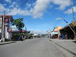 Downtown | |
 Seal | |
 Map of Nueva Ecija with Rizal highlighted | |
OpenStreetMap  | |
 Rizal Location within the Philippines | |
| Coordinates: 15°41′N 121°10′E / 15.68°N 121.17°ECoordinates: 15°41′N 121°10′E / 15.68°N 121.17°E | |
| Country | Philippines |
| Region | Central Luzon |
| Province | Nueva Ecija |
| District | 2nd district |
| Founded | 1913 |
| Named for | Dr. José Rizal |
| Barangays | 26 (see Barangays) |
| Government | |
| • Type | Sangguniang Bayan |
| • Mayor | Hanna Katrina L. Andres |
| • Vice Mayor | Bonifacio D. Soliven |
| • Representative | Micaela S. Violago |
| • Municipal Council | Members |
| • Electorate | 35,550 voters (2019) |
| Area | |
| • Total | 120.55 km2 (46.54 sq mi) |
| Elevation | 103 m (338 ft) |
| Highest elevation | 327 m (1,073 ft) |
| Lowest elevation | 71 m (233 ft) |
| Population (2020 census) [3] | |
| • Total | 70,196 |
| • Density | 580/km2 (1,500/sq mi) |
| • Households | 14,751 |
| Economy | |
| • Income class | 2nd municipal income class |
| • Poverty incidence | 15.21% (2015)[4] |
| • Revenue | ₱212,066,013.36 (2020) |
| • Assets | ₱438,491,760.48 (2020) |
| • Expenditure | ₱203,880,030.13 (2020) |
| • Liabilities | ₱148,854,816.77 (2020) |
| Service provider | |
| • Electricity | Nueva Ecija 2 Area 2 Electric Cooperative (NEECO 2 A2) |
| Time zone | UTC+8 (PST) |
| ZIP code | 3127 |
| PSGC | |
| IDD : area code | +63 (0)44 |
| Native languages | Ilocano Tagalog |

Rizal, officially the Municipality of Rizal (Ilocano: Ili ti Rizal; Tagalog: Bayan ng Rizal) is a 2nd class municipality in the province of Nueva Ecija, Philippines. According to the 2020 census, it has a population of 70,196 people. [3]
History[]
Historically, two groups were known to have settled in the area. The main group consisted entirely of the pioneer-settlers who were Ilocanos, while others, who arrived later, were of different tribes with different dialects. They merged and formed a new neighborhood, originally called Bunobon after the bunobon seedlings that thrived in the soil. It became a sitio of Cabucbucan under the jurisdiction of Bongabon municipality.
In 1904, sitio Bunobon became a barrio called Nazareth. Because of the steady arrival of new settlers, a council of elders was formed. Selected as head was Apo Juliano Paraiso, one of the eldest within the group, who headed the request to the government to convert Nazareth into an independent town. Through the help of Governor Manuel Tinio and Assemblyman Isauro Gabaldon, the request of the elders was approved in 1908.
On December 26, 1912, Vice Governor Newton signed the act and simultaneously issued a proclamation creating the town of RIZAL. The town was named after Dr. José Rizal. On January 1, 1913, Don Julian Paraiso took his oath as the first Alcalde of the Municipality. In 1917 and 1918, the Bureau of Land surveyed the Municipality into homestead and residential lots. In 1930, Barangay Paco Roman became barrio thru the leadership of the late Mr. Florentino Castelo, separating it from Barangay Estrella. Sometime in 1940, General Luna became a barrio of which the area was taken from barangay Canaan and in 1954 Villa Paraiso was created into a barrio separating it from Barangay Canaan and was named in honor of late Mayor Gaudencio V. Paraiso.
During World War II, Japanese Imperial forces occupies and entering the town in Rizal in 1942. In 1945, combined U.S. and Philippine Commonwealth ground troops including the local various recognized guerrillas and Hukbalahap Communist guerrillas liberated the town and defeated Japanese Imperial forces and ended the Second World War. After the war, many families started business and agricultural and farm lands.
In 1954, Rizal lost some of its territory when the barrios of San Felipe and San Alfonso were separated to form the town of Llanera along with some territory from Talavera and San Jose.[5]
In 1963, Villa Pascua was renamed Barangay Pag-asa which is a part of Barangay Agbanawag. In January 1968, Barangay Casilagan became a barrio thru Res. No. 2 of the Provincial Board on January 3, 1968, which was formerly a sitio of Canaan, which was bisected by the Bulalakay Creek, and it was divided into two barrios known as Canaan Este and Canaan Weste. On July 20, 1970, Sanggunian Panlalawigan passed Resolution No. 220 approving the creation of Barangay Maligaya in accordance with R.A. No. 3590, the area to be taken from the Barangay Bicos and on July 12, 1971, then the Provincial Board Resolution No. 231, Villa Labrador became a Barrio separating it to Villa Paraiso.
Barangays[]
Rizal is politically subdivided into 26 barangays.
- Agbannawag
- Aglipay
- Bicos
- Cabucbucan
- Calaocan District
- Canaan East
- Canaan West
- Casilagan
- Del Pilar
- Estrella
- General Luna
- Macapsing
- Maligaya
- Paco Roman
- Pag-asa
- Poblacion Central
- Poblacion East
- Poblacion Norte
- Poblacion Sur
- Poblacion West
- Portal
- San Esteban
- San Gregorio
- Santa Monica
- Villa Labrador
- Villa Paraiso
Climate[]
| Climate data for Quezon, Nueva Ecija | |||||||||||||
|---|---|---|---|---|---|---|---|---|---|---|---|---|---|
| Month | Jan | Feb | Mar | Apr | May | Jun | Jul | Aug | Sep | Oct | Nov | Dec | Year |
| Average high °C (°F) | 29 (84) |
30 (86) |
31 (88) |
33 (91) |
33 (91) |
31 (88) |
30 (86) |
29 (84) |
29 (84) |
30 (86) |
30 (86) |
29 (84) |
30 (87) |
| Average low °C (°F) | 19 (66) |
19 (66) |
20 (68) |
22 (72) |
23 (73) |
24 (75) |
24 (75) |
24 (75) |
23 (73) |
22 (72) |
21 (70) |
20 (68) |
22 (71) |
| Average precipitation mm (inches) | 4 (0.2) |
6 (0.2) |
7 (0.3) |
12 (0.5) |
61 (2.4) |
89 (3.5) |
96 (3.8) |
99 (3.9) |
81 (3.2) |
88 (3.5) |
37 (1.5) |
13 (0.5) |
593 (23.5) |
| Average rainy days | 2.5 | 3.0 | 4.1 | 6.3 | 15.8 | 19.4 | 22.5 | 21.6 | 20.1 | 17.5 | 9.6 | 4.0 | 146.4 |
| Source: Meteoblue [6] | |||||||||||||
Demographics[]
|
| ||||||||||||||||||||||||||||||||||||||||||||||||
| Source: Philippine Statistics Authority [7] [8] [9][10] | |||||||||||||||||||||||||||||||||||||||||||||||||
Economy[]
| Poverty Incidence of Rizal | |
| Source: Philippine Statistics Authority[11][12][13][14][15][16] | |

References[]
- ^ Municipality of Rizal | (DILG)
- ^ "2015 Census of Population, Report No. 3 – Population, Land Area, and Population Density" (PDF). Philippine Statistics Authority. Quezon City, Philippines. August 2016. ISSN 0117-1453. Archived (PDF) from the original on May 25, 2021. Retrieved July 16, 2021.
- ^ a b Census of Population (2020). "Region III (Central Luzon)". Total Population by Province, City, Municipality and Barangay. PSA. Retrieved 8 July 2021.
- ^ https://psa.gov.ph/sites/default/files/City%20and%20Municipal-level%20Small%20Area%20Poverty%20Estimates_%202009%2C%202012%20and%202015_0.xlsx; publication date: 10 July 2019; publisher: Philippine Statistics Authority.
- ^ "An Act to Create the Municipality of Llanera in the Province of Nueva Ecija". LawPH.com. Retrieved 2011-04-11.
- ^ "Rizal: Average Temperatures and Rainfall". Meteoblue. Retrieved 4 May 2020.
- ^ Census of Population (2015). "Region III (Central Luzon)". Total Population by Province, City, Municipality and Barangay. PSA. Retrieved 20 June 2016.
- ^ Census of Population and Housing (2010). "Region III (Central Luzon)". Total Population by Province, City, Municipality and Barangay. NSO. Retrieved 29 June 2016.
- ^ Censuses of Population (1903–2007). "Region III (Central Luzon)". Table 1. Population Enumerated in Various Censuses by Province/Highly Urbanized City: 1903 to 2007. NSO.
- ^ "Province of Nueva Ecija". Municipality Population Data. Local Water Utilities Administration Research Division. Retrieved 17 December 2016.
- ^ "Poverty incidence (PI):". Philippine Statistics Authority. Retrieved 28 December 2020.
- ^ https://psa.gov.ph/sites/default/files/NSCB_LocalPovertyPhilippines_0.pdf; publication date: 29 November 2005; publisher: Philippine Statistics Authority.
- ^ https://psa.gov.ph/sites/default/files/2003%20SAE%20of%20poverty%20%28Full%20Report%29_1.pdf; publication date: 23 March 2009; publisher: Philippine Statistics Authority.
- ^ https://psa.gov.ph/sites/default/files/2006%20and%202009%20City%20and%20Municipal%20Level%20Poverty%20Estimates_0_1.pdf; publication date: 3 August 2012; publisher: Philippine Statistics Authority.
- ^ https://psa.gov.ph/sites/default/files/2012%20Municipal%20and%20City%20Level%20Poverty%20Estima7tes%20Publication%20%281%29.pdf; publication date: 31 May 2016; publisher: Philippine Statistics Authority.
- ^ https://psa.gov.ph/sites/default/files/City%20and%20Municipal-level%20Small%20Area%20Poverty%20Estimates_%202009%2C%202012%20and%202015_0.xlsx; publication date: 10 July 2019; publisher: Philippine Statistics Authority.
External links[]
| Wikimedia Commons has media related to Rizal, Nueva Ecija. |
- Rizal Profile at PhilAtlas.com
- Philippine Standard Geographic Code
- Philippine Standard Geographic Code
- Philippine Census Information
- Local Governance Performance Management System
Places adjacent to Rizal, Nueva Ecija | |
|---|---|
Palayan (capital) | |
| Municipalities | |
| Component cities | |
- Municipalities of Nueva Ecija
- Populated places on the Pampanga River