Roade Cutting
| Site of Special Scientific Interest | |
 | |
| Location | Northamptonshire |
|---|---|
| Grid reference | SP 749 525[1] |
| Interest | Geological |
| Area | 15.2 hectares[1] |
| Notification | 1986[1] |
| Location map | Magic Map |

Roade Cutting is a 15.2 hectare geological Site of Special Scientific Interest along the West Coast Main Line north from Roade in Northamptonshire.[1][2] It is a Geological Conservation Review site.[3]
The cutting exposes rocks dating to the Middle Jurassic Bathonian stage, between 168.3 and 167.1 million years ago. It is described by Natural England as important for reconstructing the environment of deposition during the period, and correlating the White Limestone Formation in Oxfordshire and the East Midlands.[4]
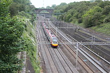
The site can be viewed from road and foot bridges.
References[]
- ^ a b c d "Designated Sites View: Roade Cutting". Sites of Special Scientific Interest. Natural England. Retrieved 20 December 2016.
- ^ "Map of Roade Cutting". Sites of Special Scientific Interest. Natural England. Retrieved 20 December 2016.
- ^ "Roade Railway Cutting (Bathonian)". Joint Nature Conservation Committee. Retrieved 18 December 2016.
- ^ "Roade Cutting citation" (PDF). Sites of Special Scientific Interest. Natural England. Retrieved 20 December 2016.
Categories:
- Sites of Special Scientific Interest in Northamptonshire
- Geological Conservation Review sites