Rockingham County, North Carolina
Rockingham County | |
|---|---|
U.S. county | |
 | |
 Location within the U.S. state of North Carolina | |
 North Carolina's location within the U.S. | |
| Coordinates: 36°24′N 79°47′W / 36.4°N 79.78°W | |
| Country | |
| State | |
| Founded | 1785 |
| Named for | Charles Watson-Wentworth, 2nd Marquess of Rockingham |
| Seat | Wentworth |
| Largest city | Eden |
| Area | |
| • Total | 573 sq mi (1,480 km2) |
| • Land | 566 sq mi (1,470 km2) |
| • Water | 7.2 sq mi (19 km2) 1.2%% |
| Population | |
| • Estimate (2019) | 91,010 |
| • Density | 166/sq mi (64/km2) |
| Time zone | UTC−5 (Eastern) |
| • Summer (DST) | UTC−4 (EDT) |
| Congressional district | 10th |
| Website | www |

Rockingham County is a county located in the U.S. state of North Carolina. As of the 2010 census, the population was 93,643.[1] Its county seat is Wentworth.[2] The county is known as "North Carolina's North Star."
Rockingham County is included in the Greensboro-High Point, NC Metropolitan Statistical Area.
History[]

Settling and founding[]
Between 1728 and 1733, the Dan River Valley was surveyed by William Byrd II. He soon thereafter purchased 20,000 acres of the land, attracting prospective farmers. The region's first western settlers came from Pennsylvania, New Jersey, Maryland, and Virginia and were of German, English, Scottish, and Irish descent.[3] The county was officially formed in 1785 from Guilford County. It was named for Charles Watson-Wentworth, 2nd Marquess of Rockingham, British Prime Minister from 1765 to 1766 and again in 1782. Rockingham's administration was dominated by the American issue. Rockingham wished for repeal of the Stamp Act 1765 and won a Commons vote on the repeal resolution by 275 to 167 in 1766.[4] This made him a popular figure among British colonials in America, who would later become known as "Americans". People in North Carolina were still fond of him in the years following the independence of the United States.
Development of industry[]
By the early 19th century a network of grist mills had been established along the Dan and Smith rivers. The textile industry was founded in 1813 with construction of the first cotton mill at the junction of the Dan and Smith rivers. Founded by John M. Morehead, it was one of the first cotton mills in the state.[3] The county was the location for the Searcy & Moore arms factory, which was at Hogans Creek, a small village 20 miles northwest of Greensboro. The factory produced firearms called the "N.C. Rifle" for the Confederate States of America forces during the Civil War. Owned by Alexander M. Searcy and Dr. J. S. Moore, the small factory made hundreds of rifles for the South between 1862 and 1863. The town of Stoneville was incorporated in 1877. Francis Henry Fries later establish several mill sites in the region, with the construction of the Mayo Mills plant in 1895 in the village of Mayodan and another site in what became the town of Avalon in 1899.[3][5][6] In 1911 a large fire destroyed the Avalon Mill.[7] The town was soon thereafter abandoned and its workers were transferred to Mayodan, while some of the other residents relocated to Stoneville. The 60 or so Avalon company houses were put on logs and rolled by mules and horses to Mayodan, where some still stand.[3] The only remains in Avalon are the mill's powerhouse, railroad tracks, and the dam works. The Mayo Mill, which was later called the Washington Mills-Mayodan Plant, closed in 1999.[5]
Geography[]
According to the U.S. Census Bureau, the county has a total area of 573 square miles (1,480 km2), of which 566 square miles (1,470 km2) is land and 7.2 square miles (19 km2) (1.2%) is water.[8]
The Dan River and Haw River drain the county.
Rockingham County has a municipal airport eight miles (13 km) northwest of Reidsville called Shiloh Airport, which has a paved 5,000-foot (1,500 m) runway, a fixed-base operation, and hangar space.
Adjacent counties[]
- Henry County, Virginia - north
- Pittsylvania County, Virginia - north
- Caswell County - east
- Alamance County - southeast
- Guilford County - south
- Forsyth County - southwest
- Stokes County - west
Demographics[]
| Historical population | |||
|---|---|---|---|
| Census | Pop. | %± | |
| 1790 | 6,211 | — | |
| 1800 | 8,277 | 33.3% | |
| 1810 | 10,316 | 24.6% | |
| 1820 | 11,474 | 11.2% | |
| 1830 | 12,935 | 12.7% | |
| 1840 | 13,442 | 3.9% | |
| 1850 | 14,495 | 7.8% | |
| 1860 | 16,746 | 15.5% | |
| 1870 | 15,708 | −6.2% | |
| 1880 | 21,744 | 38.4% | |
| 1890 | 25,363 | 16.6% | |
| 1900 | 33,163 | 30.8% | |
| 1910 | 36,442 | 9.9% | |
| 1920 | 44,149 | 21.1% | |
| 1930 | 51,083 | 15.7% | |
| 1940 | 57,898 | 13.3% | |
| 1950 | 64,816 | 11.9% | |
| 1960 | 69,629 | 7.4% | |
| 1970 | 72,402 | 4.0% | |
| 1980 | 83,426 | 15.2% | |
| 1990 | 86,064 | 3.2% | |
| 2000 | 91,928 | 6.8% | |
| 2010 | 93,643 | 1.9% | |
| 2019 (est.) | 91,010 | [9] | −2.8% |
| U.S. Decennial Census[10] 1790-1960[11] 1900-1990[12] 1990-2000[13] 2010-2013[1] | |||
As of the census[14] of 2000, there were 91,928 people, 36,989 households, and 26,188 families residing in the county. The population density was 162 people per square mile (63/km2). There were 40,208 housing units at an average density of 71 per square mile (27/km2). The racial identities of the county were 77.33% White, 19.57% Black or African American, 0.27% Native American, 0.28% Asian, 0.04% Pacific Islander, 1.69% from other race identities, and 0.83% from two or more races. 3.07% of the population were Hispanic or Latino identified of any race specific phenotype.
There were 36,989 households, out of which 30.10% had children under the age of 18 living with them, 53.60% were married couples living together, 12.80% had a female householder with no husband present, and 29.20% were non-families. 25.70% of all households were made up of individuals, and 10.80% had someone living alone who was 65 years of age or older. The average household size was 2.45 and the average family size was 2.93.
In the county, the population was spread out, with 23.40% under the age of 18, 7.60% from 18 to 24, 29.40% from 25 to 44, 24.80% from 45 to 64, and 14.80% who were 65 years of age or older. The median age was 38 years. For every 100 females there were 93.30 males. For every 100 females age 18 and over, there were 89.80 males.
The median income for a household in the county was $33,784, and the median income for a family was $40,821. Males had a median income of $30,479 versus $22,437 for females. The per capita income for the county was $17,120. About 10.20% of families and 12.80% of the population were below the poverty line, including 16.30% of those under age 18 and 15.50% of those age 65 or over.
Law and government[]
Rockingham County is a member of the regional .
In 2011, the new Rockingham County Justice Center was opened.[15] The $47 million facility replaced a more than century old courthouse in Rockingham County and includes courthouse, jail, and sheriff's office. The new facility is the first judicial center in the state of North Carolina seeking certification from the U.S. Green Building Council’s LEED Green Building Rating System and is estimated to save over $5 million over a 40-year period.[16] The three-story building will be able to accommodate 359 employees and 300 inmates.
Transportation[]
Airports[]
Rockingham County NC Shiloh Airport[18] is a public-use airport owned by Rockingham County. It is located in the town of Stoneville,[19] eight nautical miles (15 km) northwest of the central business district of the city of Reidsville.[18]
Major highways[]
Attractions[]
Attractions in Rockingham County include the state parks of the Dan and Mayo rivers, near Mayodan; the historic downtown areas of Leaksville, Draper and Spray in Eden; the Chinqua-Penn Plantation in Reidsville; the Deep Springs Plantation in Stoneville, High Rock Farm in Williamsburg, Mulberry Island Plantation in Stoneville, and the historic Penn House, located in Reidsville. One of the most famous attractions of the Reidsville area is Lake Reidsville. Various historic shops are found in the county, as well.
The Museum & Archives of Rockingham County (the MARC) is the only county historical museum and is located in the Rockingham County Courthouse in Wentworth, the county seat since 1787. The museum features exhibits and artifacts related to Rockingham County history as well as including the restored historic 1816 Wright Tavern (also historically known as Reid House or Reid Hotel) opposite the museum and 1910 Old Jail next door.
Education[]
All public schools in Rockingham County are a part of Rockingham County Schools. The area includes government elementary, middle, and high schools including 25 different schools which include: The elementary are Bethany School, Moss Street, Central, Leaksville-Spray, Dillard, Monroeton School, Douglass, Draper, South End School, Lawsonville Avenue, Stoneville, Lincoln, Wentworth, Huntsville, Williamsburg, and a magnet school New Vision. The middle schools are Bethany Charter (Rockingham County's only charter school), Holmes, Rockingham County, Reidsville, and Western Rockingham. The high schools are Dalton L. McMichael High School, John Motley Morehead High School, Reidsville High School, and Rockingham County High School. There is also the S.C.O.R.E. Center. There are currently 10 School Board members with one other board member seat being vacant currently.[20] Other schools are Rockingham County Early College (for high school students only), and Rockingham Community College, located in Wentworth.
Communities[]
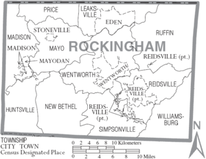
Cities[]
- Eden
- Reidsville
Towns[]
- Madison
- Mayodan
- Stoneville
- Wentworth (county seat)
- Stokesdale (part)
Townships[]
- Huntsville
- Madison
- Mayo
- New Bethel
- Price
- Reidsville
- Ruffin
- Stoneville
- Wentworth
- Williamsburg
Census-designated place[]
Unincorporated communities[]
See also[]
References[]
- ^ Jump up to: a b "State & County QuickFacts". United States Census Bureau. Archived from the original on July 17, 2011. Retrieved October 29, 2013.
- ^ "Find a County". National Association of Counties. Retrieved 2011-06-07.
- ^ Jump up to: a b c d Aheron, Piper (1997). From Avalon to Eden: A Postcard Tour of Rockingham County. Images of America (illustrated ed.). Arcadia Publishing. ISBN 9780752408248.
- ^ Ross J. S. Hoffman, The Marquis. A Study of Lord Rockingham, 1730–1782 (New York: Fordham University Press, 1973), p. 113.
- ^ Jump up to: a b Evelyn D. Causey and Kathryn Gettings Smith (December 2004). "Washington Mills-Mayodan Plant" (PDF). National Register of Historic Places - Nomination and Inventory. North Carolina State Historic Preservation Office. Retrieved 2015-02-01.
- ^ Battaglia, Danielle (14 June 2015). "THE DEATH OF A TOWN: Avalon". Greensboro News & Record. Retrieved 13 May 2016.
- ^ Graham, Nick (16 September 2011). "The Avalon Mill Fire". DigitalNC.org. North Carolina Digital Heritage Center. Retrieved 12 May 2016.
- ^ "2010 Census Gazetteer Files". United States Census Bureau. August 22, 2012. Archived from the original on January 12, 2015. Retrieved January 19, 2015.
- ^ "Population and Housing Unit Estimates". Retrieved March 28, 2020.
- ^ "U.S. Decennial Census". United States Census Bureau. Retrieved January 19, 2015.
- ^ "Historical Census Browser". University of Virginia Library. Retrieved January 19, 2015.
- ^ Forstall, Richard L., ed. (March 27, 1995). "Population of Counties by Decennial Census: 1900 to 1990". United States Census Bureau. Retrieved January 19, 2015.
- ^ "Census 2000 PHC-T-4. Ranking Tables for Counties: 1990 and 2000" (PDF). United States Census Bureau. April 2, 2001. Retrieved January 19, 2015.
- ^ "U.S. Census website". United States Census Bureau. Retrieved 2008-01-31.
- ^ Jonnelle Davis (June 19, 2011). "The new face of justice". Greensboro News & Record. Retrieved 5 July 2011.
- ^ "Open House and Grand Opening to be Held on June 21st for New Rockingham County Justice Center". Rockingham County Office of Public Information. May 9, 2011. Archived from the original on 11 May 2011. Retrieved 5 July 2011.
- ^ Leip, David. "Dave Leip's Atlas of U.S. Presidential Elections". uselectionatlas.org. Retrieved 2018-03-17.
- ^ Jump up to: a b FAA Airport Form 5010 for SIF PDF. Federal Aviation Administration. Effective 11 February 2010.
- ^ "Airport Information". Rockingham County / Shiloh Airport. Archived from the original on July 26, 2011. Retrieved March 3, 2010.
- ^ "Rockingham County Schools Board of Education Members". Rockingham County Schools. 2011. Retrieved 5 July 2011.[permanent dead link]
External links[]
- Rockingham County government official website Archived 2017-10-12 at the Wayback Machine
- NCGenWeb Rockingham County - free genealogy resources for the county
- Rockingham County, North Carolina's North Star
- Rockingham County Business & Technology Center
- The Shiloh/Rockingham County Airport
- WGSR TV47/Reidsville
| show Places adjacent to Rockingham County, North Carolina |
|---|
| show Municipalities and communities of Rockingham County, North Carolina, United States |
|---|


Coordinates: 36°24′N 79°47′W / 36.40°N 79.78°W
| show Authority control |
|---|
- North Carolina counties
- Rockingham County, North Carolina
- 1785 establishments in North Carolina
- Populated places established in 1785