Rogerstown Estuary
| Rogerstown Estuary | |
|---|---|
 | |
| Location | County Dublin, Ireland |
| Coordinates | 53°30′18″N 6°08′06″W / 53.505°N 6.135°WCoordinates: 53°30′18″N 6°08′06″W / 53.505°N 6.135°W |
| Area | 482 acres (1.95 km2) |
| Governing body | National Parks and Wildlife Service |

| Designations | |
|---|---|
| Designated | 25 October 1988 |
| Reference no. | 412[1] |
Rogerstown Estuary (Irish: Inbhear Bhaile Roiséir) is an estuary in Ireland. It is situated just north of the Donabate-Portrane peninsula, and also south of Rush, on Ireland's east coast about 25 km (16 mi) north of Dublin. It is a designated nature reserve,[2] Special Area of Conservation,[3] and a Ramsar site.
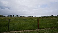
The estuary is made up of saltwater marshes, raised salt marsh, wet meadows and riverine shallows and creeks. It covers an area of 3.63 km2 (900 acres), and is divided by a causeway and bridge built in the 1840s to carry the main Dublin–Belfast railway line. It is internationally recognised as one of the most important east coast sites and is vital for wintering wildfowl and waders and birds on passage. Birds come to the estuary from the Arctic. It supports an internationally important population of Brent Geese and a further 14 species in numbers of national importance. The site is a statutory Nature Reserve and a candidate Special Area of Conservation under the E.U. Habitats Directive.[4] The former Balleally landfill site located by the railway causeway was landscaped and reopened as Rogerstown Park in 2019.
The estuary's mouth separates the beaches of Portrane and Rush, and the mouth is so narrow, it is theorized that a person would be able to cross from Rush to Portrane at a gradual walking pace, within a time span of less than a minute, if there was no water. According to local legend, there was once a bridge across the mouth, however, it was dismantled after various suicides. An apparent remain of this bridge still exists today, on the Portrane beach.[citation needed]
The townland of Turvey touches on the estuary. It is associated with the Goban Saor described as the son of Tuirbe Tragmar ("thrower of axes"), a figure whose magical axe would hold back the sea after it was thrown on the strand. This feat was said to have been performed at Tráig Tuirbi, Tuirbe's Strand or Turvey.[5]
References[]
- ^ "Rogerstown Estuary". Ramsar Sites Information Service. Retrieved 25 April 2018.
- ^ "S.I. No. 71/1988 - Nature Reserve (Rogerstown Estuary) Establishment Order, 1988". electronic Irish Statute Book (eISB). Retrieved 17 June 2021.
- ^ "Rogerstown Estuary SAC". National Parks & Wildlife Service. Retrieved 17 June 2021.
- ^ "Rogerstown Estuary | Estuaries & Wetlands | Environment | About Fingal | Interior Pages | Home | Fingal Dublin Tourism Website, Dublin, Ireland". www.fingaldublin.ie. Retrieved 2019-01-16.
- ^ [1] n.125 Tráig Tuirbi, in The Rennes Dindshenchas, edited by Whitney Stokes, pages 76-77, Revue Celtiques 16 (1895)
This geographical article about the Dublin area is a stub. You can help Wikipedia by . |
- Landforms of Fingal
- Bodies of water of the Republic of Ireland
- Ramsar sites in the Republic of Ireland
- Drainage basins of the Irish Sea
- Estuaries of Ireland
- Nethercross
- Special Areas of Conservation in the Republic of Ireland
- Nature reserves in the Republic of Ireland
- County Dublin geography stubs