Roman Forest, Texas
Roman Forest, Texas | |
|---|---|
 Welcome sign at the entrance to Roman Forest. | |
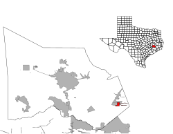
 Location of Roman Forest, Texas | |
 | |
| Coordinates: 30°10′40″N 95°9′22″W / 30.17778°N 95.15611°WCoordinates: 30°10′40″N 95°9′22″W / 30.17778°N 95.15611°W | |
| Country | United States |
| State | Texas |
| County | Montgomery |
| Government | |
| • Type | General Law Type A |
| • Mayor | Chris Parr |
| • Council members | Lori Jo Koepsel Jill Carlson David Mullane Greg Partin Conley Wallace |
| Area | |
| • Total | 2.20 sq mi (5.70 km2) |
| • Land | 2.18 sq mi (5.64 km2) |
| • Water | 0.02 sq mi (0.06 km2) |
| Elevation | 105 ft (32 m) |
| Population (2010) | |
| • Total | 1,538 |
| • Estimate (2019)[3] | 2,006 |
| • Density | 921.87/sq mi (355.91/km2) |
| Time zone | UTC-6 (Central (CST)) |
| • Summer (DST) | UTC-5 (CDT) |
| FIPS code | 48-63044[4] |
| GNIS feature ID | 1388597[5] |
| Website | www |

Roman Forest is a city in Montgomery County, Texas, United States. The population was 1,538 at the 2010 census.
Government[]

The city of Roman Forest is governed by a mayor and five council members.[1] The city also operates its own police department[6] and municipal court.[7] Fire and first responder services are provided by Montgomery County Emergency Service District No. 7, also known as the East Montgomery County Fire Department.[8]
In the Texas Senate, Roman Forest is part of District 4, represented by Republican Brandon Creighton. In the Texas House of Representatives, Roman Forest is part of District 16, represented by Republican Will Metcalf.[9]
In the United States Senate, Republicans John Cornyn and Ted Cruz represent the entire state of Texas. In the United States House of Representatives, Roman Forest is part of District 8, represented by Republican Kevin Brady.[9]
The United States Postal Service does not operate a post office in Roman Forest. The nearest post office is located in New Caney.[10]
Geography[]

Roman Forest is located at 30°10′40″N 95°9′22″W / 30.17778°N 95.15611°W (30.177744, -95.156209).[11]
According to the United States Census Bureau, the City has a total area of 1.5 square miles (3.9 km2), all of it land.
Climate[]
The climate in this area is characterized by hot, humid summers and generally mild to cool winters. According to the Köppen Climate Classification system, Roman Forest has a humid subtropical climate, abbreviated "Cfa" on climate maps.[12]
Demographics[]
| Historical population | |||
|---|---|---|---|
| Census | Pop. | %± | |
| 1980 | 929 | — | |
| 1990 | 1,033 | 11.2% | |
| 2000 | 1,279 | 23.8% | |
| 2010 | 1,538 | 20.3% | |
| 2019 (est.) | 2,006 | [3] | 30.4% |
| U.S. Decennial Census[13] | |||
As of the 2010 United States Census,[14] there were 1,538 people, 547 households, and 468 families residing in the town. The racial makeup of the town was 92.0% White, 1.3% African American, 0.4% Native American, 1.9% Asian, 3.1% from other races, and 1.3% from two or more races. Hispanic or Latino of any race were 10.3% of the population.
There were 547 households, out of which 30.5% had children under the age of 18 living with them, 74.8% were married couples living together, 6.8% had a female householder with no husband present, and 14.4% were non-families. 11.9% of all households were made up of individuals. The average household size was 2.80 and the average family size was 3.00.
In the city the population was spread out, with 23.3% under the age of 18, 6.2% from 18 to 24, 22.6% from 25 to 44, 32.5% from 45 to 64, and 15.2% who were 65 years of age or older. The median age was 43.6 years. For every 100 females, there were 93.7 males. For every 100 females age 18 and over, there were 95.2 males.
According to the 2015 American Community Survey, The median income for a household in the town was $93,289, and the median income for a family was $95,505. Males had a median income of $50,343 versus $40,074 for females. The per capita income for the town was $30,982. About 0.6% of families and 2.0% of the population were below the poverty line, including 0.7% of those under age 18 and 9.6% of those age 65 or over.
Education[]
Roman Forest is served by New Caney Independent School District.[15][16]
Residents are zoned to Dogwood Elementary School, Keefer Crossing Middle School, and New Caney High School.[17]
Aikin Elementary School was the elementary school serving Roman Forest.[18] From 2015-2017, Tavola Elementary served the Roman Forest community while Aikin Elementary was being rebuilt.[19] Aikin Elementary will reopen in August 2017 as Dogwood Elementary.[17] All Roman Forest students will attend Dogwood Elementary at the start of the 2017-2018 New Caney ISD school year.
The Texas Legislature designated New Caney ISD (and therefore Roman Forest) as part of Lone Star College (formerly the North Harris Montgomery Community College District).[20]
References[]
- ^ a b Meet your Mayor and City Council. City of Roman Forest. Retrieved March 31, 2020.
- ^ "2019 U.S. Gazetteer Files". United States Census Bureau. Retrieved August 7, 2020.
- ^ a b "Population and Housing Unit Estimates". United States Census Bureau. May 24, 2020. Retrieved May 27, 2020.
- ^ "U.S. Census website". United States Census Bureau. Retrieved 2008-01-31.
- ^ "US Board on Geographic Names". United States Geological Survey. 2007-10-25. Retrieved 2008-01-31.
- ^ Roman Forest Police Department. Retrieved March 31, 2020.
- ^ Municipal Court. City of Roman Forest. Retrieved March 31, 2020.
- ^ About Us. East Montgomery County Fire Department. Retrieved March 31, 2020.
- ^ a b Who Represents Me: Roman Forest. Texas Legislative Council. Accessed on July 6, 2017.
- ^ Find Locations: New Caney. United States Postal Service. Accessed on July 6, 2017.
- ^ "US Gazetteer files: 2010, 2000, and 1990". United States Census Bureau. 2011-02-12. Retrieved 2011-04-23.
- ^ Climate Summary for Roman Forest, Texas
- ^ "Census of Population and Housing". Census.gov. Retrieved June 4, 2015.
- ^ Factfinder: Roman Forest. Archived 2020-02-13 at archive.today United States Census Bureau. Accessed on July 6, 2017.
- ^ "SCHOOL DISTRICT REFERENCE MAP (2010 CENSUS): Montgomery County, TX" (Archive). U.S. Census Bureau. Retrieved on August 20, 2015.
- ^ "2010 CENSUS - CENSUS BLOCK MAP: Roman Forest town, TX" (Archive). U.S. Census Bureau. Retrieved on September 11, 2015.
- ^ a b Attendance Zones. New Caney Independent School District. Accessed on July 6, 2017.
- ^ "Elementary Zones[permanent dead link]." New Caney Independent School District. Retrieved on January 20, 2011.[dead link]
- ^ "Tavola Elementary School Opens August 2015" (Archive). New Caney Independent School District. Retrieved on September 11, 2015.
- ^ Texas Education Code, Sec. 130.191. LONE STAR COLLEGE SYSTEM DISTRICT SERVICE AREA..
External links[]
Municipalities and communities of Montgomery County, Texas, United States | ||
|---|---|---|
| Cities |  | |
| Towns | ||
| CDPs | ||
| Other communities | ||
| Ghost town | ||
| Footnotes | ‡This populated place also has portions in an adjacent county or counties | |
| ||
- Towns in Montgomery County, Texas
- Towns in Texas
- Greater Houston