Romilly, Vale of Glamorgan
Coordinates: 51°23′53″N 3°17′13″W / 51.398°N 3.287°W

Romilly | |
|---|---|
District of Barry | |
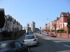 A typical street in Barry, All Saints Church pictured at the top of the hill | |
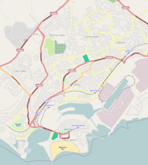 Romilly Location in Barry | |
| Coordinates: 51°23′52.8″N 3°17′13.2″W / 51.398000°N 3.287000°W | |
| Country | United Kingdom |
| Region | Wales |
| County | Vale of Glamorgan |
| Town | Barry |
| Time zone | UTC+0 (GMT) |
Romilly is a western district of Barry in the Vale of Glamorgan, South Wales, United Kingdom.
The area has an attractive public park which includes an extensive field and tennis court facilities. It is located around the corner from Cold Knap. An educational centre was built on Romilly Road in 1957.[1]

Romilly Park
References[]
- ^ Williams, Glanmor (1984). Early Glamorgan: pre-history and early history. Printed and published for the Committee by W. Lewis (printers) limited. p. 259. ISBN 978-0-904730-04-3. Retrieved 6 December 2012.
This Vale of Glamorgan location article is a stub. You can help Wikipedia by . |
Categories:
- Neighbourhoods of Barry, Vale of Glamorgan
- Glamorgan geography stubs