Ross River Dam
| Ross River Dam | |
|---|---|
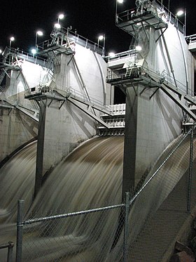 Ross River Dam at night, with open floodgates, pictured in 2008. | |
 Location of the dam wall in Queensland | |
| Country | Australia |
| Location | Between Kelso, Queensland and Mount Stuart, southwest of Townsville, North Queensland |
| Coordinates | 19°24′35″S 146°44′15″E / 19.40972°S 146.73750°ECoordinates: 19°24′35″S 146°44′15″E / 19.40972°S 146.73750°E |
| Purpose | Flood control, water supply |
| Status | Operational |
| Opening date | 1971 |
| Dam and spillways | |
| Type of dam | Embankment dam |
| Impounds | Ross River |
| Height | 34.4 metres (113 ft) |
| Length | 8,670 m (28,440 ft) |
| Dam volume | 5,085×103 m3 (179.6×10⁶ cu ft) |
| Spillway type | Controlled |
| Spillway capacity | 674 m3/s (23,800 cu ft/s) |
| Reservoir | |
| Total capacity | 803,565 ML (1.76760×10¹¹ imp gal; 2.12279×10¹¹ US gal) |
| Active capacity | 233,187 ML (5.1294×10¹⁰ imp gal; 6.1601×10¹⁰ US gal) |
| Catchment area | 750 km2 (290 sq mi) |
| Surface area | 82,000×103 m2 (880×106 sq ft) |

The Ross River Dam is a rock and earthfill-filled embankment dam across the Ross River, located between Kelso and Mount Stuart in the City of Townsville in northern Queensland, Australia. Built initially for flood control, Lake Ross, the impoundment created by the dam, serves as one of the major potable water supplies for the region.[1]
The dam reached 250% capacity in February 2019 as a result of mass rainfall and flooding in the area.[2]
Location and features[]
The dam was constructed by Leighton Contractors[3] in 1971 for the purposes of flood mitigation and water storage. The dam was an attempt to address Townsville's dual water concerns--abundance and scarcity--and added to the city's long history of attempting to tame the natural environment. Following a 2007 upgrade of facilities, the dam has a capacity of 250,000 megalitres (8,800×106 cu ft) and an earth rock embankment 8.67 kilometres (5.39 mi) in length and 34.4 metres (113 ft) high. The reservoir has a catchment area of 750 square kilometres (290 sq mi) with a controlled gated spillway. The reservoir has a current capacity of 233,187 megalitres (5.1294×10¹⁰ imp gal; 6.1601×10¹⁰ US gal) of water;[4] and can hold up to 803,565 megalitres (1.76760��1011 imp gal; 2.12279×10¹¹ US gal) of water in flood mitigation.[5][6] When the dam gates open, water spills over into the Ross River. Visitors may view the dam from a viewing platform at Ross Park. The Ross Dam Pump Station supplies up to 232 megalitres (8.2×10⁶ cu ft) of water to the Douglas Water Treatment Plant, where the water undergoes aeration, sedimentation, rapid sand filtration and chlorination treatment before being pumped to the reservoir where the water is distributed to Townsville.
At the base of the dam and on the banks of the Ross River is Ross Park, part of Riverway, with facilities for picnics or barbecues, as well as public toilets at this location.
Upgrade of the dam wall[]
- 2001 - a panel of experts in dam safety and construction undertook an investigation of the dam. Over two years, the panel conducted studies of the dam's construction with the world standards.
- 2003 - The report confirmed that upgrades were required and by late 2003 because the dam moved 10 centimetres (3.9 in) a year. At that rate, the dam would have burst in a 10-year period, causing the whole suburb of Kelso to be inundated. The first stage of lowering the spillway by 3.5 metres (11 ft) was underway, the lowering of the existing spillway has been done so the installing of dam gates to control the flow downstream and water storage levels can begin.
- 2004 - A combined GHD-MWH team was appointed to design the remaining work and manage the project. The contracting strategy was the first application of the 'Early Tenderer Involvement' (ETI) procurement model, developed by consultants ITN.
- 2005 - John Holland Group and Macmahon are awarded the construction contract.
- 2006 - Construction commenced with Constructing sand filters and supporting earthfill, extra rockwork to the dam embankment and the contraction of the gates.
- 2007 - Project completed late 2007.[7]
The spillway gates have increased the dam's capacity by around nine percent, which is about 21,000 megalitres (740×106 cu ft) or four months extra supply of water. Three spillway gates span the 40-metre (130 ft) wide spillway. The upgrade was going to take until mid-2008 to complete unless rainfall delays construction, however it was completed ahead of time in late 2007. The cost was around A$115 million.
The dam's storage was temporarily reduced with the lowering of the spillway to make way for the new floodgates that have now been fitted.
Water is supplied to surrounding areas by releasing water from the Burdekin Dam spillway into the Burdekin and Haughton Rivers. Weirs control the volume of water entering each river. The Haughton pumping station supplies water via a low pressure pipeline to Ross River Dam. The pipeline was built in 1988 by the Townsville Council. During the first decade the PVC sections of the pipeline repeatedly ruptured.
See also[]
- List of dams and reservoirs in Queensland
References[]
- ^ NQ Water (Upgrade project)
- ^ Courier Mail: Rooftop rescues as gates of hell open. https://www.couriermail.com.au/news/queensland/weather/townsville-floods-rooftop-rescues-as-ross-river-dam-floodgates-open/news-story/db0fc048e13b16a6fcbc511dd3dc98a2
- ^ Leighton Holdings history Archived 11 December 2007 at the Wayback Machine
- ^ "Paluma and Ross River Dam Levels". Dam and Water Storage Levels. Townsville City Council. Retrieved 15 October 2015.
- ^ Townsville Library on Twitter
- ^ "Register of Large Dams in Australia" (Excel (requires download)). Dams information. Australian National Committee on Large Dams. 2010. Retrieved 15 October 2015.
- ^ NQ Water
External links[]
- NQ Water
- Queensland Government; Townsville City Council (October 2014). "Regional Water Supply Security Assessment: Townsville" (PDF). Department of Energy and Water Supply. Queensland Government.
- Ross River Emergency Action Plan (EAP)
- BOM Latest River Heights for Ross R at Ross River Dam
Water supply in Queensland, Australia | |||||||||||||
|---|---|---|---|---|---|---|---|---|---|---|---|---|---|
| |||||||||||||
| |||||||||||||
- Reservoirs in Queensland
- Buildings and structures in Townsville
- Dams completed in 1971
- Dams in Queensland
- 1971 establishments in Australia
- Townsville