Rottendorf
Rottendorf | |
|---|---|
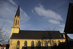 Church of Saint Vitus | |
 Coat of arms | |
show Location of Rottendorf within Würzburg district | |
 Rottendorf | |
| Coordinates: 49°47′26″N 10°01′36″E / 49.79056°N 10.02667°ECoordinates: 49°47′26″N 10°01′36″E / 49.79056°N 10.02667°E | |
| Country | Germany |
| State | Bavaria |
| Admin. region | Unterfranken |
| District | Würzburg |
| Subdivisions | 2 Ortsteile |
| Government | |
| • Mayor (2020–26) | Roland Schmitt[1] (CSU) |
| Area | |
| • Total | 14.83 km2 (5.73 sq mi) |
| Elevation | 252 m (827 ft) |
| Population (2020-12-31)[2] | |
| • Total | 5,311 |
| • Density | 360/km2 (930/sq mi) |
| Time zone | UTC+01:00 (CET) |
| • Summer (DST) | UTC+02:00 (CEST) |
| Postal codes | 97228 |
| Dialling codes | 09302 |
| Vehicle registration | WÜ |
| Website | http://www.rottendorf.eu/ |


Rottendorf is a municipality in the district of Würzburg in Bavaria, Germany.
History[]
As part of the bishopric Würzburg (Stift Haug) Rottendorf was secularisized 1803 in support of Bavaria, then Archduke Ferdinand gave it 1805 from Preßburg in peace for the formation of the grand duchy Würzburg, with which it passed to Bavaria in 1814 finally.

References[]
- ^ Liste der ersten Bürgermeister/Oberbürgermeister in kreisangehörigen Gemeinden, Bayerisches Landesamt für Statistik, 15 July 2021.
- ^ "Tabellenblatt "Daten 2", Statistischer Bericht A1200C 202041 Einwohnerzahlen der Gemeinden, Kreise und Regierungsbezirke". Bayerisches Landesamt für Statistik (in German). June 2021.
| Wikimedia Commons has media related to Rottendorf. |
| show Towns and municipalities in Würzburg (district) |
|---|
| Authority control |
|---|
This Würzburg district location article is a stub. You can help Wikipedia by . |
Categories:
- Municipalities in Bavaria
- Würzburg (district)
- Lower Franconia geography stubs