Roubidoux Formation
| Roubidoux Formation Stratigraphic range: Ordovician | |
|---|---|
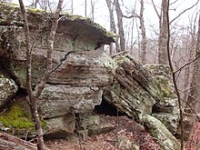 Outcrop of Roubidoux sandstone in the Missouri Ozarks | |
| Type | Formation |
| Underlies | Jefferson City Formation in the Missouri Ozarks |
| Overlies | Gasconade Formation[1] |
| Thickness | 100 to 300 feet[2] |
| Lithology | |
| Primary | Sandstone |
| Other | dolomite, chert |
| Location | |
| Coordinates | 36°54′N 92°34′W / 36.90°N 92.57°WCoordinates: 36°54′N 92°34′W / 36.90°N 92.57°W |
| Region | Missouri, Virginia |
| Country | United States |
| Type section | |
| Named for | Roubidoux Creek, Texas and Pulaski counties, Missouri[2] |

The Roubidoux Formation is a geologic formation in the Ozarks of Missouri and in Virginia. It preserves fossils dating back to the Ordovician period.
Paleofauna[]
Monoplacophora[]
- Kirengella
- K. oregonensis[3]
- W. inexpectans[3]
See also[]
- List of fossiliferous stratigraphic units in Missouri
- Paleontology in Missouri
- List of fossiliferous stratigraphic units in Virginia
- Paleontology in Virginia
References[]
- ^ Thompson, Thomas L., 2001, Lexicon of Stratigraphic Nomenclature in Missouri, Missouri Department of Natural Resources, Division of Geology and Land Survey, Report of Investigation Number 73, p 244-245
- ^ a b Thompson, Thomas L., Paleozoic Succession in Missouri: Part 2 Ordocician System, Report of Investigation No. 70, 1991, Missouri Department og Natural Resources, Rolla, MO, pp. 30-37
- ^ a b Stinchcomb, Bruce; Angeli, Nicholas (2002). "New Cambrian and Lower Ordovician monoplacophorans form the Ozark Uplift, Missouri". Journal of Paleontology. 76 (6): 965–974.
- Various Contributors to the Paleobiology Database. "Fossilworks: Gateway to the Paleobiology Database". Retrieved 17 December 2021.
{{cite web}}:|author=has generic name (help)
This article about a specific stratigraphic formation in Missouri is a stub. You can help Wikipedia by . |
This article about a specific stratigraphic formation in Virginia is a stub. You can help Wikipedia by . |
Categories:
- Ordovician Missouri
- Ordovician geology of Virginia
- Ordovician System of North America
- Geologic formations of Missouri
- Geologic formations of Virginia
- Landforms of the Ozarks
- Ordovician southern paleotemperate deposits
- Ordovician southern paleotropical deposits
- Midwestern United States geologic formation stubs
- Missouri geography stubs
- Southern United States geologic formation stubs
- Virginia geography stubs