Rouez
Rouez-en-Champagne | |
|---|---|
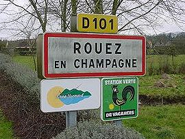 A road sign at the entrance to Rouez | |
 Coat of arms | |
show Location of Rouez-en-Champagne | |
 Rouez-en-Champagne | |
| Coordinates: 48°08′25″N 0°06′46″W / 48.1403°N 0.1128°WCoordinates: 48°08′25″N 0°06′46″W / 48.1403°N 0.1128°W | |
| Country | France |
| Region | Pays de la Loire |
| Department | Sarthe |
| Arrondissement | Mamers |
| Canton | Sillé-le-Guillaume |
| Intercommunality | Champagne Conlinoise et Pays de Sillé |
| Government | |
| • Mayor (2020–2026) | Ludovic Robidas[1] |
| Area 1 | 33.65 km2 (12.99 sq mi) |
| Population (Jan. 2018)[2] | 767 |
| • Density | 23/km2 (59/sq mi) |
| Demonym(s) | Rouéziens |
| Time zone | UTC+01:00 (CET) |
| • Summer (DST) | UTC+02:00 (CEST) |
| INSEE/Postal code | 72256 /72140 |
| Elevation | 92–171 m (302–561 ft) |
| 1 French Land Register data, which excludes lakes, ponds, glaciers > 1 km2 (0.386 sq mi or 247 acres) and river estuaries. | |


Rouez, also called Rouez-en-Champagne, is a commune in the Sarthe department in the region of Pays de la Loire in north-western France.
Geography[]
The village lies in the middle of the commune, on the left bank of the Merdereau, a left tributary of the Vègre, which flows southeastward through the commune.
See also[]
- Communes of the Sarthe department
References[]
- ^ "Répertoire national des élus: les maires". data.gouv.fr, Plateforme ouverte des données publiques françaises (in French). 2 December 2020.
- ^ "Populations légales 2018". INSEE. 28 December 2020.
| Wikimedia Commons has media related to Rouez. |
| show Communes of the Sarthe department |
|---|
| show Authority control |
|---|
This Sarthe geographical article is a stub. You can help Wikipedia by . |
Categories:
- Communes of Sarthe
- Sarthe geography stubs