Rue Royale, Brussels
 A view along Rue Royale/Koningsstraat in Saint-Josse-ten-Noode facing the Église Royale Sainte-Marie in neighbouring Schaerbeek | |
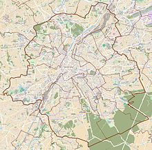
 Location within Brussels | |
| Location | Brussels-Capital Region, Belgium |
|---|---|
| Coordinates | 50°51′01″N 04°21′51″E / 50.85028°N 4.36417°ECoordinates: 50°51′01″N 04°21′51″E / 50.85028°N 4.36417°E |
Rue Royale (French) or Koningsstraat (Dutch), meaning "Royal Street" or "King's Street", is a street in Brussels, Belgium, running through the municipalities of Schaerbeek, Saint-Josse-ten-Noode and the City of Brussels. It is limited to the south by the Place Royale/Koningsplein in the city centre and to the north by the Place de la Reine/Koninginplein in Schaerbeek. Several places of interest lie along Rue Royale, for instance the Royal Palace of Brussels, the Centre for Fine Arts, Brussels' Park, the Congress Column, the Botanical Garden of Brussels, the Botanique concert hall and St. Mary's Royal Church.
Two Brussels Metro stations can be accessed from Rue Royale: Parc/Park metro station and Botanique/Kruidtuin metro station. The street is continued to the north by Rue Royale Sainte-Marie/Koninklijke Sinte-Mariastraat and to the south by Rue de la Régence/Regentschapsstraat. It has a crossing with the small ring road at the Botanique crossroad. Many companies have offices on Rue Royale, for instance Accenture and BNP Paribas Fortis. The French-speaking Community of Belgium also has offices on Rue Royale.
Leopold II[]
In November 1902, King Leopold II was attacked by the Italian anarchist Gennaro Rubino on Rue Royale and escaped death. However his Grand Marshall, Count Charles d'Oultremont, was almost killed.[1][2]
Gallery[]

Statue of Augustin Daniel Belliard on Rue Royale

The Congress Column and the Finance Tower seen from Rue Royale

St. Mary's Royal Church from Rue Royale
See also[]
- List of streets in Brussels
- History of Brussels
References[]
External links[]
- Streets in Brussels
- City of Brussels
- Belgium geography stubs
- Europe road stubs
- Belgium transport stubs


