Rundāle Parish
Rundāle Parish | |
|---|---|
parish of Latvia | |
 Coat of arms | |
 | |
| Country | Latvia |
| Area | |
| • Total | 91.46 km2 (35.31 sq mi) |
| • Land | 89.49 km2 (34.55 sq mi) |
| • Water | 1.97 km2 (0.76 sq mi) |
| Population (1 January 2021)[2] | |
| • Total | 1,709 |
| • Density | 19/km2 (48/sq mi) |

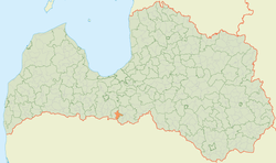
Rundāle Parish (Latvian: Rundāles pagasts) is an administrative unit of Bauska Municipality in the Semigallia region of Latvia.
Towns, villages and settlements of Rundāle Parish[]
References[]
- ^ https://data.stat.gov.lv/pxweb/lv/OSP_PUB/START__ENV__DR__DRT/DRT010/; Central Statistical Bureau of Latvia; retrieved: 26 February 2021.
- ^ https://data.stat.gov.lv/pxweb/lv/OSP_PUB/START__POP__IR__IRS/IRD060/; Central Statistical Bureau of Latvia; retrieved: 15 June 2021.
Coordinates: 56°23′50″N 24°02′12″E / 56.39722°N 24.03667°E
This Semigallia location article is a stub. You can help Wikipedia by . |
Categories:
- Parishes of Latvia
- Bauska Municipality
- Semigallia
- Zemgale geography stubs