Rustad Knoll
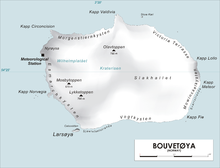
Map of Bouvetøya
Rustad Knoll (54°28′S 3°23′E / 54.467°S 3.383°ECoordinates: 54°28′S 3°23′E / 54.467°S 3.383°E) is a rounded, snow-topped elevation (365 m) which surmounts the south shore of the island of Bouvetøya immediately east of Cato Point. First charted in 1898 by a German expedition under Carl Chun. [1]The knoll was recharted in December 1927 by the Norvegia expedition under Captain . [2]They named it for who was in charge of the biological research of the expedition.[3]
 WikiMiniAtlas
References[]
- ^ "Prof. Dr. phil., Dr. med. h. c. Carl Chun". University of Leipzig. Retrieved October 1, 2016.
- ^ "Norvegia I". polarhistorie.no. Retrieved October 1, 2016.
- ^ "Norvegia-ekspedisjonene". Store norske leksikon. Retrieved October 1, 2016.
![]() This article incorporates public domain material from the United States Geological Survey document: "Rustad Knoll". (content from the Geographic Names Information System)
This article incorporates public domain material from the United States Geological Survey document: "Rustad Knoll". (content from the Geographic Names Information System) ![]()
This Bouvet Island location article is a stub. You can help Wikipedia by . |
Categories:
- Hills of Antarctica
- Landforms of Bouvet Island
- Norway geography stubs
- Subantarctic island geography stubs