Rya Tunnel
 | |
| Overview | |
|---|---|
| Location | Tromsø, Troms og Finnmark, Norway |
| Coordinates | 69°34′02″N 018°48′02″E / 69.56722°N 18.80056°ECoordinates: 69°34′02″N 018°48′02″E / 69.56722°N 18.80056°E |
| Status | In use |
| Route | |
| Start | |
| End | Balsnesodden |
| Operation | |
| Work begun | March 2009 |
| Opened | 29 September 2011 |
| Operator | Statens vegvesen |
| Character | Automotive |
| Toll | Toll until 2030 |
| Technical | |
| Length | 2,675 metres (1.7 mi) |
| No. of lanes | 2 |
| Operating speed | 80 km/h (50 mph) |
| Lowest elevation | −87 metres (−285 ft) |
| Grade | 7.8% |

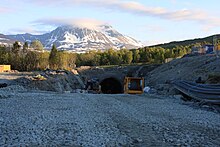
The Rya Tunnel (Norwegian: Ryaforbindelsen or Ryatunnelen) is a subsea road tunnel in Tromsø Municipality in Troms og Finnmark county, Norway. The tunnel links the island of Kvaløya to the mainland Malangshalvøya peninsula. Located along , the tunnel runs under between the village of (on Kvaløya) and the Balsnes area on the mainland. The 2,675-metre (8,776 ft) long tunnel reaches a maximum depth of 87 metres (285 ft) below mean sea level and has a maximum grade of 7.8%. The two-lane tunnel opened on 29 September 2011 and cost about 250 million kr, part of which will be recouped by tolls until 2030.[1][2] It is open to cyclists since fall 2013.[3]
References[]
- ^ Norwegian Public Roads Administration. "Prosjektbeskrivelse" (PDF) (in Norwegian). Retrieved 13 September 2011.
- ^ Merzagora, Eugenio A.; Lotsberg, Gunnar (eds.). "Road Tunnels in Norway 3 000 - 2 000 m". Road Tunnels in Norway. Retrieved 2012-12-09.
- ^ "sykling i ryatunnelen" (in Norwegian). Archived from the original on 28 May 2014. Retrieved 28 May 2014.
External links[]
 Media related to Ryatunnelen at Wikimedia Commons
This Norwegian tunnel-related article is a stub. You can help Wikipedia by . |
This article about a location in Troms og Finnmark is a stub. You can help Wikipedia by . |
- Subsea tunnels in Norway
- Road tunnels in Troms og Finnmark
- Buildings and structures in Tromsø
- 2011 establishments in Norway
- Tunnels completed in 2011
- Toll tunnels in Norway
- Roads within the Arctic Circle
- Norwegian tunnel stubs
- Troms og Finnmark geography stubs