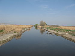
Sárvíz (Sió)
This article includes a list of general references, but it remains largely unverified because it lacks sufficient corresponding inline citations. (July 2018) |
| Sárvíz | |
|---|---|
 | |
| Location | |
| Country | Hungary |
| Counties | Fejér and Tolna |
| Towns | Székesfehérvár |
| Physical characteristics | |
| Source | |
| • location | Sárszentmihály, Fejér county |
| Mouth | Sió |
• location | Sióagárd |
• coordinates | 46°23′13″N 18°40′07″E / 46.3870°N 18.6686°ECoordinates: 46°23′13″N 18°40′07″E / 46.3870°N 18.6686°E |
| Basin features | |
| Progression | Sió→ Danube→ Black Sea |
| Tributaries | |
| • right | Séd |
The Sárvíz[1] is a river in Hungary. It is 110 kilometres (68 mi) long and flows into the Sió in the village of Sióagárd.
References[]
- ^ "Regulation of the Sió and the Sárvíz". Sulinet, educational site of the Hungarian government.
External links[]
| Wikimedia Commons has media related to Sárvíz (Sió). |
Categories:
- Tributaries of the Sió
- Geography of Fejér County
- Geography of Tolna County
- Rivers of Hungary
- Europe river stubs
- Hungary geography stubs
