Séguéla
Séguéla | |
|---|---|
Town, Sub-prefecture, and commune | |
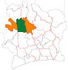
 Séguéla Location in Ivory Coast | |
| Coordinates: 7°58′N 6°40′W / 7.967°N 6.667°WCoordinates: 7°58′N 6°40′W / 7.967°N 6.667°W | |
| Country | |
| District | Woroba |
| Region | Worodougou |
| Department | Séguéla |
| Population (2014)[1] | |
| • Total | 63,774 |
| Time zone | UTC+0 (GMT) |

Séguéla is a town in western Ivory Coast. It is the seat of both the Woroba District and the Worodougou Region. It is also a commune and the seat of and a sub-prefecture of Séguéla Department.
Séguéla is served by Séguéla Airport. In 2014, the population of the sub-prefecture of Séguéla was 63,774.[2]
Villages[]
The forty two villages of the sub-prefecture of Séguéla and their population in 2014 are:[2]
- Bemasso (143)
- Fizanigoro (195)
- Gbena (1 307)
- Séguéla (46 189)
- Banandjé (363)
- Békro (174)
- Dangbasso (371)
- Diarabala (212)
- Djamina (359)
- Flana (166)
- Gbalo (649)
- Gbéna (212)
- Gbingoro (648)
- Gbofraka (348)
- Gbohovo (371)
- Gbolo (532)
- Gbona (589)
- Gnahoulégo (244)
- Kamana (284)
- Kavéna (333)
- Kénégbè-Sud (589)
- Kromina (196)
- Linguékro (477)
- Mamourla (282)
- Manguilo (138)
- Ména (250)
- Messoromasso (176)
- Mouina (767)
- Niangoro (232)
- Ouahama (1 050)
- Ouahi (685)
- Ouéla Katogola Ou Djiguibasso (349)
- Sakouasso (177)
- Séna (410)
- Siakasso 1 (724)
- Soba (635)
- Sokoura (163)
- Somina (427)
- Sotiéma (118)
- Sualla (499)
- Téguéla (1 579)
- Trafesso (162)
References[]
- ^ "Côte d'Ivoire". geohive.com. Retrieved 5 December 2015.
- ^ Jump up to: a b "RGPH 2014, Répertoire des localités, Région Worodougou" (PDF). ins.ci. Retrieved 5 August 2019.
| show Authority control |
|---|
This Woroba District location article is a stub. You can help Wikipedia by . |
Categories:
- Sub-prefectures of Worodougou
- District capitals of Ivory Coast
- Communes of Worodougou
- Regional capitals of Ivory Coast
- Woroba District geography stubs