Sørreisa (village)
Sørreisa (Norwegian)
Orjješ-Ráisa (Northern Sami) | |
|---|---|
Village | |
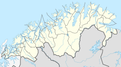
 Sørreisa Location of the village | |
| Coordinates: 69°08′41″N 18°09′10″E / 69.14472°N 18.15278°ECoordinates: 69°08′41″N 18°09′10″E / 69.14472°N 18.15278°E | |
| Country | Norway |
| Region | Northern Norway |
| County | Troms og Finnmark |
| District | Midt-Troms |
| Municipality | Sørreisa Municipality |
| Area | |
| • Total | 1.64 km2 (0.63 sq mi) |
| Elevation | 8 m (26 ft) |
| Population (2017)[1] | |
| • Total | 1,538 |
| • Density | 938/km2 (2,430/sq mi) |
| Time zone | UTC+01:00 (CET) |
| • Summer (DST) | UTC+02:00 (CEST) |
| Post Code | 9310 Sørreisa |
Sørreisa (Norwegian) or Orjješ-Ráisa (Northern Sami) is the administrative centre of Sørreisa Municipality in Troms og Finnmark county, Norway. The village (also known as Straumen) is located at the eastern end of the , an arm off of the main Solbergfjorden, and north of the lake Reisvatnet. The village of Skøelva is located about 5 kilometres (3.1 mi) southwest of Sørreisa.[3]
Sørreisa is the location of the intersection of Norwegian County Road 86 and . Straumen Chapel is the main church for the village. The 1.64-square-kilometre (410-acre) village has a population (2017) of 1,538 which gives the village a population density of 938 inhabitants per square kilometre (2,430/sq mi).[1]
References[]
- ^ Jump up to: a b c Statistisk sentralbyrå (1 January 2017). "Urban settlements. Population and area, by municipality".
- ^ "Sørreisa" (in Norwegian). yr.no. Retrieved 2012-10-22.
- ^ Store norske leksikon. "Sørreisa – tettstedet" (in Norwegian). Retrieved 2012-10-22.
Categories:
- Sørreisa
- Villages in Troms
- Troms og Finnmark geography stubs

