Sabanetas, Mayagüez, Puerto Rico
Sabanetas | |
|---|---|
Barrio | |
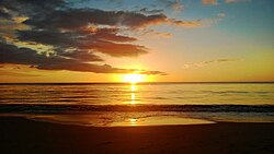 El Maní Beach at sunset | |
 Location of Sabanetas within the municipality of Mayagüez shown in red | |
 Sabanetas Location of Puerto Rico | |
| Coordinates: 18°15′38″N 67°10′57″W / 18.260656°N 67.182623°WCoordinates: 18°15′38″N 67°10′57″W / 18.260656°N 67.182623°W[1] | |
| Commonwealth | |
| Municipality | |
| Area | |
| • Total | 8.30 sq mi (21.5 km2) |
| • Land | 6.46 sq mi (16.7 km2) |
| • Water | 1.84 sq mi (4.8 km2) |
| Elevation | 3 ft (0.9 m) |
| Population (2010) | |
| • Total | 4,005 |
| • Density | 620/sq mi (240/km2) |
| Source: 2010 Census | |
| Time zone | UTC−4 (AST) |

Sabanetas is a barrio in the municipality of Mayagüez, Puerto Rico. Its population in 2010 was 4,005.[3][4][5]
History[]
Puerto Rico was ceded by Spain in the aftermath of the Spanish–American War under the terms of the Treaty of Paris of 1898 and became an unincorporated territory of the United States. In 1899, the United States Department of War conducted a census of Puerto Rico finding that the population of Sabanetas barrio was 1,401.[6]
| Historical population | |||
|---|---|---|---|
| Census | Pop. | %± | |
| 1900 | 1,401 | — | |
| 1980 | 3,418 | — | |
| 1990 | 3,794 | 11.0% | |
| 2000 | 4,161 | 9.7% | |
| 2010 | 4,005 | −3.7% | |
| U.S. Decennial Census[7] 1899 (shown as 1900)[8] 1910-1930[9] 1930-1950[10] 1980-2000[11] 2010[12] | |||
Name[]
Sabanetas Barrio is a coastal rural and riverside barrio, which borders the municipality of Añasco to the north. It derives its name from the plains or savannas found in the northern beaches of Mayagüez, in front of the Mona Channel, and in the vicinity of the mouth of the river now called the Río Grande de Añasco.[13] It is one of two barrios in Mayagüez whose jurisdiction extends form the main island, because its jurisdiction includes the hilly island of Desecheo, whose name is a Taino name which means "hilly land".[13] "Eta" in the "Sabana" noun suffix means an indicative of the extent of these savannas is limited in nature, as indeed it is, because it is located among the sea of the West Indies, the Goaorabo River, the swamp of the convent, the caño of La Boquilla and the hills of Algarrobos and Miradero.[13]
Notable landmarks[]
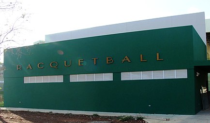
Sabanetas is home the El Mani community.[14] Inside Sabanetas barrio the El Mani Pavilion is located, where the handball events were held for the 2010 Central American and Caribbean Games.[15] The Boquilla Creek Wildlife Reserve (Reserva Natural del Caño de la Boquilla) is also located in Sabanetas.[16] The Eugenio María de Hostos Airport regional airport is located inside the boundaries of the barrio.
Gallery[]

Eugenio Maria de Hostos Airport Tower in Sabanetas
El Maní Pavilion


See also[]
References[]
- ^ Jump up to: a b "US Gazetteer 2019". US Census. US Government.
- ^ U.S. Geological Survey Geographic Names Information System: Sabanetas barrio
- ^ Picó, Rafael; Buitrago de Santiago, Zayda; Berrios, Hector H. Nueva geografía de Puerto Rico: física, económica, y social, por Rafael Picó. Con la colaboración de Zayda Buitrago de Santiago y Héctor H. Berrios. San Juan Editorial Universitaria, Universidad de Puerto Rico,1969.
- ^ Gwillim Law (20 May 2015). Administrative Subdivisions of Countries: A Comprehensive World Reference, 1900 through 1998. McFarland. p. 300. ISBN 978-1-4766-0447-3. Retrieved 25 December 2018.
- ^ Puerto Rico:2010:population and housing unit counts.pdf (PDF). U.S. Dept. of Commerce, Economics and Statistics Administration, U.S. Census Bureau. 2010.
- ^ Joseph Prentiss Sanger; Henry Gannett; Walter Francis Willcox (1900). Informe sobre el censo de Puerto Rico, 1899, United States. War Dept. Porto Rico Census Office (in Spanish). Imprenta del gobierno. p. 164.
- ^ "U.S. Decennial Census". United States Census Bureau. Archived from the original on February 13, 2020. Retrieved September 21, 2017.
- ^ "Report of the Census of Porto Rico 1899". War Department Office Director Census of Porto Rico. Archived from the original on July 16, 2017. Retrieved September 21, 2017.
- ^ "Table 3-Population of Municipalities: 1930 1920 and 1910" (PDF). United States Census Bureau. Archived (PDF) from the original on August 17, 2017. Retrieved September 21, 2017.
- ^ "Table 4-Area and Population of Municipalities Urban and Rural: 1930 to 1950" (PDF). United States Census Bureau. Archived (PDF) from the original on August 30, 2015. Retrieved September 21, 2014.
- ^ "Table 2 Population and Housing Units: 1960 to 2000" (PDF). United States Census Bureau. Archived (PDF) from the original on July 24, 2017. Retrieved September 21, 2017.
- ^ Puerto Rico:2010:population and housing unit counts.pdf (PDF). U.S. Dept. of Commerce Economics and Statistics Administration U.S. Census Bureau. 2010. Archived (PDF) from the original on 2017-02-20. Retrieved 2019-08-02.
- ^ Jump up to: a b c Cedó Alzamora, Federico (2010). MAYAGÜEZ,SU NOMBRE, SOBRENOMBRES Y LOS DE SUS BARRIOS (PDF). Mayagüez: Gobierno Municipal de Mayagüez. pp. 1–28.
- ^ General Purpose Population Data, Census 2000. Unidad de Sistemas de Información Geográfica, Área de Tecnología de Información Gubernamental, Oficina de Gerencia y Presupuesto. Gobierno de Puerto Rico. Archived 2010-08-12 at the Wayback Machine Retrieved September 21, 2010.
- ^ http://www.mayaguez2010.com/es/instalaciones/deportivas/229-pabellon-de-boxeo.html
- ^ "Archived copy" (PDF). Archived from the original (PDF) on 2011-07-18. Retrieved 2010-08-20.CS1 maint: archived copy as title (link) Brochure about Boquilla Creek Wildlife Reserve (in Spanish)
- Barrios of Mayagüez, Puerto Rico