Saint-Étienne-en-Dévoluy
Saint-Étienne-en-Dévoluy | |
|---|---|
Part of Le Dévoluy | |
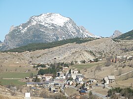 The village of Saint-Étienne-en-Dévoluy, with the south face of Le Gicon in the background | |
 Coat of arms | |
show Location of Saint-Étienne-en-Dévoluy | |
 Saint-Étienne-en-Dévoluy | |
| Coordinates: 44°41′36″N 5°56′31″E / 44.6933°N 5.9419°ECoordinates: 44°41′36″N 5°56′31″E / 44.6933°N 5.9419°E | |
| Country | France |
| Region | Provence-Alpes-Côte d'Azur |
| Department | Hautes-Alpes |
| Arrondissement | Gap |
| Canton | Saint-Étienne-en-Dévoluy |
| Commune | Le Dévoluy |
| Area 1 | 67.87 km2 (26.20 sq mi) |
| Population (2017)[1] | 502 |
| • Density | 7.4/km2 (19/sq mi) |
| Time zone | UTC+01:00 (CET) |
| • Summer (DST) | UTC+02:00 (CEST) |
| Postal code | 05250 |
| Elevation | 1,134–2,652 m (3,720–8,701 ft) (avg. 1,263 m or 4,144 ft) |
| 1 French Land Register data, which excludes lakes, ponds, glaciers > 1 km2 (0.386 sq mi or 247 acres) and river estuaries. | |


Saint-Étienne-en-Dévoluy (Vivaro-Alpine: Sant Estève de Devolui) is a former commune in the Hautes-Alpes department in southeastern France. On 1 January 2013, Agnières-en-Dévoluy, La Cluse, Saint-Disdier, and Saint-Étienne-en-Dévoluy amalgamated into the new commune of Le Dévoluy.
SuperDévoluy, a ski resort, was part of the commune.
Population[]
| Year | Pop. | ±% |
|---|---|---|
| 1962 | 385 | — |
| 1968 | 417 | +8.3% |
| 1975 | 471 | +12.9% |
| 1982 | 527 | +11.9% |
| 1990 | 538 | +2.1% |
| 1999 | 538 | +0.0% |
| 2008 | 573 | +6.5% |
See also[]
- Communes of the Hautes-Alpes department
References[]
| Wikimedia Commons has media related to Saint-Étienne-en-Dévoluy. |
| Authority control |
|
|---|
This Hautes-Alpes geographical article is a stub. You can help Wikipedia by . |
Categories:
- Former communes of Hautes-Alpes
- Hautes-Alpes geography stubs