Saint-Jacques-de-Leeds, Quebec
Saint-Jacques-de-Leeds | |
|---|---|
Municipality | |
 | |
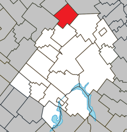 Location within Les Appalaches RCM | |
 St-Jacques-de-Leeds Location in province of Quebec | |
| Coordinates: 46°17′N 71°21′W / 46.283°N 71.350°WCoordinates: 46°17′N 71°21′W / 46.283°N 71.350°W[1] | |
| Country | Canada |
| Province | Quebec |
| Region | Chaudière-Appalaches |
| RCM | Les Appalaches |
| Constituted | September 23, 1929 |
| Government | |
| • Mayor | Philippe Chabot |
| • Federal riding | Mégantic—L'Érable |
| • Prov. riding | Lotbinière-Frontenac |
| Area | |
| • Total | 83.20 km2 (32.12 sq mi) |
| • Land | 80.90 km2 (31.24 sq mi) |
| Population | |
| • Total | 711 |
| • Density | 8.8/km2 (23/sq mi) |
| • Pop 2006-2011 | |
| • Dwellings | 340 |
| Time zone | UTC−5 (EST) |
| • Summer (DST) | UTC−4 (EDT) |
| Postal code(s) | G0N 1J0 |
| Area code(s) | 418 and 581 |
| Highways | |
| Website | www |

Saint-Jacques-de-Leeds is a municipality located in the Municipalité régionale de comté des Appalaches in Quebec, Canada. It is part of the Chaudière-Appalaches region and the population is 686 as of 2009. It is named after one of Jesus' apostles, James, son of Zebedee, and the city of Leeds, England.
Sister city[]
References[]
- ^ Reference number 56797 of the Commission de toponymie du Québec (in French)
- ^ Jump up to: a b Geographic code 31140 in the official Répertoire des municipalités (in French)
- ^ Jump up to: a b "(Code 2431140) Census Profile". 2011 census. Statistics Canada. 2012.
External links[]
 Media related to Saint-Jacques-de-Leeds at Wikimedia Commons
- Commission de toponymie du Québec
- Ministère des Affaires municipales, des Régions et de l'Occupation du territoire
| show Places adjacent to Saint-Jacques-de-Leeds, Quebec |
|---|
| show |
|---|
| show Authority control |
|---|
Categories:
- Municipalities in Quebec
- Incorporated places in Chaudière-Appalaches