Saint-Jean-de-Sauves
Saint-Jean-de-Sauves | |
|---|---|
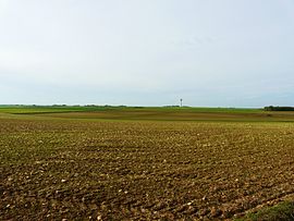 The plain between Mazeuil and Saint-Jean-de-Sauves. | |
show Location of Saint-Jean-de-Sauves | |
 Saint-Jean-de-Sauves | |
| Coordinates: 46°50′28″N 0°05′38″E / 46.8411°N 0.0939°ECoordinates: 46°50′28″N 0°05′38″E / 46.8411°N 0.0939°E | |
| Country | France |
| Region | Nouvelle-Aquitaine |
| Department | Vienne |
| Arrondissement | Châtellerault |
| Canton | Loudun |
| Intercommunality | Pays Loudunais |
| Government | |
| • Mayor (2020–2026) | Christian Moreau[1] |
| Area 1 | 56.58 km2 (21.85 sq mi) |
| Population (Jan. 2018)[2] | 1,402 |
| • Density | 25/km2 (64/sq mi) |
| Time zone | UTC+01:00 (CET) |
| • Summer (DST) | UTC+02:00 (CEST) |
| INSEE/Postal code | 86225 /86330 |
| Elevation | 60–130 m (200–430 ft) (avg. 82 m or 269 ft) |
| 1 French Land Register data, which excludes lakes, ponds, glaciers > 1 km2 (0.386 sq mi or 247 acres) and river estuaries. | |


Saint-Jean-de-Sauves is a commune in the Vienne department in the Nouvelle-Aquitaine region in western France.
Demographics[]
| Year | 1962 | 1968 | 1975 | 1982 | 1990 | 1999 | 2006 | 2009 |
|---|---|---|---|---|---|---|---|---|
| Population | 1 469 | 1 557 | 1 480 | 1 486 | 1 436 | 1 294 | 1 353 | 1 319 |
See also[]
References[]
- ^ Maires au 17-06-2020, data.gouv.fr, accessed 1 December 2020
- ^ "Populations légales 2018". INSEE. 28 December 2020.
| Wikimedia Commons has media related to Saint-Jean-de-Sauves. |
| show Authority control |
|---|
This Vienne geographical article is a stub. You can help Wikipedia by . |
Categories:
- Communes of Vienne
- Vienne geography stubs