Saint-Léger-des-Bois
Saint-Léger-des-Bois | |
|---|---|
Part of Saint-Léger-de-Linières | |
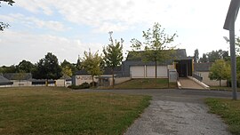 The school and library | |
show Location of Saint-Léger-des-Bois | |
 Saint-Léger-des-Bois | |
| Coordinates: 47°27′40″N 0°42′25″W / 47.461°N 0.707°WCoordinates: 47°27′40″N 0°42′25″W / 47.461°N 0.707°W | |
| Country | France |
| Region | Pays de la Loire |
| Department | Maine-et-Loire |
| Arrondissement | Angers |
| Canton | Angers-3 |
| Commune | Saint-Léger-de-Linières |
| Area 1 | 15.42 km2 (5.95 sq mi) |
| Population (2017)[1] | 1,771 |
| • Density | 110/km2 (300/sq mi) |
| Time zone | UTC+01:00 (CET) |
| • Summer (DST) | UTC+02:00 (CEST) |
| Postal code | 49170 |
| Elevation | 38–79 m (125–259 ft) (avg. 79 m or 259 ft) |
| 1 French Land Register data, which excludes lakes, ponds, glaciers > 1 km2 (0.386 sq mi or 247 acres) and river estuaries. | |


Saint-Léger-des-Bois is a former commune in the Maine-et-Loire department in western France. On 1 January 2019, it was merged into the new commune Saint-Léger-de-Linières.[2]
See also[]
- Communes of the Maine-et-Loire department
References[]
- ^ Téléchargement du fichier d'ensemble des populations légales en 2017, INSEE
- ^ Arrêté préfectoral 20 September 2018 (in French)
| Wikimedia Commons has media related to Saint-Léger-des-Bois. |
| show Authority control |
|---|
This Maine-et-Loire geographical article is a stub. You can help Wikipedia by . |
Categories:
- Former communes of Maine-et-Loire
- Maine-et-Loire geography stubs