Sainte-Foy-de-Montgommery
show This article may be expanded with text translated from the corresponding article in French. (December 2008) Click [show] for important translation instructions. |
Sainte-Foy-de-Montgommery | |
|---|---|
Part of Val-de-Vie | |
 | |
 Coat of arms | |
show Location of Sainte-Foy-de-Montgommery | |
 Sainte-Foy-de-Montgommery | |
| Coordinates: 48°58′N 0°11′E / 48.96°N 0.18°ECoordinates: 48°58′N 0°11′E / 48.96°N 0.18°E | |
| Country | France |
| Region | Normandy |
| Department | Calvados |
| Arrondissement | Lisieux |
| Canton | Livarot |
| Commune | Val-de-Vie |
| Area 1 | 4.59 km2 (1.77 sq mi) |
| Population (2017)[1] | 174 |
| • Density | 38/km2 (98/sq mi) |
| Time zone | UTC+01:00 (CET) |
| • Summer (DST) | UTC+02:00 (CEST) |
| Postal code | 14140 |
| Elevation | 77–200 m (253–656 ft) (avg. 84 m or 276 ft) |
| 1 French Land Register data, which excludes lakes, ponds, glaciers > 1 km2 (0.386 sq mi or 247 acres) and river estuaries. | |


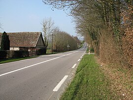
Sainte-Foy-de-Montgommery is a former commune in the Calvados department in the Normandy region in northwestern France. On 1 January 2016, it was merged into the new commune of Val-de-Vie.[2]
Population[]
| Year | Pop. | ±% |
|---|---|---|
| 1962 | 194 | — |
| 1968 | 186 | −4.1% |
| 1975 | 168 | −9.7% |
| 1982 | 145 | −13.7% |
| 1990 | 192 | +32.4% |
| 1999 | 174 | −9.4% |
| 2008 | 204 | +17.2% |
See also[]
- Communes of the Calvados department
References[]
- ^ Téléchargement du fichier d'ensemble des populations légales en 2017, INSEE
- ^ "Arrêté préfectoral" (PDF) (in French). 22 December 2015.
External links[]
| Wikimedia Commons has media related to Sainte-Foy-de-Montgommery. |
This Calvados geographical article is a stub. You can help Wikipedia by . |
Categories:
- Former communes of Calvados (department)
- Calvados (department) geography stubs